Erharting
| coat of arms | Germany map | |
|---|---|---|

|
Coordinates: 48 ° 17 ' N , 12 ° 35' E |
|
| Basic data | ||
| State : | Bavaria | |
| Administrative region : | Upper Bavaria | |
| County : | Mühldorf am Inn | |
| Management Community : | Rohrbach | |
| Height : | 400 m above sea level NHN | |
| Area : | 13.68 km 2 | |
| Residents: | 919 (Dec. 31, 2019) | |
| Population density : | 67 inhabitants per km 2 | |
| Postal code : | 84513 | |
| Primaries : | 08631, 08635 | |
| License plate : | MÜ, VIB , WS | |
| Community key : | 09 1 83 116 | |
| Community structure: | 13 districts | |
| Association administration address: | Rohrbach 20 84513 Erharting, Germany |
|
| Website : | ||
| Mayor : | Matthias Huber (Independent Voting Group Erharting) | |
| Location of the municipality of Erharting in the Mühldorf am Inn district | ||
Erharting is a municipality in the Upper Bavarian district of Mühldorf am Inn .
geography
Geographical location
Erharting is located on both sides of the Isen in the Southeast Upper Bavaria region in the Alpine foothills on the edge of the extensive Inn valley, around twelve kilometers south of Neumarkt-Sankt Veit , seven kilometers northeast of Mühldorf , eleven kilometers northwest of Neuötting , 13 km from Altötting and 86 km from the state capital Munich away. In the district of Rohrbach is a station on a regular basis by the SüdostBayernBahn busy railway line Mühldorf-Neumarkt . In addition, the A 94 (junctions Mühldorf-Nord and Töging) runs directly south of Erharting , which should provide a quick connection to Munich and Passau in the future.
Community structure
The municipality of Erharting has 13 districts:
|
There is only the Erharting district .
Neighboring communities
history
Until the church is planted
The place was first mentioned in the year 718, the village Ehardinga , consisting of 15 farms, was donated to the monastery of St. Peter in Salzburg around 700 AD . In the Erhartingen Treaties of 1254 and 1275, the boundary between the Archbishopric of Salzburg and the Duchy of Bavaria was established. In 1322 the battle of Mühldorf between Ludwig the Bavarian and Frederick the Fair took place near Erharting .
Power rivalries between the (Lower) Bavarian dukes and the Salzburg archbishops were also the rule.
In the early modern era, Erharting belonged to the Landshut Rent Office and the Neumarkt Regional Court of the Electorate of Bavaria . By the chairman shaft Erharting but the practiced archbishopric of Salzburg until the secularisation in Bavaria from the lower jurisdiction over his subjects in this area 1,803th In the course of the administrative reforms in Bavaria , today's municipality was created with the municipal edict of 1818 . By founding the Rohrbach administrative community in the early 1980s, the municipalities of Erharting, Niederbergkirchen and Niedertaufkirchen were able to maintain the political independence of the rural area between the district town of Mühldorf am Inn in the south and the town of Neumarkt-Sankt Veit in the north.
Population development
Between 1988 and 2018 the municipality grew from 810 to 939 by 129 inhabitants or by 15.9%.
- 1961: 875 inhabitants
- 1970: 954 inhabitants
- 1987: 820 inhabitants
- 1991: 854 inhabitants
- 1995: 863 inhabitants
- 2000: 921 inhabitants
- 2005: 945 inhabitants
- 2010: 918 inhabitants
- 2015: 947 inhabitants
politics
The community is a member of the Rohrbach administrative community . Matthias Huber of the Independent Voters' Group Erharting (UWG) has been the first mayor since May 1, 2020. The municipal council consists of the first mayor and four politicians each from the UWG and the FWE Erharting.
coat of arms
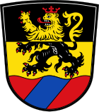
| Blazon : "Above a red corrugated shield base, inside a blue oblique left bar, divided by black and gold with a red crowned and red armored lion in mixed up colors." | |
Public facilities
Educational institutions
Erharting has a kindergarten with 29 places (as of 2014). At the end of the 2007 school year, the elementary school in Erharting was irrevocably closed after a 100-year history, after the building had only served as a "relocation" for the Mühldorf secondary school in the 2006/2007 school year.
Offices
The seat of the administrative community Rohrbach , consisting of the communities Erharting, Niederbergkirchen and Niedertaufkirchen , is located in the Erharting district of Rohrbach.
Attractions
The Catholic parish church of St. Peter and Paul in Erharting is a baroque building with an ornate, gabled front. The tower stands on the back and closes with an onion dome . The single-nave interior with choir and organ gallery also shows the baroque style.
Economy including agriculture and forestry
In 1998 there were none in the field of agriculture and forestry, 127 in the manufacturing industry, none in the trade and transport sector and 72 in other economic sectors at the place of work. A total of 288 employees subject to social insurance contributions were resident there.
There were no companies in the manufacturing sector and three in the construction sector.
In addition, in 1999 the municipality had 27 farms with an agricultural area of 778 ha, of which 674 ha were arable.
Web links
Individual evidence
- ↑ "Data 2" sheet, Statistical Report A1200C 202041 Population of the municipalities, districts and administrative districts 1st quarter 2020 (population based on the 2011 census) ( help ).
- ^ Municipal council of the Erharting municipality. Erharting community, accessed on June 26, 2020 .
- ↑ Erharting municipality in the local database of the Bavarian State Library Online . Bavarian State Library, accessed on June 17, 2017.
- ^ Entry on the Erharting coat of arms in the database of the House of Bavarian History


