
Oberndorf near Schwanenstadt
|
Oberndorf near Schwanenstadt
|
||
|---|---|---|
| coat of arms | Austria map | |
 |
|
|
| Basic data | ||
| Country: | Austria | |
| State : | Upper Austria | |
| Political District : | Vöcklabruck | |
| License plate : | VB | |
| Surface: | 6.04 km² | |
| Coordinates : | 48 ° 3 ' N , 13 ° 46' E | |
| Height : | 390 m above sea level A. | |
| Residents : | 1,376 (January 1, 2020) | |
| Population density : | 228 inhabitants per km² | |
| Postal code : | 4690 | |
| Area code : | 07673 | |
| Community code : | 4 17 20 | |
| NUTS region | AT315 | |
| Address of the municipal administration: |
Atzbacher Strasse 20 4690 Oberndorf near Schwanenstadt |
|
| Website: | ||
| politics | ||
| Mayor : | Rupert Imlinger ( ÖVP ) | |
|
Municipal Council : (2015) (19 members) |
||
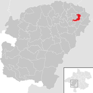
| Location of Oberndorf near Schwanenstadt in the Vöcklabruck district | ||
  |
||
| Source: Municipal data from Statistics Austria | ||

Oberndorf bei Schwanenstadt is a municipality in Upper Austria in the Vöcklabruck district in the Hausruckviertel with 1,376 inhabitants (as of January 1, 2020). The community is located in the judicial district of Vöcklabruck .
geography
Oberndorf near Schwanenstadt lies at an altitude of 390 m in the Hausruckviertel. The extension is 4.1 km from north to south and 3.6 km from west to east. The total area is 6.1 km². 4.9% of the area is forested, 80.3% of the area is used for agriculture.
Community structure
The municipality includes the following localities (population in brackets as of January 1, 2020):
- Edt (30)
- Kaiseredt (133)
- Cooking Spoonbill (20)
- Lebertsham (219)
- Niederholzham (230)
- Oberndorf (630)
- Winkl (114)
history
The earliest written document is from 889 and is "Obrinindorf".
Originally located in the eastern part of the Duchy of Bavaria, the place belonged to the Duchy of Austria since the 12th century. Since 1490 it has been assigned to the Principality of Austria ob der Enns .
During the Napoleonic Wars , the Austrian-Bavarian border temporarily ran through the municipality.
Since 1918 the place belongs to the federal state of Upper Austria. After the annexation of Austria to the German Reich on March 13, 1938, the place belonged to the Gau Oberdonau . After 1945 the restoration of Upper Austria took place.
The community was part of the Schwanenstadt judicial district until the end of 2004 and became part of the Vöcklabruck judicial district on January 1, 2005.
For cost reasons, Oberndorf has joined forces with the neighboring communities of Pitzenberg , Pühret and Rutzenham to form an administrative community. The joint municipal office is in Oberndorf. In the course of this cooperation, a joint building yard for the four communities was also built, which is housed in Rutzenham. On the basis of an initiative review of the savings potential, the State Audit Office recommended in 2015 that the four municipalities should be merged.
coat of arms
The municipal coat of arms, awarded in 1972, symbolizes the significant natural gas deposits in the municipality.
Blazon : In a black, twice corrugated shield base, three silver, two-to-one, directed towards the two wave crests and the central wave trough, rounded at the bottom, sloping to the right and pointed to the left (natural gas deposits); above three red flames in gold, the middle one from the trough of the waves to the upper edge of the shield, the two on the sides reaching from the wave crests to the head of the shield. The community colors are red-white-black
Population development
In 1991 the community had 1277 inhabitants according to the census, in 2001 it had 1351 inhabitants.
politics
The municipal council has a total of 19 members.
- With the municipal council and mayoral elections in Upper Austria in 2003, the municipal council had the following distribution: 9 ÖVP, 7 SPÖ, and 3 FPÖ.
- With the 2009 election, the municipal council had the following distribution: 9 ÖVP, 6 SPÖ, and 4 FPÖ.
- With the 2015 election , the municipal council has the following distribution: 10 ÖVP, 6 FPÖ, and 3 SPÖ.
- mayor
- since 1996 Rupert Imlinger (ÖVP)
Web links
- Map in the Digital Upper Austrian Room Information System ( DORIS )
- 41720 - Oberndorf near Schwanenstadt. Community data, Statistics Austria .
- Further information about the municipality of Oberndorf bei Schwanenstadt can be found on the geo-information system of the federal state of Upper Austria .
Individual evidence
- ↑ Statistics Austria: Population on January 1st, 2020 by locality (area status on January 1st, 2020) , ( CSV )

Ampflwang in the Hausruckwald | Attersee am Attersee | Attnang-Puchheim | Atzbach | Aurach am Hongar | Berg im Attergau | Desselbrunn | Fornach | Frankenburg | Frankenmarkt | Gampern | Innerschwand am Mondsee | Lenzing | Manning | Mondsee | Neukirchen an der Vöckla | Niederthalheim | Nussdorf am Attersee | Oberhofen am Irrsee | Oberndorf near Schwanenstadt | Oberwang | Ottnang am Hausruck | Pfaffing | Pilsbach | Pitzenberg | Pondorf | Puchkirchen | Pühret | Redleiten | Redlham | Regau | Riistorf | Rutzenham | Schlatt | Schörfling am Attersee | Schwanenstadt | Seewalchen am Attersee | St. Georgen im Attergau | St. Lorenz | Steinbach am Attersee | Straß im Attergau | Dig deep | Timelkam | Inaccurate | Unterach am Attersee | Vöcklabruck | Vöcklamarkt | Weißenkirchen im Attergau | Weyregg am Attersee | Wolfsegg am Hausruck | Zell am Moos | Zell am Pettenfirst