
Gampern
|
Gampern
|
||
|---|---|---|
| coat of arms | Austria map | |
 |
|
|
| Basic data | ||
| Country: | Austria | |
| State : | Upper Austria | |
| Political District : | Vöcklabruck | |
| License plate : | VB | |
| Surface: | 26.33 km² | |
| Coordinates : | 47 ° 59 ' N , 13 ° 33' E | |
| Height : | 509 m above sea level A. | |
| Residents : | 2,976 (January 1, 2020) | |
| Population density : | 113 inhabitants per km² | |
| Postal code : | 4851 | |
| Area code : | 07682 | |
| Community code : | 4 17 11 | |
| NUTS region | AT315 | |
| Address of the municipal administration: |
Hauptstrasse 14 4851 Gampern |
|
| Website: | ||
| politics | ||
| Mayor : | Jürgen Lachinger ( ÖVP ) | |
|
Municipal Council : (2015) (25 members) |
||
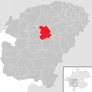
| Location of Gampern in the Vöcklabruck district | ||
  |
||
.JPG) Center with the parish church of St. Remigius |
||
| Source: Municipal data from Statistics Austria | ||

Gampern is a municipality in Upper Austria in the Vöcklabruck district in the Hausruckviertel with 2976 inhabitants (as of January 1, 2020). The responsible judicial district is Vöcklabruck .
geography
Gampern is located at an altitude of 509 m in the Hausruckviertel. The extension is 5.9 km from north to south and 6.8 km from west to east. The total area is 26.1 km². 19.2% of the area is forested, 71.3% of the area is used for agriculture.
Districts of the municipality
The municipality includes the following localities (population in brackets as of January 1, 2020):
- Baumgarting (184)
- Bergham (107)
- Beer tree (339)
- Egning (62)
- Fischham (51)
- Fish Ham Ring (86)
- Gallnbrunn (26)
- Gampern (760)
- Genstetten (58)
- Haunolding (105)
- Hehenberg (54)
- Hörgattern (65)
- Koberg (52)
- Oberheikerding (55)
- Piesdorf (86)
- Poering (82)
- Black Moss (131)
- Settling (50)
- Stone (23)
- Stötten (32)
- Unterheikerding (15)
- Cattle house (72)
- Moving on (268)
- Witch (133)
- Ceiling (80)
Neighboring communities
| Neukirchen an der Vöckla | ||
| Vöcklamarkt |
.svg)
|
Timelkam |
| Berg in the Attergau | Seewalchen am Attersee |
history
Gampern is mentioned for the first time around the year 800 under the name Campara in the tradition book of Mondsee. From 1143 it was incorporated into the Collegiat-Stift Mattsee as a branch of Vöcklamarkt until it became an independent parish in 1900. The right of patronage remained with Mattsee Abbey.
Originally located in the eastern part of the Duchy of Bavaria , the place belonged to the Duchy of Austria since the 12th century . Since 1490 it has been assigned to the Principality of Austria ob der Enns .
During the Napoleonic Wars , the place was occupied several times.
Since 1918 the place belongs to the federal state of Upper Austria . After the annexation of Austria to the German Reich on March 13, 1938, the place belonged to the Gau Oberdonau . After 1945 the restoration of Upper Austria took place.
In 2019 the municipality received the "IMPULS Award" in the digitization category.
Population development
In 2001, according to the census, the municipality had 2,472 inhabitants, in 2011 already 2701 inhabitants and at the beginning of 2019 2965 inhabitants.
politics
With the 2015 election, the municipal council with a total of 25 members has the following distribution: 13 ÖVP, 8 SPÖ and 4 FPÖ.
- mayor
- 2002–2020 Hermann Stockinger (ÖVP)
- since 2020 Jürgen Lachinger (ÖVP)
Since May 12, 2011, the municipality of Gampern has a member of the Upper Austrian state parliament, Hermann Krenn ( SPÖ ) .
coat of arms
Blazon : Between golden flanks in blue a golden, late Gothic winged altar with cafeteria, predella, central shrine, two wings and a five-part vent. The community colors are yellow-blue-yellow.
The coat of arms, awarded in 1974, shows the parish church's winged altar, which is important in terms of art history .
Culture and sights
- Parish Church of St. Remigius : The two-aisled late Gothic hall church was built from 1480 to 1486. At the beginning of the 16th century the mighty Gothic west tower was erected up to the roof level and in 1890 it was expanded to a height of 63 m. The winged altar in the late Gothic parish church of Gampernis a special attraction. The altar is the third largest Gothic winged altar in Upper Austria, made between 1497 and 1507.
- Memorial courtyard Kernstockhaus in Pöring : Former chaplain’s house, smoke house in log construction, today local museum.
Personalities
- Daniela Holzinger-Vogtenhuber (* 1987), politician (now - Pilz List, formerly SPÖ), grew up in Gampern
literature
- Gustav Bochenek: Heimatbuch Gampern. Gampern 1974. New: Hans Plötzeneder, edited by the community of Gampern, Mattighofen 1993.
- Maria Magdalena Gstöttner: first and last names in the Upper Austrian parish of Gampern between 1658 and 1710 . Diploma thesis University of Vienna, Vienna September 2008 ( pdf , othes.univie.ac.at)
Web links
- Map in the Digital Upper Austrian Room Information System ( DORIS )
- 41711 - Gampern. Community data, Statistics Austria .
- More information about the community of Gampern on the geo-information system of the federal state of Upper Austria .
Individual evidence
- ↑ Information on the website of the municipality of Gampern: New addressing and street names in Gampern
- ↑ Statistics Austria: Population on January 1st, 2020 by locality (area status on January 1st, 2020) , ( CSV )
- ↑ Municipal on June 27, 2019: Winner of the IMPULS Award
- ^ Hermann Kaser: The memorial courtyard Kernstockhaus / Poering. Munich 1974. New ed. Office of the Upper Austrian State government. Red. Fritz Lichtenauer. In: Kulturbericht Oberösterreich vol. 59, 2005, no. 7, supplement, Linz 2005, p. 9 ff.
- ↑ Denkmalhof Kernstockhaus , ooemuseumsverbund.at
- ↑ Core floor house . Entry in AtterWiki

Ampflwang in the Hausruckwald | Attersee am Attersee | Attnang-Puchheim | Atzbach | Aurach am Hongar | Berg im Attergau | Desselbrunn | Fornach | Frankenburg | Frankenmarkt | Gampern | Innerschwand am Mondsee | Lenzing | Manning | Mondsee | Neukirchen an der Vöckla | Niederthalheim | Nussdorf am Attersee | Oberhofen am Irrsee | Oberndorf near Schwanenstadt | Oberwang | Ottnang am Hausruck | Pfaffing | Pilsbach | Pitzenberg | Pondorf | Puchkirchen | Pühret | Redleiten | Redlham | Regau | Riistorf | Rutzenham | Schlatt | Schörfling am Attersee | Schwanenstadt | Seewalchen am Attersee | St. Georgen im Attergau | St. Lorenz | Steinbach am Attersee | Straß im Attergau | Dig deep | Timelkam | Inaccurate | Unterach am Attersee | Vöcklabruck | Vöcklamarkt | Weißenkirchen im Attergau | Weyregg am Attersee | Wolfsegg am Hausruck | Zell am Moos | Zell am Pettenfirst
Cadastral communities: Baumgarting | Beer tree | Gampern
Locations: Baumgarting | Bergham | Beer tree | Egning | Fischham | Fish ham ring | Gallnbrunn | Gampern | Genstetten | Haunolding | Hehenberg | Hörgattern | Koberg | Oberheikerding | Piesdorf | Poering | Black moss | Settling | Stone | Stötten | Unterheikerding | Viehaus | Swinging on | Witzling | Zeiling
Villages: Baumgarting • Bergham • Bierbaum • Egning • Gampern • Genstetten • Haunolding • Piesdorf • Schwarzmoos • Viehaus • Weiterschwang • Witzling • Zeiling | Weiler: Gallnbrunn • Siedling • Stein • Unterheikerding | Rotten: Fischham • Fischhamering • Hehenberg • Hörgattern • Koberg • Oberheikerding • Pöring • Stötten
Counting district: Gampern-Süd | Gampern-Nord