
Redlham
|
Redlham
|
||
|---|---|---|
| coat of arms | Austria map | |
 |
|
|
| Basic data | ||
| Country: | Austria | |
| State : | Upper Austria | |
| Political District : | Vöcklabruck | |
| License plate : | VB | |
| Surface: | 8.04 km² | |
| Coordinates : | 48 ° 1 ' N , 13 ° 45' E | |
| Height : | 403 m above sea level A. | |
| Residents : | 1,637 (January 1, 2020) | |
| Population density : | 204 inhabitants per km² | |
| Postal code : | 4846 | |
| Area code : | 07674 and 07673 | |
| Community code : | 4 17 30 | |
| NUTS region | AT315 | |
| Address of the municipal administration: |
Redlham 1 4846 Redlham |
|
| Website: | ||
| politics | ||
| Mayor : | Wolfgang Kaiß ( ÖVP ) | |
|
Municipal Council : (2015) (19 members) |
||
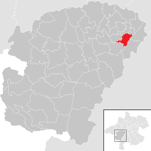
| Location of Redlham in the Vöcklabruck district | ||
  |
||
| Source: Municipal data from Statistics Austria | ||

Redlham is a municipality in Upper Austria in the Vöcklabruck district in the Hausruckviertel with 1637 inhabitants (as of January 1, 2020). The community is located in the judicial district of Vöcklabruck .
geography
Redlham is 403 m above sea level in the Hausruckviertel. The extension is 4.7 km from north to south and 4 km from west to east. The total area is 8.04 km². 8.2% of the area is forested, 76.6% of the area is used for agriculture and 15.2% is building land.
Districts of the municipality
The municipality includes the following localities (population in brackets as of January 1, 2020):
- Au (203)
- Waiting (114)
- Erlau (172)
- Fishing (56)
- Business Park Mitte (13)
- Business Park East (0)
- Business Park West (18)
- Hainprechting (241)
- Jebing (15)
- Landertsham (67)
- Piesing (36)
- Redlham (381)
- Sonnfeld (40)
- Tuffeltsham (281)
coat of arms
Blazon : Divided by an oblique left-hand bar, which is undulating at the top and straight at the bottom and sloping undulating with blue and silver; above in gold a blue cornflower, below in red a silver, overturned shovel blade. The community colors are red and yellow.
The coat of arms was on January 21, 1985 by the Upper Austrian. State government awarded. The blue stream, which divides the coat of arms diagonally, refers to the Redlbach, whose name also forms the community name. The white sloping part indicates that the Wiener Bundesstrasse (B1) and the western railway line of the ÖBB running parallel to it divides the municipal area. The cornflower blossom symbolizes the agriculture in the municipality. The silver shovel blade refers to trade and industry, especially the rich gravel deposits.
history
Originally located in the eastern part of the Duchy of Bavaria, the place belonged to the Duchy of Austria since the 12th century. Since 1490 it has been assigned to the Principality of Austria ob der Enns . The municipality of Redlham first appears in records around 1300 under the name Roetelhaim and around 1500 as Retlham . The places with the "-ing" in their name (Hainprechting, Jebing, Piesing, Fisching) indicate that the community was already settled at the time of the Bavarian conquest in the 6th and 7th centuries AD. For the longest time Redlham belonged to the Puchheim manor. The municipal law of 1850 declared Redlham as an autonomous municipality, which, however, has been merged into an administrative community with Oberndorf and Schlatt . From September 1, 1850, Johann Fellner was the first mayor of the community. The administrative community was dissolved in 1931 and Redlham has been managed independently since then.
During the Napoleonic Wars , the place was occupied several times.
Since 1918 the place belongs to the federal state of Upper Austria. After the annexation of Austria to the German Reich on March 13, 1938, the place belonged to the Gau Oberdonau . After 1945 the restoration of Upper Austria took place.
The community was part of the Schwanenstadt judicial district until the end of 2004 and became part of the Vöcklabruck judicial district on January 1, 2005.
politics
The municipal council has 19 members and has been composed as follows since the election in September 2015 : 12 ÖVP, 5 SPÖ and 2 FPÖ.
- mayor
- 1850–1858 Johann Fellner (first mayor)
- 2003–2020 Johann Forstinger (ÖVP)
- since 2020 Wolfgang Kaiß (ÖVP)
Population development
In 1991 the community had 1230 inhabitants according to the census, in 2001 it had 1309 inhabitants. On October 31, 2010 there were 1437 inhabitants - this corresponds to an increase of 16.83%.
Economy and Transport
Redlham is an extremely interesting business location for companies, as several factors prove to be very beneficial:
- A fully developed infrastructure (sewer, electricity, water, gas and broadband)
- Sandwich community between the two cities of Attnang-Puchheim and Schwanenstadt
- The location directly on the B 1 federal highway and on the western railway line Salzburg-Vienna
- In addition, the proximity to the A 1 western motorway
There are currently more than 35 small and medium-sized businesses in the community.
Furthermore, the large gravel deposits represent an important economic factor. The company Niederndorfer Bau-GmbH has been based in Redlham since 1955 and the company Hofmann GmbH & Co KG since 1972. Other large companies are the companies AVE Austria GmbH , Tropper Maschinen und Anlagen GmbH and Domo-Sanifer Koller & Reisinger Produktion-Handel GmbH .
Leisure and culture
The Römerradweg R6 and the Jakobsweg run right through the municipality . For all sports enthusiasts, in addition to the tennis courts and the beach volleyball court, there is also a stick sports facility in the village of Redlham. If the snow conditions allow it in winter, a trail is groomed for cross-country skiers.

In addition to the plague column in the village of Redlham, some small chapels in the various villages are culturally interesting. Furthermore, the Troadkasten in the village of Tuffeltsham is used for a cozy get-together for the population.
literature
- Redlham Parish (ed.): Redlham Home Directory. 2004
- Master's thesis "Quo vadis Redlham", author Anton Maringer, MPA, 2008; http://www.redlham.ooe.gv.at/gemeindeamt/html/Quo_vadis_Redlham.pdf
Web links
- Map in the Digital Upper Austrian Room Information System ( DORIS )
- http://www.redlham.at
- 41730 - Redlham. Community data, Statistics Austria .
- Further information about the municipality of Redlham on the geographic information system of the federal state of Upper Austria .
Individual evidence
- ↑ Statistics Austria: Population on January 1st, 2020 by locality (area status on January 1st, 2020) , ( CSV )

Ampflwang in the Hausruckwald | Attersee am Attersee | Attnang-Puchheim | Atzbach | Aurach am Hongar | Berg im Attergau | Desselbrunn | Fornach | Frankenburg | Frankenmarkt | Gampern | Innerschwand am Mondsee | Lenzing | Manning | Mondsee | Neukirchen an der Vöckla | Niederthalheim | Nussdorf am Attersee | Oberhofen am Irrsee | Oberndorf near Schwanenstadt | Oberwang | Ottnang am Hausruck | Pfaffing | Pilsbach | Pitzenberg | Pondorf | Puchkirchen | Pühret | Redleiten | Redlham | Regau | Riistorf | Rutzenham | Schlatt | Schörfling am Attersee | Schwanenstadt | Seewalchen am Attersee | St. Georgen im Attergau | St. Lorenz | Steinbach am Attersee | Straß im Attergau | Dig deep | Timelkam | Inaccurate | Unterach am Attersee | Vöcklabruck | Vöcklamarkt | Weißenkirchen im Attergau | Weyregg am Attersee | Wolfsegg am Hausruck | Zell am Moos | Zell am Pettenfirst