
Lenzing
|
market community Lenzing
|
||
|---|---|---|
| coat of arms | Austria map | |
 |
|
|
| Basic data | ||
| Country: | Austria | |
| State : | Upper Austria | |
| Political District : | Vöcklabruck | |
| License plate : | VB | |
| Surface: | 8.89 km² | |
| Coordinates : | 47 ° 59 ' N , 13 ° 37' E | |
| Height : | 485 m above sea level A. | |
| Residents : | 5,219 (January 1, 2020) | |
| Population density : | 587 inhabitants per km² | |
| Postal code : | 4860 | |
| Area code : | 07672 | |
| Community code : | 4 17 13 | |
| NUTS region | AT315 | |
| Address of the municipal administration: |
Hauptplatz 4 4860 Lenzing |
|
| Website: | ||
| politics | ||
| Mayor : | Rudolf Vogtenhuber ( SPÖ ) | |
|
Municipal Council : (2015) (31 members) |
||
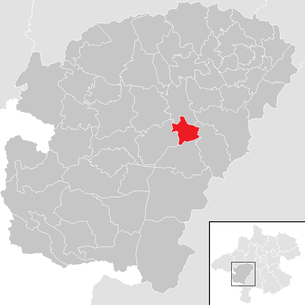
| Location of Lenzing in the Vöcklabruck district | ||
  |
||
| Source: Municipal data from Statistics Austria | ||

Lenzing is a market town in Upper Austria in the Vöcklabruck district in the Hausruckviertel with 5219 inhabitants (as of January 1, 2020). The responsible judicial district is Vöcklabruck .
geography
Lenzing lies at 485 m above sea level. A. Höhe in the Hausruckviertel. The extension is 4.1 km from north to south and 4.2 km from west to east. The total area is 8.9 km². 13.2% of the area is forested (1.17 km²) and 56.4% of the area is used for agriculture (5.01 km²).
Localities
The municipality includes the following localities (population in brackets as of January 1, 2020):
- Alt Lenzing (720)
- Haid (51)
- Kraims (56)
- Lenzing (3083)
- Neuhausen (48)
- Oberachmann (358)
- Pichlwang (316)
- Raudaschlmühle (0)
- Reibersdorf (109)
- Thal (41)
- Ulrichsberg (55)
- Unterachmann (382)
Neighboring communities
| Timelkam | ||
| Seewalchen am Attersee |
.svg)
|
Aurach am Hongar |
| Schörfling am Attersee |
coat of arms
Blazon : Divided diagonally to the right by a silver wavy bar; at the top a silver retort, half filled in blue, turned outwards; below in blue a silver conifer. The community colors are red-white-blue.
The coat of arms, awarded in 1967, is the result of an ideas competition organized by the municipality. The tree and retort refer to the wood, paper and pulp industries that characterize the place, the corrugated strip symbolizes the ager that made the settlement of these companies possible in the first place.
history
Originally located in the eastern part of the Duchy of Bavaria, the area of today's Lenzing has belonged to the Duchy of Austria since the 12th century. Since 1490 it has been assigned to the Principality of Austria ob der Enns .
In 1892 the industrialist Emil Hamburger founded a paper mill in Pettighofen, a forerunner of today's Lenzing AG . Since 1918 the area has belonged to the newly founded federal state of Upper Austria.
After Austria was annexed to the German Reich in 1938, "Zellwolle Lenzing AG" was founded. In 1939 today's community was founded from the parent community of Oberachmann as well as through assignments of territory by the neighboring communities. On January 1, 1940, the name of the community was changed to "Agerzell".
In November 1944, an external command of the Mauthausen concentration camp was set up in the Lenzing district of Pettighofen . The up to 565 prisoners, mostly women, had to do forced labor, especially at Lenzinger Zellwolle AG . The camp was liberated by the US Army in early May 1945.
Lenzing has been a market town since 1984.
politics
With the 2015 election, the municipal council with a total of 31 members has the following distribution: 18 SPÖ, 8 FPÖ and 5 ÖVP.
- mayor
- since 2013 Rudolf Vogtenhuber (SPÖ)
Population development
In 1991 the community had 5063 inhabitants according to the census, then 5049 inhabitants in 2001, 5090 inhabitants in 2007 and 4986 inhabitants in 2017.
Culture and sights


- Parish church Lenzing : Catholic parish church hl. Geist, built between 1959 and 1962 according to plans by the architect Hans Eigner, is a listed building
- Schimmelkirche Pichlwang : A late Gothic church from the 15th / 16th centuries. Century.
Sports
The ATSV Lenzing Modal is at home in Lenzing.
traffic
train
The single-track, electrified Vöcklabruck – Kammer-Schörfling railway runs through Lenzing . Trains stop at the Lenzing and Lenzing Ort stations at irregular intervals Monday through Friday, some of which continue to Attnang-Puchheim.
Street
- The Attersee Straße - from Timelkam to Mondsee - leads through the community.
- South of Lenzing are the Seewalchen and Schörfling motorway access roads to the A1 West motorway .
Economy and Infrastructure
Established businesses

- Lenzing AG : Lenzing AG's Lenzing location has the world's largest integrated pulp and viscose fiber production with a pulp capacity of 225,000 t per year.
- Furthermore, a number of medium and small businesses are located in Lenzing.
Personalities
People related to the place
- Therese Neudorfer (1920–1990), from 1961 member of the Lenzing municipal council, 1967–1985 member of the state parliament (SPÖ)
Web links
- Map in the Digital Upper Austrian Room Information System ( DORIS )
- 41713 - Lenzing. Community data, Statistics Austria .
- Further information about the municipality of Lenzing can be found on the geographic information system of the federal state of Upper Austria .
Individual evidence
- ↑ Statistics Austria: Population on January 1st, 2020 by locality (area status on January 1st, 2020) , ( CSV )
- ^ Herbert Erich Baumert: The coats of arms of the cities, markets and communities of Upper Austria (2nd supplement) . In: Oberösterreichische Heimatblätter, Heft 1/2, 1970, p. 58, online (PDF; 1.6 MB) in the forum OoeGeschichte.at
- ↑ The history of the market town of Lenzing on Lenzing.ooe.gv.at
- ↑ https://www.mauthausen-memorial.org/en/History/The-Mauthausen-Concentration-Camp-19381945/Female-Prisoners

Ampflwang in the Hausruckwald | Attersee am Attersee | Attnang-Puchheim | Atzbach | Aurach am Hongar | Berg im Attergau | Desselbrunn | Fornach | Frankenburg | Frankenmarkt | Gampern | Innerschwand am Mondsee | Lenzing | Manning | Mondsee | Neukirchen an der Vöckla | Niederthalheim | Nussdorf am Attersee | Oberhofen am Irrsee | Oberndorf near Schwanenstadt | Oberwang | Ottnang am Hausruck | Pfaffing | Pilsbach | Pitzenberg | Pondorf | Puchkirchen | Pühret | Redleiten | Redlham | Regau | Riistorf | Rutzenham | Schlatt | Schörfling am Attersee | Schwanenstadt | Seewalchen am Attersee | St. Georgen im Attergau | St. Lorenz | Steinbach am Attersee | Straß im Attergau | Dig deep | Timelkam | Inaccurate | Unterach am Attersee | Vöcklabruck | Vöcklamarkt | Weißenkirchen im Attergau | Weyregg am Attersee | Wolfsegg am Hausruck | Zell am Moos | Zell am Pettenfirst