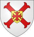
Saint-André-de-Roquelongue
| Saint-André-de-Roquelongue | ||
|---|---|---|

|
|
|
| region | Occitania | |
| Department | Aude | |
| Arrondissement | Narbonne | |
| Canton | Les Corbières | |
| Community association | Région Lézignanaise, Corbières et Minervois | |
| Coordinates | 43 ° 7 ' N , 2 ° 50' E | |
| height | 48-291 m | |
| surface | 30.81 km 2 | |
| Residents | 1,390 (January 1, 2017) | |
| Population density | 45 inhabitants / km 2 | |
| Post Code | 11200 | |
| INSEE code | 11332 | |
 12th century church |
||
Saint-André-de-Roquelongue is a French commune with a population of 1,390 (1 January 2017) in the Aude department in the region of Occitania .
geography
Saint-André-de-Roquelongue is sixteen kilometers southwest of Narbonne . The municipality is traversed by the Aussou River , a tributary of the Orbieu .
history
The earliest traces of human settlement go back to the Neolithic Age (5000-2500 BC). Traces from this era can still be found in the municipality today, including a dolmen.
Sheep breeding was always the most important livelihood of the population until the middle of the 19th century. The settlement gained importance through the Roman occupation, which began in 118 BC. There were also four Gallo-Roman villas in the area of today's municipality.
Saint-André later fell under the rule of Montséret . It was also farmers from Montséret who founded the village at the foot of the Roquelongue hill . The church was mentioned in 1178, in 1744 it was restored. The Abbot of Fontfroide had been the main ruler of Saint-André since 1189 , and the Archbishop of Narbonne, the Lord of Montséret and the Viscount of Narbonne also had a claim to territory. In the Middle Ages, the pre-ecclesiastical Saint-Jacques chapel existed next to the parish church , of which only remains can be found on the Vernède hill today. It was not until 1791 that Saint-André became an independent municipality (previously part of Montséret). After the revolution, agriculture was dominated by arable farming (especially wheat) and livestock, and viticulture made up only a limited proportion. In 1891 the population reached its peak with 1228 inhabitants. After the Second World War , the population fell, down to 680 in 1982. Due to the proximity to the centers of Narbonne and Lézignan-Corbières , the number of inhabitants has since increased again.
Personalities
- Léopold Servole , French rugby player, born in Saint-André in 1906
Population development
| year | 1962 | 1968 | 1975 | 1982 | 1990 | 1999 | 2008 | 2016 |
| Residents | 760 | 813 | 756 | 680 | 755 | 828 | 1063 | 1406 |
