Palairac
| Palairac | ||
|---|---|---|

|
|
|
| region | Occitania | |
| Department | Aude | |
| Arrondissement | Narbonne | |
| Canton | Les Corbières | |
| Community association | Région Lézignanaise, Corbières et Minervois | |
| Coordinates | 42 ° 57 ′ N , 2 ° 40 ′ E | |
| height | 252-631 m | |
| surface | 17.93 km 2 | |
| Residents | 30 (January 1, 2017) | |
| Population density | 2 inhabitants / km 2 | |
| Post Code | 11330 | |
| INSEE code | 11271 | |
 Place de la Font , the town center |
||
Palairac is a French commune in the Aude department in the region of Occitania . It belongs to the Arrondissement Narbonne and the communal association Communauté de communes Région Lézignanaise, Corbières et Minervois .
geography
The municipality of Palairac is located about 35 kilometers northwest of Perpignan (as the crow flies).
The municipality covers a section of the Corbières mountain range north of the Mont Tauch massif. The village lies in the valley of the small river Ruisseau de la Peyre , which flows over the Ruisseau du Moulin , the Mas de Ségure and the Petit Verdouble to the Verdouble . The hilly area is characterized by open Mediterranean shrub heaths ( garigue ) and somewhat denser tree vegetation in the valleys. The highest point in the municipality is the Pech de Guillaumet at 631 m above sea level.
Palairac borders in the north on Talairan (point of contact), in the east on Quintillan , in the south-east on Tuchan , in the south-west on Maisons , in the west on Davejean and in the north-west on Félines-Termenès and Villerouge-Termenès .
history
The history of Palairac goes back to the 8th century. Charles the Bald gave the place to one of his vassals named Milon in 842 . From 876 until the French Revolution, Palairac remained in the possession of the Lagrasse Abbey .
There has been evidence of mining in and around Palairac since the Carolingian era . Small iron mines were exploited, but coal was also extracted. In the 13th century, the mines belonged to the Viscount of Béziers and the Lords of Termes . A treaty between the kings of France and Aragon, Philip the Bold and Peter the Great, was concluded in Palairac Castle on August 18, 1283 . The castle was devastated during fighting in 1655, today only sparse remains of the wall are visible.
Population development
In the middle of the 19th century the community still had over 200 residents. With the decline of mining at the beginning of the 20th century, an emigration trend gradually set in, and it wasn't until the end of the 20th century that the population stabilized at a low level. With 30 inhabitants (as of January 1, 2017), Palairac is one of the smallest communities in the Aude department today.
| year | 1962 | 1968 | 1975 | 1982 | 1990 | 1999 | 2007 | 2017 | |
| Residents | 49 | 30th | 20th | 19th | 26th | 18th | 28 | 30th | |
| Sources: Cassini and INSEE | |||||||||
Attractions
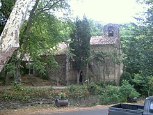
The Romanesque parish church of Saint-Saturnin, just outside the village, dates from the 12th century. The simply constructed church building with a barrel vault was extended by two side chapels in the 14th century. The square bell tower with a gable roof is located on the west gable of the nave. The church is listed as a monument historique .
Economy and Infrastructure
There are six farms in the community (grain cultivation, a winegrower, breeding of horses, sheep and goats). The vines in the municipality are within the protected designation of origin Corbières .
The community is located away from the major national traffic routes. From the southeast, a road leads from Tuchan to Palairac; further road connections exist over the Col de Ferréol to Maisons , over the Col de Couise to Félines-Termenès and over the passes Col de la Gineste and Col d'Amiel to Quintillan .
supporting documents
- ↑ Brief history, private website, author: Stéphane Guizard (French)
- ↑ Palairac on cassini.ehess.fr
- ↑ Palairac on insee.fr
- ↑ Saint-Saturnin Church in the Base Mérimée of the French Ministry of Culture (French)
- ↑ Farms on annuaire-mairie.fr (French)

