Saint-Pierre-des-Champs
| Saint-Pierre-des-Champs | ||
|---|---|---|

|
|
|
| region | Occitania | |
| Department | Aude | |
| Arrondissement | Narbonne | |
| Canton | Les Corbières | |
| Community association | Région Lézignanaise, Corbières et Minervois | |
| Coordinates | 43 ° 4 ′ N , 2 ° 36 ′ E | |
| height | 133-520 m | |
| surface | 15.89 km 2 | |
| Residents | 181 (January 1, 2017) | |
| Population density | 11 inhabitants / km 2 | |
| Post Code | 11220 | |
| INSEE code | 11363 | |
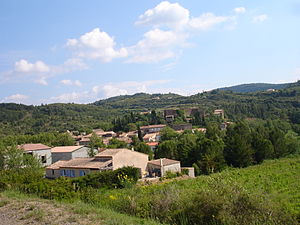
 Place view |
||
Saint-Pierre-des-Champs ( Occitan Sant Pèire dels Camps ) is a French commune with 181 inhabitants (as of January 1, 2017) in the Aude department in the Occitanie region . It belongs to the Arrondissement of Narbonne and the canton of Les Corbières .
Neighboring communities
Neighboring municipalities of Saint-Pierre-des-Champs are Lagrasse in the northeast, Talairan in the southeast, Saint-Martin-des-Puits in the southwest and Caunettes-en-Val in the northwest.
Population development
| year | 1962 | 1968 | 1975 | 1982 | 1990 | 1999 | 2013 |
| Residents | 189 | 155 | 152 | 121 | 134 | 127 | 177 |
Attractions
- Chateau
- Saint-Pierre church
Web links
Commons : Saint-Pierre-des-Champs - Collection of images, videos and audio files
