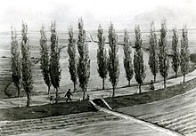
Trenkengraben
|
Trenkengraben also Tränkengraben |
||
|
Trenkengraben on a map from 1908 |
||
| Data | ||
| location | Germany , Saxony | |
| River system | Elbe | |
| Drain over | Mühlpleiße → Pleiße → Weisse Elster → Saale → Elbe → North Sea | |
| source | Teufelsloch in Probstheida 51 ° 18 ′ 26 ″ N , 12 ° 26 ′ 0 ″ E |
|
| Source height | 145 m | |
| muzzle | in Connewitz in the Mühlpleiße coordinates: 51 ° 18 '10 " N , 12 ° 22' 30" E 51 ° 18 '10 " N , 12 ° 22' 30" E |
|
| Mouth height | 109 m | |
| Height difference | 36 m | |
| Bottom slope | about 9 ‰ | |
| length | about 4 km | |
| Big cities | Leipzig | |
The Trenkengraben was a stream in the villages of Probstheida and Connewitz, which today belong to Leipzig, and flowed into the Mühlpleiße on the right-hand side to the west of Connewitz .
The source of the Trenkengraben was the Teufelsloch in Probstheida in the area of today's Trendelenburgstrasse; from there it ran through the center of Probstheida, then a little bit to the north to the west next to today's Prager Strasse, before turning west. From here the course of the brook was dammed up several times to form ponds (the westernmost was the poplar pond) and ran through the area of today's Südfriedhof and today's Märchenwiese in the current district of Marienbrunn to Connewitz, where it emptied into Mühlpleiße.
The village of Ölschwitz, which had already fallen desolate in the Middle Ages, lay on its bank in the area of the Märchenwiese .
The Trenkengraben can no longer be found in today's townscape, it was piped in stages, beginning in 1870 at the end of the mouth, until 1930 and integrated into the Leipzig sewer system. His valley can still be seen in the course of the Märchenwiese and Hildebrandstrasse.
Individual evidence
- ^ Connewitz - A historical and urban study . PRO LEIPZIG 2008, p. 58
swell
- Miles sheets from Saxony "Freiberger Exemplar" , recorded 1802–1876, from the holdings of the Deutsche Fotothek Dresden [1]

