Burgauenbach
| Burgauenbach | ||
|
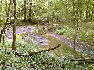
The Burgauenbach in the Burgaue |
||
| Data | ||
| location | Saxony , Germany | |
| River system | Elbe | |
| Drain over | Bauerngraben → Neue Luppe → White Elster → Saale → Elbe → North Sea | |
| source | as a tributary of the Nahle in Leipzig 51 ° 21 '23 " N , 12 ° 20' 1" E |
|
| Source height | 103 m above sea level NN | |
| muzzle | at Lützschena-Stahmeln in the Bauerngraben Coordinates: 51 ° 22 '12 " N , 12 ° 17' 18" E 51 ° 22 '12 " N , 12 ° 17' 18" E |
|
| Mouth height | 98.9 m above sea level NN | |
| Height difference | 4.1 m | |
| Bottom slope | 0.76 ‰ | |
| length | 5.4 km | |
| Drain |
MQ |
500 l / s |
| Big cities | Leipzig | |
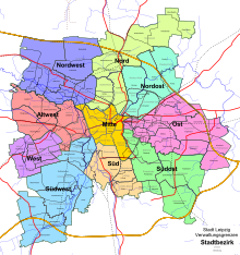
| Communities | City districts: Old-West , North -West districts: Leutzsch and Wahren | |
The Burgauenbach is one of the numerous tributaries of the White Elster in its anastomosing river course (often referred to as the inland delta ). It was artificially created between 1997 and 1999 as part of a renaturation measure and flows exclusively in the Leipzig city area.
The Burgauenbach is a second order body of water under water law .
Surname
The Burgauenbach takes its name from the Burgaue forest (formerly also Bürgeraue), as its main function is its watering.
Water bed
The bed of the Burgauenbach mostly consists of oxbow lakes and flood channels from historic waters that have been connected to one another. Some sections had to be re-profiled or newly created.
The Burgauenbach is on average one to two meters wide and is characterized by numerous meanders along its entire length , which, with their impact and sliding slopes, enable the typical dynamic interplay of erosion and sedimentation. In some sections with a slight gradient, the stream bed is widened and the Burgauenbach splits into several small streams, only to reunite shortly afterwards.
course
The Burgauenbach branches off from the Nahle in the Leipzig district of Alt-West in the district of Leutzsch above the Nahle weir . Over the next three kilometers it first passes the Kleine Luppe in three culverts , then the Leipzig – Leutzsch railway line (the Wahren – Leutzsch railway line that follows shortly thereafter is crossed in the tunnel) and finally Gustav-Esche-Straße. In this area, a junction leads about 0.2 m³ of water per second to the Bauerngraben . At the nearby border with the Burgaue district in the district of Wahren, the Burgauenbach has almost half of its way behind it.
After about 3.5 km of flowing, a trough bridge leads the Burgauenbach over the Bauerngraben, which runs almost two meters lower. The Burgauenbach joins it after a total of 5.374 km and, according to the current definition, ends at this long-standing body of water. According to the criterion of greater water flow, however, the Bauerngraben flows into the Burgauenbach, shortly before it flows into the Neue Luppe .
Renaturation
As early as the 1980s, volunteer conservationists campaigned for the rewetting of the Leipzig floodplain forest . However, this only became possible after the political change in the 1990s through the cooperation of NABU , the Office for Environmental Protection of the City of Leipzig and the Saxon Ministry for Environment and Agriculture.
Proof of feasibility was followed by the preparation of the approval documents by Beller Consult GmbH, which was provided by the Naturschutzbund Deutschland, Landesverband Sachsen e. V. was commissioned in 1996. After the planning approval, the employment promotion company started work on the formation of the river bed in December 1997. Subsequently, the crossing of paths and railway lines, the crossing of the water with the Bauerngraben and an extraction structure on the Nahle were completed.
After over two years of construction, the Burgauenbach was officially opened on March 22, 1999. The project costs of around 1.5 million DM were borne by funds from the Saxon Ministry for Environment and Agriculture as well as own funds from NABU and the city of Leipzig.
See also
Web links
- Restoration of former watercourses of the Luppe , part 2, bgmr landscape architects, 2009 ( PDF file; 9.7 MB )
Individual evidence
- ↑ Der Burgauenbach ( Memento of the original dated February 2, 2010 in the Internet Archive ) Info: The archive link was inserted automatically and has not yet been checked. Please check the original and archive link according to the instructions and then remove this notice. On: leipzig.de
- ↑ a b c Leipzig River II. Order ( Memento of the original from January 4, 2014 in the Internet Archive ) Info: The archive link has been inserted automatically and has not yet been checked. Please check the original and archive link according to the instructions and then remove this notice.
- ↑ a b Restoration of the former rivers of the Luppe. , Part 1, bgmr Landschaftsarchitekten, 2006 ( PDF file; 13.7 MB )
- ^ Topographic map of Saxony 1: 25000. (Measuring table sheets & equidistant map), Royal General Staff, Leipzig, various editions 1874–1942, sheet 10, on: deutschefotothek.de
- ↑ Leipzig Lexicon: Burgauenbach
- ↑ Nature Conservation Today - Issue 3/00 ( Memento from June 15, 2009 in the Internet Archive )

