
Near
| Near | ||
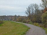
 The Nahle (shown in red) in the Leipzig water junction |
||
| Data | ||
| location | Leipzig , Saxony , Germany | |
| River system | Elbe | |
| Drain over | New Luppe → White Elster → Saale → Elbe → North Sea | |
| source | Northwest end of the Elster Basin 51 ° 21 ′ 19 ″ N , 12 ° 20 ′ 13 ″ E |
|
| Source height | 103 m above sea level NN | |
| muzzle | in the Neue Luppe Coordinates: 51 ° 22 ′ 5 ″ N , 12 ° 18 ′ 39 ″ E 51 ° 22 ′ 5 ″ N , 12 ° 18 ′ 39 ″ E |
|
| Mouth height | 99.6 m above sea level NN | |
| Height difference | 3.4 m | |
| Bottom slope | 1.3 ‰ | |
| length | 2.7 km | |
| Left tributaries | Little doll | |
| Big cities | Leipzig | |
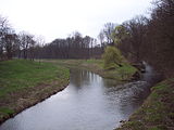
 The confluence of the Nahle in the Neue Luppe |
||
The Nahle is a 2.7 kilometer long tributary of the White Elster in Leipzig , Saxony , and flows into the Neue Luppe . It is part of the Elster-Luppe system in the northern Leipzig floodplain forest .
course
Today's course

The Nahle is a flowing body of first order. It begins as an outflow of the Elster basin (10) at its north-west end and initially leads in a straight line in a north-westerly direction. After just a few meters, the Burgauenbach (9), which leads west, branches off , then the Nahle crosses the Nahle weir (8) and picks up the Kleine Luppe (7) on the left, in whose original bed it flows from there. In its further course it crosses under the railway line Leipzig – Großkorbetha (6), the Leipziger Güterring (5) and the Gustav-Esche-Straße (4). About 300 m west of the Auensee (2) the Nahle flows into the Neue Luppe (1), which at this point has a level of 99.6 m above sea level. NN has.
Shortly before that, a 3 km long flood bed branches off on the left side, which runs parallel to the Neue Luppe further south and finally disappears into the landscape. Via the Nahle outlet structure (3) built in 1954 after the floods of July 1954 , the floodplain forest south of the Neue Luppe including the Burgaue can be flooded. The outlet structure was opened partially on January 9, 2011 and fully opened on January 14, 2011. In June 2013 the outlet was opened a second time during the flood . The near outlet structure was replaced by a new building in 2014.
Original course
The Nahle originally began further east, where it branched off from the Weisse Elster at Niederholz opposite the Rosental . Its inflow was regulated by the Nagel- or Amelungs weir, which lies immediately to the north in the Elster. In the area of what is now the Elster Basin, it absorbed the Kuhburg water, which has now been filled in, from the south . It finally flowed into the bowl .
Surname
The name Nahle means "the pool water".

Nahleberg
The former Möckern landfill, which is located west of the river and is wooded on the slopes, with a height of about 30 meters is sometimes referred to as Nahleberg ; the summit stone also bears this name.
photos

Junction of the Nahle (left) and the White Elster (far right) from the Elster basin

Branch of the Nahle (left) from the Elster basin, in the background the Luppewehr, the railway line and the Wahrener water tower
Nahlewehr

Kleine Luppe (in front) and Nahle with weir, in the background the city high-rise
Mouth of the Kleiner Luppe (right) into the Nahe

Bridge of the Leipzig freight ring

Nahle during floods (January 2011)

The opened Nahle outlet structure in January 2011

New near outlet structure with Neuer Luppe in the foreground


literature
- Georg Grebenstein: The Leipzig waters from the turn of the millennium to the present , in: Neue Ufer 3, Stadt-Kultur-Projekt Leipzig, Leipzig 1995, pp. 6, 23, 25
- Horst Riedel: Stadtlexikon Leipzig from A to Z. 1st edition, ProLEIPZIG 2005, p. 424
Individual evidence
- ↑ Der Bergauenbach ( Memento from February 2, 2010 in the Internet Archive ) On: leipzig.de
- ↑ Leipzig rivers 1st order
- ↑ Georg Grebenstein: The Leipzig waters from the turn of the millennium to the present , in: Neue Ufer 3, Stadt-Kultur-Projekt Leipzig, Leipzig 1995, p. 25
- ^ Georg Grebenstein: The Leipzig waters from the turn of the millennium to the present , in: Neue Ufer 3, Stadt-Kultur-Projekt Leipzig, Leipzig 1995, p. 4
Web links
- Detailed description of the Nahle in the Leipzig Lexicon , accessed on February 13, 2010