
Paußnitz
| Paußnitz | ||
 The Paußnitz (shown in red) in the Leipzig water junction |
||
| Data | ||
| location | Saxony , Germany | |
| River system | Elbe | |
| Drain over | White Elster → Saale → Elbe → North Sea | |
| source | as a branch of the Lauer border ditch in Leipzig 51 ° 17 '17 " N , 12 ° 20' 42" E |
|
| Source height | 112 m above sea level NN | |
| muzzle | In Leipzig in the Elster flood bed coordinates: 51 ° 19 ′ 1 ″ N , 12 ° 21 ′ 8 ″ E 51 ° 19 ′ 1 ″ N , 12 ° 21 ′ 8 ″ E |
|
| Mouth height | 107.4 m above sea level NN | |
| Height difference | 4.6 m | |
| Bottom slope | 0.77 ‰ | |
| length | 6 km | |
| Drain |
MQ |
50 l / s |
| Big cities | Leipzig | |
| Communities | Boroughs: southwest , south ; Districts: Großzschocher and Connewitz | |
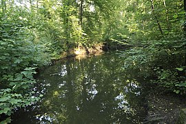
 The middle Paußnitz on the Blümelsteig |
||
The Paußnitz is one of the numerous tributaries of the White Elster in its anastomosing river course (often referred to as the inland delta ). However, it does not branch off directly from the White Elster, but from an artificial tributary of the magpie, the Lauer Grenzgraben .
It flows exclusively in the Leipzig city area and is a water body of the 2nd order under water law .
Surname
The name Paußnitz has been used (reliably verifiable) since 1889. Before that is often found the name Black Pool (also Black Lagge), reflecting the fact that the Paußnitz not resulted in any year water constantly, but often an oxbow lake or Flutgerinne with standing water character was like.
geography
Demarcation
Depending on the definition (minimum width three or five meters), the Paußnitz is a small river or stream . Due to scouring , it is sometimes wider than five meters. Due to the low runoff, however, the name Bach is preferable.
Hydromorphology
The White Elster near Leipzig was originally a gravelly lowland river . Since human deforestation began several thousand years ago in its upper reaches, it has mainly transported fine sediments, which it deposits as clay in the Leipzig lowland bay.
Since the White Elster flows through a valley more than a kilometer wide from Zeitz and transports a lot of sand and silt , numerous river islands and tributaries such as the Paußnitz have formed here. This is facilitated by the fact that the White Elster, despite its comparatively low flow rate (MQ = 15 m³ / s near Leipzig), transports thirty times the mean discharge (MQ) through the river valley during a 100-year flood (HQ100) . In connection with the sediment load, the loamy soils and the low gradient of the White Elster, floods led to regular relocation, separation or re-covering of river beds and tributaries.
The course of the Paußnitz changed regularly due to extreme flood events and many flood channels, oxbow lakes and pools were created. Due to the almost complete regulation of the White Elster, this has not been done since 1956. Today about half of the original, strongly winding river course is still flowed through, about 80 percent of which is still present and only interrupted in a few places by dikes or paths (excavated not included).
Original course


The Paußnitz branched off from the Batschke between the Markkleeberg districts of Gautzsch , Zöbigker and Gut Lauer (since 1920 to the city of Leipzig) . (Also a former Elster tributary, now called Floßgraben ) The Cospuden opencast mine , however, arose in this area and in 1974 destroyed the natural connection between the two rivers to the White Elster.
Today there is the Cospudener See , from which the Floßgraben is mainly fed, while the Paußnitz is no longer connected to it. The historical course of the Batschke still marks the border between Markkleeberg and Leipzig at this point .
The Paußnitz flowed into the Pleiße around 1780 . One hundred years later it had shifted its lower course northwest to the Rödel through several floods . This branch of the Pleiße, also known as Rödelwasser, branched off near the Connewitz weir and flowed into the White Elster in the area of the Könneritzbrücke (Ernst-Mey-Straße). The course of the river was interrupted by the construction of the Elster flood bed and backfilled from 1926 to 1927, so that the Paußnitz now flowed directly into the White Elster or its flood bed.
Today's course
Today the Paußnitz branches off from the Lauer Grenzgraben in the south-west of Leipzig in the Großzschocher district and in the Lauer district. After just a few hundred meters, it reaches the Großzschocher district, where it flows about half of its remaining distance and is partially straightened .
In the Connewitz district, the Paußnitz in the Leipzig Ratsholz mainly uses its natural, winding river bed . After a total of 5.95 km, it flows through a sluice into the Elster flood bed, which runs between the districts (and the districts of the same name) Connewitz and Schleußig .
Human interventions
The Paußnitz was straightened in the Großzschocher area in particular, which was partly due to the construction of the Elster flood bed over a hundred years ago. Through it, three loops of the river were separated from the course and each replaced by an abbreviation.
In the 1940s, a second run was artificially created on the Blümelsteig, today's junction of the Untere Paußnitz, which is much shorter and less structured. The old course was separated under the Blümelsteig, but a tributary was branched off a few hundred meters upstream, through which the Untere Paußnitz received water regularly (but not all year round).
Batschke and Paußnitz were interrupted in the 1970s due to lignite mining , which is the most dramatic human intervention. In order to keep both of them from drying out, they were fed with swamp water from the open pit drainage. Since the high degree of acidity and rust content were critical for the valuable sections, the Lower Paußnitzlauf was separated and thus became a still water.
During the construction of Brückenstraße in 1989 between the districts of Großzschocher and Connewitz, the river bed at the underpass was raised by about half a meter, which permanently connected many flood channels and oxbow lakes to the Paußnitz.
Renaturation


Since the mining of lignite was discontinued in the 1990s, the Paußnitz has drawn its water from the Lauer Grenzgraben, an artificially created connection from the White Elster. The need to cross under the Elster flood bed and the small size of the culvert limits the flow rate to a maximum of 300 l / s. The cross-section of the culvert is also reduced by the deposition of the sediment load carried along, so that only about 50 l / s flow into the Paußnitz. However, the city of Leipzig is planning to upgrade or enlarge the culvert, which will not only increase the flow rate of the Paußnitz but also dilute the water in the raft ditch. This has been heavily contaminated with sulfur salts since it was mainly fed from the Cospudener See.
The Paußnitz branch to the Upper Paußnitzsiel has been dammed since 1993 in March for around four weeks as part of a long-term test to water the alluvial forest. The city of Leipzig is planning to create a new, constantly water-bearing tributary on the regularly flooded area.
In 1995 the cordon of the Untere Paußnitz am Blümelsteig was removed after about twenty years at the instigation of leading conservationists. At the time of the above-mentioned flooding, the inflow to the Lower Paußnitz was blocked again, as the area to be flooded is higher and otherwise not reached by the water. However, the barrier should not be opened since 2006 after the flooding because of the declining amphibian populations. The latter measure is controversial, as the Lower Paußnitz is the only larger near-natural section and completely overgrown with duckweed due to the barrier. After they die in autumn, they consume the oxygen when they rot and regularly cause the water to tilt.
From 2006, the Lower Paußnitz will only flow through if the barrier is manipulated or removed by unauthorized persons, which happens almost every year. In the period from 2012 to 2016 no barriers were installed and the Untere Paußnitz flowed through unhindered.
The shut-off allows only a minimal flow, so that the water level in the Lower Paußnitz falls by more than twenty centimeters. In some places the river, some five meters wide, is only a few decimeters wide. Many pools fall dry and the last 400 m to the mouth are then only a narrow and shallow trickle. It was precisely in this last section that the kingfisher could often be seen fishing between 2012 and 2016.
In the summer of 2018 there was a flood above the Blümelsteiges, in the area of the central Paußnitz, which flooded the surrounding alluvial forest. The Paußnitz dammed up to the Brückenstraße, flooded paths and flowed off into the Lower Paußnitz via the flow path that was already in use in 1940.
nature
Not least because of its strongly meandering river course through protected alluvial forest , the Paußnitz is the habitat of countless animal and plant species, many of which are classified as endangered .
fauna
Living in and around the Paußnitz (selection):
Bridges over the Paußnitz
- Blümelsteig

- Black bridge
photos

The Mittlere Paußnitz shortly after the Brückenstraße

The Middle Paußnitz between Blümelsteig and Brückenstraße

The drainage ditch to the Obere Paußnitzsiel after the barrier on the Blümelsteig
The Untere Paußnitz from the Black Bridge towards the east

Flow of the Untere Paußnitz through the Untere Paußnitzsiel into the Elster flood bed


See also
Web links
Individual evidence
- ↑ a b Leipzig rivers, 2nd order
- ↑ a b c Topographical map of Saxony 1: 25000 (equidistant map ), edited in the topographical bureau of the Royal General Staff, Leipzig: Giesecke & Devrient, various editions 1874–1918, sheets 11, 25 and 26, on: deutschefotothek.de
- ↑ a b c Meilenblätter von Sachsen 1: 12000 "Berliner Exemplar", recorded 1780–1806 under the direction of Friedrich Ludwig Aster, box M 14433, sheets B18 and B27, on: deutschefotothek.de
- ↑ Restoration of the former watercourses of the Luppe , part 1, bgmr landscape architects, 2006 ( PDF; 13.7 MB )
- ↑ Overview of all Leipzig rivers 1st order On: wasserinleipzig.de
- ↑ Excerpt from Mestischblatt 26 (from 1876), Topographical Map Saxony 1: 25000 (equidistant map ), edited in the topographical office of the Royal General Staff, Leipzig: Giesecke & Devrient, Auf: deutschefotothek.de
- ↑ 51 ° 16 '27.2 " N , 12 ° 20' 44" E
- ↑ Leipzig Lexicon: White Elster.
- ↑ Leipzig Lexicon: Rödel
- ↑ Topographic map Saxony 1: 25000 (measuring table sheets), department for land survey of the Königl. Saxon. General Staff, Leipzig, various editions 1905–1942, sheets 11 and 26, on: deutschefotothek.de
- ↑ a b c d Karl Heyde: A new concept for the Lower Paußnitz - Measures to improve the water balance and amphibian spawning conditions ( Memento from February 20, 2009 in the Internet Archive ) Internet presentation of NABU-Leipzig from January 19, 2009, (PDF, German , 1.36 MB)
- ↑ a b Karl Heyde: Why Saxony has not yet basically met the objectives of Natura 2000 - using the example of the crested newt in Leipzig's southern floodplain. Internet presentation of NABU Leipzig on December 28, 2008.
- ^ City of Leipzig, Office for Urban Green and Water
- ^ Karl Heyde: Vision for a second stream in the Probstei - Possibilities for the development of external dynamic processes on the Middle Paußnitz ( Memento from February 20, 2009 in the Internet Archive ) Internet presentation of NABU-Leipzig from January 22, 2009, (PDF, German, 1 , 84 MB)
- ↑ publicly presented on April 16, 2011 in the Leipzig City Hall at the “5. Leipzig floodplain symposium "
- ↑ Paußnitz flooding does not fail in 2012 either: metal barrier stolen, sandbags should help Article in the Leipziger Internet newspaper from March 15, 2012, on: l-iz.de