Valença (Portugal)
| Valença | ||||||
|---|---|---|---|---|---|---|
|
||||||
| Basic data | ||||||
| Region : | Norte | |||||
| Sub-region : | Alto Minho | |||||
| District : | Viana do Castelo | |||||
| Concelho : | Valença | |||||
| Coordinates : | 42 ° 1 ′ N , 8 ° 37 ′ W | |||||
| Residents: | 3448 (as of June 30, 2011) | |||||
| Surface: | 3.89 km² (as of January 1, 2010) | |||||
| Population density : | 886 inhabitants per km² | |||||
| Height: | 72 m | |||||
| Postal code : | 4930 | |||||
| politics | ||||||
| Address of the municipal administration: | Junta de freguesia de Valença Rua Mouzinho de Albuquerque, 119 4930-733 Valença |
|||||
| Website: | www.jf-valenca.com | |||||
| Valença County | ||||||
|
||||||
| Residents: | 14,127 (as of June 30, 2011) | |||||
| Surface: | 117.14 km² (as of January 1, 2010) | |||||
| Population density : | 121 inhabitants per km² | |||||
| Number of municipalities : | 11 | |||||
| administration | ||||||
| Administration address: | Câmara Municipal de Valença Praça da República 4930-702 Valença |
|||||
| President of the Câmara Municipal: | Dr. Jorge Mendes | |||||
| Website: | www.cm-valenca.pt | |||||
Valença (occasionally Valença do Minho ) is a city ( Cidade ) and a district ( concelho ) in northern Portugal with 3448 inhabitants (as of June 30, 2011).
The place
history
Rock engravings prove a prehistoric settlement of the area up to the appearance of the Romans . Decimus Junius Brutus Callaicus encamped on his campaign of conquest in 137 BC. BC probably in the area of today's municipality of Gandra . The place was called Castrum Tydis Roman frontier fortress. From the 5th century AD, the Suebi conquered the area, which subsequently became part of the Visigoth Empire . King Witiza resided in his palace in Tui, across from Valença. In 716 Abd al-Aziz conquered the area for the Moors , from whom King Alfonso I of Asturias took it back in 736 . The place now called Contra-Castra was part of the First County of Portucale before Almansor took possession of it again for the Umayyads in 997 , with great destruction , on his campaign of conquest to Santiago de Compostela .
In the course of the Reconquista , the Arabs were pushed back again. From 1139 the Kingdom of Portugal became independent, but had to defend its independence against the Kingdoms of León and Castile . In 1200 , King Sancho I built fortress walls around the border town now known as Contrasta . After the place was destroyed in renewed clashes by León, King D. Afonso II had the place repopulated in 1217 and granted it new city rights ( Foral ), in whose document he mentions previously granted city rights by his father D.Sancho I.
The place, increasingly known as a popular stop for the pilgrims on the way to the nearby Santiago de Compostela, was given its current name in 1262 by King D. Afonso III . In the 14th Valença experienced significant extensions to buildings and fortifications. During the Restoration War , the fortifications were expanded again and the place withstood repeated Spanish attacks from 1657 to 1668.
In the course of the Napoleonic invasions , Valença was captured by the French invading army under General Soult in 1809 . In 1912 the town fought against the invading troops of the second monarchist uprising in northern Portugal and remained loyal to the Portuguese Republic, which was proclaimed in 1910 .
In 2009 Valença was elevated to a city ( Cidade ).
Attractions

A Roman milestone from the time of Emperor Claudius (43 AD) was found on the IV. Roman military road that connected Braga with Tui and erected near the church. It has the shape of a 2.15 m high monolithic column, with a diameter of 54 cm. The stone has a small hole with an iron nail in it. An information board shows the inscription. At the top: “TI (berius) CLAUDIUS.CAESAR / AUG (ustus) GERMANICUS / PONTIFEX. MAX (imus). IMP (erator) V / CO (n) S (ul) III, TRIB (unicia) POTEST (ate), III, P (ater) P (atriae) BRACA (ra) / XLII ". The pile acted like others, however, derived from the Romanesque period "Pelourinho", as a whipping post . It also marked the place where justice was administered and notices made. Also worth seeing is the three-aisled church Igreja de Santo Estévão (around 1400) with its renaissance facade . Between 1792 and 1805 the church was rebuilt as a collegiate church.
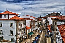
The place is surrounded by a fortress smauer. The gates Porta da Coroada and Porto do Meio lead into the old town. The fortress dates from the time of the Restoration War in the 17th century.
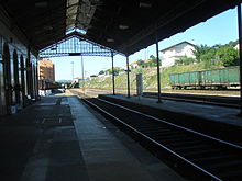
The other monuments of the place include u. a. numerous sacred buildings , historical public buildings and houses, the train station, bridges and stone fountains. The historic town center as a whole is also a listed building.
A monument to Charles Lindbergh, who landed here in 1933, can be seen in the municipality of Friestas .
The circle
administration
Valença is also the seat of the district of the same name, which borders on Spain in the north . The neighboring areas are (starting clockwise in the east): Monção , Paredes de Coura and Vila Nova de Cerveira .
With the regional reform in September 2013 , several municipalities were merged into new municipalities, so that the number of municipalities decreased from 16 to 11.
The following municipalities ( Freguesias ) are in the Valença County:
| local community | Population (2011) |
Area km² |
Density of population / km² |
LAU code |
|---|---|---|---|---|
| Boivão | 239 | 7.97 | 30th | 160802 |
| Cerdal | 1,693 | 18.78 | 90 | 160803 |
| Fontoura | 751 | 9.17 | 82 | 160805 |
| Friestas | 562 | 4.15 | 135 | 160806 |
| Gandra e Taião | 1,471 | 20.19 | 73 | 160817 |
| Ganfei | 1,296 | 9.47 | 137 | 160808 |
| Gondomil e Sanfins | 464 | 17.72 | 26th | 160818 |
| São Julião e Silva | 623 | 8.18 | 76 | 160819 |
| Sao Pedro da Torre | 1,267 | 7.79 | 163 | 160812 |
| Valença, Cristelo Covo e Arão | 5,153 | 9.49 | 543 | 160820 |
| Verdoejo | 608 | 4.23 | 144 | 160816 |
| Valença County | 14,127 | 117.14 | 121 | 1608 |
Population development

Municipal holiday
- February 18
economy
Tourism is of great importance. In particular, the many Spanish day tourists populate the historic old town streets and its many souvenir shops, which are well worth seeing.
With the Parque Industrial de São Pedro da Torre , the Parque Empresarial and the Plataforma Logística , the district has three commercial and logistics parks. Agriculture is also important.
traffic
Valença is on the Linha do Minho railway line . A railway museum has been set up at the listed station.
The A3 motorway , part of European route 1 , leads from Porto via Valença into Galicia, Spain .
The place is integrated into the national bus network of Rede Expressos .
Between Valença and Tui in Galicia, a single-arched Roman bridge ( Portuguese ponte romana ), the Ponte Velha of Chamozinhos, crosses the Rio Miño .
Sons and daughters
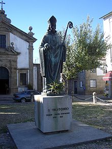
- São Teotónio (1082–1162), canonized prior of the Santa Cruz Monastery
- João Manuel Abreu (1757–1815), mathematician
- José Joaquim Champalimaud (1771-1825), Marshal
- Joaquim Antônio Ferreira (1777–1859), military, politician and slave trader in Brazil
- Francisco Xavier da Silva Pereira (1793–1852), aristocratic military and politician, Setembrist
- José Augusto Vieira (1856–1890), writer
- José Maria Rodrigues (1857–1942), theologian and writer
- Júlio Evangelista (1927–2005), lawyer, journalist, functionary of the Estado Novo regime
- José Augusto Martins Fernandes Pedreira (* 1935), bishop
literature
- Thomas G. Schattner (Ed.): Archaeological guide through Portugal (= cultural history of the ancient world . Vol. 74). Philipp von Zabern, Mainz 1998, ISBN 3-8053-2313-1 p. 57
Web links
- Map of the Freguesia Valença (Portugal) at the Instituto Geográfico do Exército
- Official website
Individual evidence
- ↑ www.ine.pt - indicator resident population by place of residence and sex; Decennial in the database of the Instituto Nacional de Estatística
- ↑ a b Overview of code assignments from Freguesias on epp.eurostat.ec.europa.eu
- ↑ www.ine.pt - indicator resident population by place of residence and sex; Decennial in the database of the Instituto Nacional de Estatística
- ↑ History page of the circle's website ( page no longer available , search in web archives ) Info: The link was automatically marked as defective. Please check the link according to the instructions and then remove this notice. (Portuguese), accessed March 4, 2013.
- ^ João Fonseca: Dicionário do Nome das Terras. 2nd Edition. Casa das Letras, Cruz Quebrada 2007, ISBN 978-972-46-1730-5 , p. 266.
- ↑ Article of June 12, 2009 in the daily newspaper Público , accessed on March 4, 2013.
- ↑ www.monumentos.pt , accessed on March 4, 2013.
- ^ Publication of the administrative reorganization in the Diário da República gazette of January 28, 2013, accessed on March 16, 2014.
- ^ Lydia Hohenberger, Jürgen Strohmaier: Portugal . 2nd edition, DuMont Reiseverlag, Ostfildern 2009, p. 291.
- ↑ www.cm-valenca.pt ( Memento of the original from December 19, 2015 in the Internet Archive ) Info: The archive link was inserted automatically and has not yet been checked. Please check the original and archive link according to the instructions and then remove this notice. , accessed March 4, 2013.
| ← Previous location: Ponte de Lima or Vila Nova de Cerveira |
|
Next town: Tui (Galicia) 5 km → |


