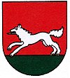
Vlkanová
| Vlkanová | ||
|---|---|---|
| coat of arms | map | |

|
|
|
| Basic data | ||
| State : | Slovakia | |
| Kraj : | Banskobystrický kraj | |
| Okres : | Banská Bystrica | |
| Region : | Horehrony | |
| Area : | 7.778 km² | |
| Residents : | 1,318 (Dec. 31, 2019) | |
| Population density : | 169 inhabitants per km² | |
| Height : | 320 m nm | |
| Postal code : | 976 31 | |
| Telephone code : | 0 48 | |
| Geographic location : | 48 ° 40 ' N , 19 ° 9' E | |
| License plate : | BB | |
| Kód obce : | 557293 | |
| structure | ||
| Community type : | local community | |
| Administration (as of November 2018) | ||
| Mayor : | Antonin Melichar | |
| Address: | Obecný úrad Vlkanová Matuškova 53 976 31 Vlkanová |
|
| Website: | www.vlkanova.sk | |
| Statistics information on statistics.sk | ||
Vlkanová (until 1927 Slovak "Vlkanová Peťová"; Hungarian Farkaspetőfalva - to 1895 Farkasfalva ) is a municipality in the middle of Slovakia , with a population of 1,318 (as of December 31, 2019) and is part of the Banská Bystrica District , a circle of kraj Banskobystrický .
geography
The village is located on the left bank of the Hron in the Zvolenská kotlina basin . The center of the village lies at an altitude of 320 m nm and is nine kilometers south of Banská Bystrica .
history
The place was first mentioned in writing in 1293 as Welchena .
In 1895 the previously independent place Peťová (Hungarian Petőfalva ) was incorporated.
1979–1990 Vlkanová was part of the city of Banská Bystrica .
population
Results after the 2001 census (851 inhabitants):
|
By ethnicity:
|
By religion:
|
Buildings
- Country castle from the 17th century with four corner towers
- Roman Catholic Church of the Assumption
