
Würm (Amper)
| Worm | ||
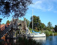
 The upper reaches of the Würm, from Starnberg to Leutstetten. |
||
| Data | ||
| Water code | EN : 1646 | |
| location | Bavaria , Germany | |
| River system | Danube | |
| Drain over | Amper → Isar → Danube → Black Sea | |
| origin | Outflow of Lake Starnberg 47 ° 59 ′ 52 ″ N , 11 ° 21 ′ 23 ″ E |
|
| Source height | 596 m above sea level NN | |
| muzzle |
Amper bei Hebertshausen Coordinates: 48 ° 17 ′ 6 " N , 11 ° 28 ′ 28" E 48 ° 17 ′ 6 " N , 11 ° 28 ′ 28" E |
|
| Mouth height | 482 m | |
| Height difference | 114 m | |
| Bottom slope | 2.9 ‰ | |
| length | 39.8 km | |
| Catchment area | 428.96 km² | |
| Discharge at the Leutstetten A Eo gauge: 329.37 km² Location: 35.7 km above the mouth |
NNQ (09/28/2003) MNQ 1921/2012 MQ 1921/2012 Mq 1921/2012 MHQ 1921/2012 HHQ (06/15/1965) |
1.25 m³ / s 2.7 m³ / s 4.74 m³ / s 14.4 l / (s km²) 8.07 m³ / s 16.5 m³ / s |
| Discharge at the Obermenzing A Eo gauge: 385.74 km² Location: 14.6 km above the mouth |
NNQ MNQ 1984/2012 MQ 1984/2012 Mq 1984/2012 MHQ 1984/2012 HHQ (07/19/1999) |
650 l / s 1.74 m³ / s 3.38 m³ / s 8.8 l / (s km²) 6.32 m³ / s 9.54 m³ / s |
| Left tributaries | Reschenbach | |
| Right tributaries | Röhrlbach | |
| Big cities | Munich | |
| Medium-sized cities | Starnberg , Gauting , Dachau | |
| Small towns | Planegg , Graefelfing , Karlsfeld | |
The Würm is a 39.5 kilometer long river in Bavaria . It is the only outflow from Lake Starnberg , which was called Würmsee until 1962 , and begins at its northeast end near Starnberg . The main arm flows into the Amper at Dachau , which then flows into the Isar at Moosburg . The Würm also feeds the north Munich canal system , through which parts of the Würmwasser reach the Isar and Moosach .
Origin of name
The river name Würm is first attested as Uuirma in 772 and later as Wirmiseo 'Würmsee' (910), Vuirama (956/957), Wirmina (1056), Wirm (1310) and finally in 1674 as Würm . It is traditionally derived from a Celtic expression wirmina , the fast flowing one. According to Hans Bahlow , however, it is probably pre-Celtic, but still of Indo-European origin. The name would thus belong to the layer of the oldest preserved water names . Würm is therefore composed of Indo-European * uer-, * uor- 'water, rain, river' and an m- suffix . A corresponding settlement in the Bronze Age has been archaeologically proven in the Würmtal by archaeological finds and pollen analyzes .
geology
The Würm is the namesake for the last great glacial in the foothills of the Alps, the Würm Ice Age , which ended around 10,000 years ago and left in its glacier tongues, among other things, Ammersee and Starnberger See (formerly Würmsee) as well as the Munich gravel area. In the breakthrough of the double terminal moraine , between Leutstetten and the Mühltal , the Würm has dug up to 50 meters into the tertiary underground . In this section of the wild and romantic valley, one primarily encounters marl from the Tertiary and Nagelfluh banks from the Mindel glacial period . In the further course, beyond the double terminal moraine wall, the Würm is not cut particularly deep and is characterized by meltwater gravel from the lower terrace .
fauna

For a few years now, beavers have settled again on the Würm, especially in Pasing , Stockdorf , Gauting and Starnberg .
The Würm offers some fish species the possibility of natural reproduction, which has become rare. Aitel and river barbel , as well as pike , live here, among others , in many places along the urban river course and near Starnberg, not infrequently large specimens. There is also a good population of the threatened fish species Schneider on the Würm around Gauting . Also, eels , trout and tench live in the Würm. Specimens of the European catfish grow to be over 2 meters long in the Würm between Starnberg and Leutstetten.
course

The Munich tourist guide for 1865 sees the origin of the Würm already south of Lake Starnberg in "the moors and small lakes in the south between Iffeldorf and Schledorf ". Other sources also indicate the Bodenbach or the Ostersee-Ach or the Steinbach as Altwürm . This also includes the register of brook and river areas in Bavaria of the Bavarian State Office for the Environment , which lists the Würm under the water code 1646 as Würm - Steinbach .
On its upper course, it crosses the Leutstettener Moos , a reed and peat landscape designated as a nature reserve , and then, after having passed Leutstetten with the remains of a Roman estate ( Villa rustica ) and a representative Wittelsbach castle, flows through the idyllic Mühltal and at a somewhat faster rate the woods to Gauting . There the Fußberg Castle stands on a bend in the river.
The further course takes you through populated areas with small to medium-sized villages (including Gauting, Stockdorf , Krailling , Planegg , Graefelfing ) to Munich - Pasing .
In a length of 11.2 km, it crosses the western Munich urban area with the districts of Pasing , Obermenzing , Untermenzing and Allach . In Obermenzing it flows past Blutenburg Castle and feeds its moat.
In the Munich city area, the river is surrounded almost everywhere by a wide green strip with associated cycling and hiking trails, accompanied by the Pasinger Stadtpark in the south, its course is only crossed by three main traffic and a few quiet side streets.
The Würm feeds parts of the north Munich canal system . In Pasing, near the local train station, water is drained from the Würm via the Pasing-Nymphenburg Canal . This initially flows through Pasing, Obermenzing to the east in the Nymphenburg Park , then the lock channel , the fountain in Schlossrondell and Nymphenburg Biedersteiner channel to dine. The latter fills the Olympic lake in the Olympic Park and flows into the Schwabinger Bach in the Hirschau .
In Pasing, the Würm is crossed by the Bodenseestraße . In Obermenzing through the Verdistraße leading to the A8 . In Untermenzing the Würm runs under Von-Kahr-Straße , a main traffic artery. The Inselmühle beer garden is located on the southern side of Von-Kahr-Straße .
At Munich's northern border, most of the Würm water is channeled through a weir into the Würm Canal, which is also part of the northern Munich canal system and flows into the Schleissheim Canal in the Schleißheim Palace complex .
The main arm of the Würm continues through Karlsfeld to the north. Between Dachau and Karlsfeld the Reschenbach flows into the Würm and with it forms the Würm-Reschenbach-Aue, which the city of Dachau has renatured . Immediately afterwards, the Würm is dammed up by a private hydropower plant. The course in the city of Dachau leads past the concentration camp memorial. Shortly before the Würmmühle , whose miller has been responsible for the transition over the Würm-Amper-Aue in the mouth of the Würm into the Amper, at least since the 10th century, the Pollnbach flows out, which nowadays exceeds this in water volume due to the discharge from the Würm. A few hundred meters further, the Würm flows into the Amper south of Hebertshausen .
The Würm at its beginning at the northern end of Lake Starnberg

in the Leutstettener Moos

at the bridge near Leutstetten

in the Mühltal between Leutstetten and Gauting, with a blooming, flowing water cockfoot

south of Gauting

in Krailling

in the Pasing city park

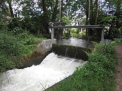
at the weir in Pasing near the old mill

Landscape protection area "Würmniederung" in Pasing
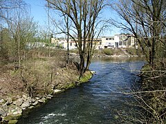
in Allach

in Karlsfeld
at its confluence with the Amper near Hebertshausen


history
Since the Würm already attracted settlers in earlier times, artifacts from different epochs are discovered here again and again. One of the oldest finds is an almost 4,000-year-old stool grave from the early Bronze Age, which was excavated in Obermenzing in 1910 during road construction work.
A memorial and memorial plaques remind of recent history: in April 1945 prisoners from the Dachau concentration camp , which is located directly on the Würm, were driven on a death march through the Würmtal towards the Alps .
literature
- Hans Jürgen Hansen, Evelinde Manon: The Würmtal between Starnberg and Dachau. Urbes, Graefelfing 1982.
- Erich Weichelt, Mark Schütze, Gerhard Ongyerth: The Würm. Buchendorfer Verlag, Munich 1995, ISBN 3-927984-46-9 .
- Rolf K. Meyer, Hermann Schmidt-Kaler: Walks into the history of the earth, Volume 9: On the trail of the Ice Age south of Munich - western part. Pfeil, Munich, ISBN 978-3-931516-10-9 .
- Marianne Heilmannseder: My Würm - a hiked river landscape. Berg & Tal Heinrich Bauregger, Munich 2011, ISBN 978-3-939499-24-4 .
Web links
- Recreational landscape between Würm and Isar In: Erholungsflächenverein, accessed on June 2, 2020.
- Green corridor and river landscape in the west of Munich - the Würm
- The Würm - a river from icy times ( Memento from April 16, 2016 in the Internet Archive )
- Traveling exhibition on the natural and cultural landscape on the Würm - The Würm as a decentralized project of the Munich Federal Garden Show 2005
- Level in the catchment area of the Isar of the flood news service Bavaria
- Tom Soyer: What is the Isar compared to the Würm? In: Süddeutsche Zeitung . Online version from June 2, 2020, accessed June 2, 2020.
Individual evidence
- ↑ a b c Directory of brook and river areas in Bavaria - Isar river area, page 58 of the Bavarian State Office for the Environment, as of 2016 (PDF; 2.5 MB)
- ^ German Hydrological Yearbook Danube Region 2006, single sheet Leutstetten gauge . Bavarian State Office for the Environment, p. 209, accessed on October 4, 2017, at: hnd.bayern.de (PDF, German).
- ^ Bavarian flood news service
- ↑ Wolf-Armin Frhr. von Reitzenstein : Lexicon of Bavarian place names. Origin and meaning . 2nd, improved and enlarged edition. Verlag C. H. Beck, Munich 1991, ISBN 3-406-35330-4 , p. 421.
- ^ Dieter Berger: Duden - Geographical names in Germany. 2nd Edition. Dudenverlag, Mannheim Leipzig 1999, p. 301. - Compare Hans Bahlow : Germany's geographical world of names, etymological lexicon of river and place names of old European origin. Suhrkamp Taschenbuch Verlag, 1985. - Compare Albrecht Greule : The historical horizons of geographical names in Bavaria. 2007, p. 2
- ↑ Stephan Müller-Wendlandt: High school graduate researches fish in the Würm. In: Merkur.de. April 19, 2019, accessed May 14, 2019 .
- ↑ Munich Tourist Guide for 1865 . JJ Lentner'sche Buchhandlung, Munich. ( Online , accessed January 19, 2016.)
- ↑ Erich Weichelt, Mark Schütze, Gerhard Ongyerth: Die Würm . Buchendorfer Verlag, Munich 1995, ISBN 3-927984-46-9 , p. 7.
- ↑ The newly designed Würm-Reschenbach-Aue
- ↑ The mill. In: wuermmuehle.de. Retrieved April 19, 2019 .