World Heritage in Niger
World Heritage Sites in Niger |
The world heritage in Niger includes (as of 2018) three UNESCO world heritage sites , including one world cultural heritage site and two world natural heritage sites. Niger acceded to the World Heritage Convention in 1974, and the first World Heritage site was added to the World Heritage List in 1991. The last World Heritage site to date was registered in 2013, and one site is on the Red List of World Heritage in Danger .
World heritage sites
The following table lists the UNESCO World Heritage Sites in Niger in chronological order according to the year of their inclusion on the World Heritage List (K - cultural heritage, N - natural heritage, K / N - mixed, (R) - on the Red List of World Heritage in Danger ).
| image | designation | year | Type | Ref. | description |
|---|---|---|---|---|---|
| Aïr and Ténéré nature reserves | 1991 | N (R) |
573 | comprises diverse, dry landforms, which are characterized by the sandy Ténéré desert and the rocky Aïr mountains.
An additional award as a cultural heritage site is on the tentative list (Ref. 5055 ). |
|
| W-Arly-Pendjari National Park Complex | 1996 | N | 749 | Originally included that part of the W National Park in Niger, which crosses borders in Benin , Burkina Faso and Niger. In 2017, the natural heritage was expanded by adding areas in Benin and Burkina Faso to the W-Arly-Pendjari National Park Complex .
An additional award of the National Park W as a cultural heritage site is on the tentative list (Ref. 5054 ). |
|
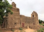
| Historic center of Agadez | 2013 | K | 1268 | Historic center of the city of Agadez |
Tentative list
The sites that are intended for nomination for inclusion in the World Heritage List are entered in the tentative list . Currently (2018) 19 sites are entered in the tentative list of Niger, the last entry was made in 2018. The following table lists the sites in chronological order according to the year of their inclusion in the tentative list.
![]() Map with all coordinates of current World Heritage candidates: OSM
Map with all coordinates of current World Heritage candidates: OSM
| image | designation | year | Type | Ref. | description |
|---|---|---|---|---|---|
|
Old town of Zinder, the Birni district and the Sultanate ( location ) |
2006 | K | 5040 | Birni is the historic center of the city of Zinder . The district was built over large granite formations and is characterized by richly decorated Hausa architecture. Remnants of the once massive city wall around the quarter have been preserved. Located in the center of Birni, the Sultan's Palace of Zinder was built between 1850 and 1852 under Ténimoun dan Sélimane . | |
|
Palace of Zarmakoye in Dosso ( location ) |
2006 | K | 5041 | The Zarmakoye are important traditional rulers of the Zarma . The incumbent ruler has been sultan since 2010 . The palace of Zarmakoye in the city of Dosso was built in 1904. The tombs of the rulers and the Dey Zarmakoye , the old "fountain of the Zarmakoye", are located in the walled complex . | |
| Mud mosques in the Tahoua region | 2006 | K | 5042 | The mosques in the Tahoua region , built between the 1960s and 1980s, are the work of the self-taught architect Falké Barmou and his student Elhadj Habou. The most important of the adobe buildings influenced by traditional Hausa architecture is the Great Mosque of Yama in Badaguichiri . | |
| Cultural routes of the Sahara desert: the salt road | 2006 | K | 5043 | The west-east route is used by the salt caravans in the Sahara . It begins in the high mountains of Aïr , leads over the Arbre du Ténéré through the sandy desert Ténéré and ends at the salt pans in the Bilma oasis in the Kaouar valley . The caravans need around 35 days to cover the dangerous distance between 1200 and 1500 kilometers. | |
| Djado plateau and small fort | 2006 | K | 5044 | The hyperarid plateau of Djado is located in one of the most inaccessible areas of the central Sahara in the area of the rural municipality of Djado . There are numerous Sahara rock art here . Fortress ruins made of dry stone and clay point to the civilizations of the Garamanten , Libu-Berbers and Tubu during the drying up of the Sahara. | |
| Bura archaeological site | 2006 | K | 5045 | The archaeological site of Bura is located around 150 kilometers northwest of Niamey . It includes a necropolis that was used between the 3rd and 13th centuries and was discovered in 1975, as well as cult sites and traces of settlement. Typical of the culture of Bura are anthropomorphic statuettes. | |
| Lougou | 2006 | K | 5046 | The village of Lougou in the Dogondoutchi department is the seat of the Sarraounia , a traditional ruler and spiritual leader. The most important individual sites are the court stone Toungouma , the Azna cult place Jakouda , the tomb of the rulers, the battlefield of the mission Voulet-Chanoine from 1899 and the residence of the Sarraounia. | |
| Giraffe Zone | 2006 | N | 5047 | The 840 km 2 zone is the last area in West Africa with wild giraffes . The animals are the subspecies of the West African giraffe ( Giraffa camelopardalis peralta ). They settle in the area of Kouré and the northern Dallol Bosso . The vegetation here is characterized by tree and bush savannahs. | |
| Termite massif | 2006 | N | 5048 | The Termit massif is located in the Zinder region and reaches a height of 710 m. It connects to the Dilia valley . The flora and fauna show elements of the Sahara and the Sahel zone . The populations of the critically endangered Mende and Damaga cells are particularly important . | |
| Gadabédji reserve | 2006 | N | 5049 | The Gadabédji Reserve , established in 1955, is located in the Sahel region on the edge of the Sahara . It covers an area of 68,000 hectares. The animal world includes residual populations of Dorcas gazelles , as well as hussar monkeys , jackals , fennecs and various reptiles, as well as lark-ears , sparrow's eggs , nubian siblings and other bird species. | |
| Protected forests of the Agadez region | 2006 | N | 5050 | In the Tchirozérine department of the Agadez region , 50 forest areas are protected. Located in a region characterized by a hyperarid climate, they offer important vegetable resources. The doum palms that thrive here are used to make mats and ropes as well as to obtain a sweet flour. | |
| Mare d'Ossolo | 2006 | N | 5051 | The Mare d'Ossolo or N'Solo is a semi-permanent waterhole northwest of the city of Téra . The river Dargol flows through it. In an area of 9000 hectares around the waterhole there is a rich flora with over 100 plant species. The mammals living here include red-fronted gazelles , South African jumping hares and gray squirrels . | |
|
Nigerien part of Lake Chad ( location ) |
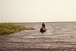
2006 | N | 5052 | Niger is one of four countries bordering Lake Chad . The Nigerian part is in the N'Guigmi department . Lake Chad has a high biodiversity , especially in terms of fish stocks . The water surface is subject to great fluctuations and last fell sharply in the 1970s and 1980s. | |
| The Niger River, Islands and Valley | 2006 | N | 5053 | ||
| Archaeological sites in the National Park W | 2006 | K | 5054 | It is proposed that the National Park W, which has been declared a natural heritage site, be given additional cultural heritage status. In the river valley of the Mékrou there are about sixty sites from the Acheuléen , the Old Stone Age and the New Stone Age, as well as evidence of early metallurgy . Numerous place names correspond with myths and legends. | |
| Aïr and Ténéré nature reserve | 2006 | K | 5055 | The Aïr and Ténéré nature reserve (Ref. 573 ) is also to be declared a World Heritage Site. In the 77,360 km 2 area, there are prehistoric rock carvings with depictions of animals and everyday scenes created since the Neolithic Age . | |
| Dinosaur deposits | 2006 | N | 5056 | with the localities Tillia , In Abangharit , Gadoufaoua and In Gall-Marandet | |
| Protected forest, Lake Madarounfa and the tombs of the 99 saints | 2006 | K / N | 5057 | at Madarounfa | |
| The cultural landscape around Lake Chad. | 2018 | K / N | 6360 | It is a transnational application from Cameroon , Niger , Nigeria and Chad . The Nigerian part of Lake Chad is already on the tentative list. |
Web links
- Niger on the UNESCO World Heritage Center website.
Individual evidence
- ↑ Niger. In: whc.unesco.org. UNESCO World Heritage Center, accessed June 29, 2017 .
- ^ Tentative list of Niger. In: whc.unesco.org. UNESCO World Heritage Center, accessed June 29, 2017 .
- ↑ Mahamane Amadou: Cérémonie de dénomination de la province de Dosso en Sultanat. L'honorable Maïdanda Saidou intronisé Sultan . In: Le Sahel . No. 8013 , October 20, 2010, p. 5 ( nigerdiaspora.net [PDF; accessed April 13, 2017]).
- ↑ Jolijn Geels: Niger . Bradt, Chalfont St Peter 2006, ISBN 1-84162-152-8 , p. 224 .
- ↑ Parcs et réserves du Niger: Evaluation de l'efficacité de gestion des aires protégées . IUCN , Ouagadougou 2010, ISBN 978-2-8317-1314-4 , pp. 61 ( data.iucn.org [PDF; 16 kB ; accessed on April 14, 2017]).
- ↑ Plan Forestier National (PFN-Niger) 2012–2021. Version final. Annexe n ° 1: Situation des forêts au Niger. (PDF) Ministère de l'Hydraulique et de l'Environnement, March 2012, pp. I – ii , accessed on April 22, 2017 (French).


