Gargantilla del Lozoya y Pinilla de Buitrago: Difference between revisions
Content deleted Content added
m rm overlink, cleanup using AWB |
GreenC bot (talk | contribs) Reformat 1 citation per Category:CS1 errors: archive-url. Wayback Medic 2.5 |
||
| (13 intermediate revisions by 9 users not shown) | |||
Line 1:
{{Expand Spanish|topic=geo|date=November 2014|Gargantilla del Lozoya y Pinilla de Buitrago}}
{{Infobox
<!-- See
<!-- Basic info ---------------->
|name = Gargantilla del Lozoya y Pinilla de Buitrago
Line 13:
|imagesize =
|image_caption =
|image_flag = Bandera_de_Gargantilla_de_Lozoya.svg
|flag_size =
|image_seal = Escudo_de_Gargantilla_de_Lozoya.svg
|seal_size =
|image_shield =
Line 51:
|area_land_km2 = 24.12<!--See table @ Template:Infobox Settlement for details on automatic unit conversion-->
<!-- Population ----------------------->
|population_footnotes =▼
|population_note =
|
▲|population_footnotes = {{Spain metadata Wikidata|population_footnotes}}
|population_total = {{Spain metadata Wikidata|population_total}}
|population_density_km2 =
|population_density_sq_mi =
Line 69:
|timezone_DST = [[Central European Summer Time|CEST]]
|utc_offset_DST = +2
|coordinates = {{coord|40|57|56|N|3|43|1|W|display=inline}}
|elevation_footnotes = <!--for references: use <ref> </ref> tags-->
|elevation_m = 1133
Line 85 ⟶ 84:
|footnotes =
}}
'''Gargantilla del Lozoya y Pinilla de Buitrago''' is a [[Municipalities of Spain|municipality]] of the [[Community of Madrid]], Spain. It is the municipality with the longest official name in Spain.<ref>{{cite web|url=http://www.emiliopolis.net/es/int/geo/nombres_es.htm|title=Municipios españoles más cortos y largos|work=Emiliopolis|archive-url=https://web.archive.org/web/20160316213519/http://www.emiliopolis.net/es/int/geo/nombres_es.htm|archive-date=16 March 2016}}</ref>
==Geography==
===Climate===
According to the [[Köppen climate classification]], Gargantilla del Lozoya y Pinilla de Buitrago have a Csb<ref name="test23">{{cite web|url=http://www.aemet.es/documentos/es/conocermas/publicaciones/Atlas-climatologico/Atlas.pdf|title=Atlas climático ibérico|publisher=State Meteorological Agency|archive-url=https://web.archive.org/web/20200422054507/http://www.aemet.es/documentos/es/conocermas/publicaciones/Atlas-climatologico/Atlas.pdf|archive-date=22 April 2020}}</ref> climate (temperate with a dry and temperate summer).
==References==
{{reflist}}
<ref>{{cite web |last1=García Gutiérrez |first1=Rafael |title=Introduction |url=https://www.gargantillaypinilla.madrid/ |website=Gargantilla del Lozoya y Pinilla de Buitrago |access-date=11 July 2022 |language=Spanish}}</ref>
==External links==
{{Municipalities in the Community of Madrid}}
{{authority control}}
[[Category:Municipalities in the Community of Madrid]]
{{Madrid-geo-stub}}
| |||
Latest revision as of 00:25, 21 August 2023
You can help expand this article with text translated from the corresponding article in Spanish. (November 2014) Click [show] for important translation instructions.
|
Gargantilla del Lozoya y Pinilla de Buitrago | |
|---|---|
 Municipal location within the Community of Madrid. | |
| Coordinates: 40°57′56″N 3°43′1″W / 40.96556°N 3.71694°W | |
| Country | |
| Autonomous community | Community of Madrid |
| Area | |
| • Land | 9.31 sq mi (24.12 km2) |
| Elevation | 3,717 ft (1,133 m) |
| Population (2018)[1] | |
| • Total | 318 |
| Time zone | UTC+1 (CET) |
| • Summer (DST) | UTC+2 (CEST) |
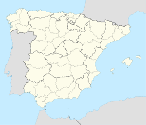
Gargantilla del Lozoya y Pinilla de Buitrago is a municipality of the Community of Madrid, Spain. It is the municipality with the longest official name in Spain.[2]
Geography[edit]
Climate[edit]
According to the Köppen climate classification, Gargantilla del Lozoya y Pinilla de Buitrago have a Csb[3] climate (temperate with a dry and temperate summer).
References[edit]
- ^ Municipal Register of Spain 2018. National Statistics Institute.
- ^ "Municipios españoles más cortos y largos". Emiliopolis. Archived from the original on 16 March 2016.
- ^ "Atlas climático ibérico" (PDF). State Meteorological Agency. Archived from the original (PDF) on 22 April 2020.
External links[edit]
- ^ García Gutiérrez, Rafael. "Introduction". Gargantilla del Lozoya y Pinilla de Buitrago (in Spanish). Retrieved 11 July 2022.


