Zarzalejo
| Zarzalejo | ||
|---|---|---|
| coat of arms | Map of Spain | |

|
|
|
| Basic data | ||
| Autonomous Community : |
|
|
| Province : | Madrid | |
| Comarca : | Sierra Oeste | |
| Coordinates | 40 ° 33 ′ N , 4 ° 11 ′ W | |
| Height : | 1104 msnm | |
| Area : | 20.2 km² | |
| Residents : | 1,658 (Jan 1, 2019) | |
| Population density : | 82.08 inhabitants / km² | |
| Postal code : | 28293 | |
| Municipality number ( INE ): | 28183 | |
| administration | ||
| Mayor : | Rafael Herranz Ventura ( PP ) | |
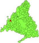
| Location of the city | ||

|
||
Zarzalejo is a Spanish municipality in the autonomous region of Madrid .
Zarzalejo borders the municipalities of Santa María de la Alameda and San Lorenzo del Escorial to the north, and Robledo de Chavela to the south and east . The city lies at the foot of the Machotas Mountains , which are part of the Sierra de Guadarrama .
Zarzalejo has an upper and a lower town center. Around the upper one is the old town, around the lower one - called “La Estación” (the train station) - numerous chalets have been built in recent years .
Web links
Commons : Zarzalejo - Collection of images, videos and audio files
- Basic information about Zarzalejo ( Memento from January 13, 2011 in the Internet Archive ) on sierraoeste.org (Spanish)
Individual evidence
- ↑ Cifras oficiales de población resultantes de la revisión del Padrón municipal a 1 de enero . Population statistics from the Instituto Nacional de Estadística (population update).
