Colmenar de Oreja
| Colmenar de Oreja municipality | ||
|---|---|---|
 Colmenar de Oreja - main square with town hall (ayuntamiento) , warehouse (pósito) and church of Santa María la Mayor
|
||
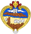
| coat of arms | Map of Spain | |

|
|
|
| Basic data | ||
| Autonomous Community : |
|
|
| Province : | Madrid | |
| Comarca : | Comarca de Las Vegas | |
| Coordinates | 40 ° 7 ′ N , 3 ° 23 ′ W | |
| Height : | 760 msnm | |
| Area : | 114.32 km² | |
| Residents : | 8,032 (Jan 1, 2019) | |
| Population density : | 70.26 inhabitants / km² | |
| Postal code : | 28890 | |
| Municipality number ( INE ): | 28043 | |
| administration | ||
| Website : | Colmenar de Oreja | |
Colmenar de Oreja is a city and a central Spanish municipality ( municipio ) with 8,032 inhabitants (as of January 1 2019) in the southeast of the community of Madrid in the transition to the autonomous region of Castile-La Mancha . The municipality belongs to the cultural landscape of the Alcarria .
Location and climate
The town of Colmenar de Oreja, located about 760 m above sea level, is located in the Iberian Highlands ( meseta ) southeast of the Castilian Scheidegebirge . The Spanish capital Madrid is a good 50 km (driving distance) to the northwest; the city of Aranjuez is about 23 km to the southwest. The climate in winter is temperate, while in summer it is warm to hot; the rather low amounts of precipitation (approx. 450 mm / year) fall - with the exception of the almost rainless summer months - distributed over the whole year.
Population development
| year | 1857 | 1900 | 1950 | 2001 | 2019 |
| Residents | 4,833 | 6,182 | 5,695 | 5,548 | 8,032 |
Despite its location in the greater Madrid area, the population of the municipality has remained stable for a long time; only at the beginning of the 21st century did a population surge take place.
economy
Colmenar de Oreja was dominated by agriculture for centuries; the people lived largely as a self-sufficient source of income from the surrounding fields and house gardens. In the past, the manufacture of large clay jugs (tinajas) for the storage and transport of olive oil and wine was of great importance for the economic life of the place; Today a sulphate mine , the most important employer in the municipality, produces around 25% of the Spanish demand.
history
There are sparse finds from the Celtic and Roman times in the municipality, but these cannot yet be interpreted as evidence of human settlement. After the re-conquest of the areas north of Toledo in 1085 by Alfonso VI. from León the area was subordinated to the Santiagoorden . A little later began a phase of repopulation ( repoblación ) by Christians from all parts of the Iberian Peninsula . In 1440 the place received city rights (villazgo) , but in the 16th century it came under the manorial rule (señorio) of the dukes of Maqueda, which officially ended at the beginning of the 19th century .
Attractions
- The main square (Plaza Mayor) is a square from the 17th century surrounded by two-story houses with arcades and balconies , on which cattle markets and bullfights (corridas) took place well into the 20th century . The representative Warehouse (Pósito) with its lateral projections also served as a courthouse and a prison.
- The three-aisled Iglesia de Santa María Mayor was built in the 13th century as the Church of the Order of Santiago . In the 15./16. However, it was largely rebuilt and received Renaissance portals. The stern-looking, over 60 m high tower of the church was designed by Juan de Herreras , the architect of the Escorial . The three naves of the church are of the same height ( hall church ); The apse and crossing have star-shaped rib vaults , whereas otherwise ridge vaults dominate. The two side aisles each run towards a baroque altar , the central nave ends in a clearly raised and flat-closing choir with a large classicistic altarpiece (retablo) .
- The church of the Augustinian recollects impresses with its baroque brick facade with heraldic shields and a blown and curly gable .
- The single-aisled baroque chapel of the Ermita de San Roque stands in the middle of the village.
- The Ermita del Santísimo Cristo del Humilladero is located about 1 km south of the village.
- Surroundings
- The ruins of the Moorish fortress of Castillo de Oreja , conquered by the troops of Alfonso VII of León in 1139, stand in the area of the neighboring municipality of Ontígola south of the Tagus . The castle was later completely rebuilt by the Christians, but after the border of the Islamic sphere of influence was shifted to the south, it lost its importance and fell into disrepair. The people who once lived under the protection of the castle moved to the Colmenar plain.
Web links
- Colmenar de Oreja, sights - photo + info (arteguias, Spanish)
- Colmenar de Oreja, history and places of interest - photo + short information (Spanish)
Individual evidence
- ↑ Cifras oficiales de población resultantes de la revisión del Padrón municipal a 1 de enero . Population statistics from the Instituto Nacional de Estadística (population update).
- ↑ Colmenar de Oreja / Madrid - climate tables
- ↑ Colmenar de Oreja - population development
- ↑ Colmenar de Oreja - History
- ↑ Colmenar de Oreja - main square
- ↑ Colmenar de Oreja - Church
- ↑ Colmenar de Oreja / Ontígola - castle ruins
- ↑ Colmenar de Oreja / Ontígola - castle ruins


