Torrejon de la Calzada
| Torrejón de la Calzada municipality | ||
|---|---|---|
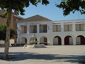
 The town hall (ayuntamiento)
|
||
| coat of arms | Map of Spain | |

|
|
|
| Basic data | ||
| Autonomous Community : | Madrid | |
| Province : | Madrid | |
| Coordinates | 40 ° 25 ′ N , 3 ° 48 ′ W | |
| Height : | 629 msnm | |
| Area : | 8.98 km² | |
| Residents : | 8,872 (Jan 1, 2019) | |
| Population density : | 987.97 inhabitants / km² | |
| Postal code : | 28991 | |
| Municipality number ( INE ): | 28149 | |
| administration | ||
| Mayor : | Eusebio García Gomez ( PP ) | |
| Website : | [1] | |
| Location of the municipality | ||

|
||
Torrejón de la Calzada is a Spanish municipality in the province of Madrid in the autonomous community of Madrid . In 2016, the municipality had a population of 8,171 on an area of 8.98 km².
location
The municipality is located around 27 km southwest of Madrid on the A-42 autovía , which runs from Madrid to Toledo and is crossed here by the M-404 road.
Development of the population

Individual evidence
- ↑ Cifras oficiales de población resultantes de la revisión del Padrón municipal a 1 de enero . Population statistics from the Instituto Nacional de Estadística (population update).

