Guadarrama (municipality)
| Guadarrama parish | ||
|---|---|---|
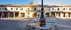
 Guadarrama - Plaza Mayor
|
||
| coat of arms | Map of Spain | |

|
|
|
| Basic data | ||
| Autonomous Community : | Madrid | |
| Coordinates | 40 ° 40 ′ N , 4 ° 5 ′ W | |
| Height : | 950 msnm | |
| Area : | 56.98 km² | |
| Residents : | 16,032 (Jan 1, 2019) | |
| Population density : | 281.36 inhabitants / km² | |
| Postal code : | 28440 | |
| Municipality number ( INE ): | 28068 | |
| administration | ||
| Website : | Guadarrama | |
Guadarrama is a city and a municipality (municipio) with a total of 16,032 inhabitants (as of January 1, 2019) in the northwest of the autonomous region of Madrid ( Spain ).
Location and climate
The city is located on the west bank of the Río Guadarrama in the southern foothills of the Sierra de Guadarrama about 50 km (driving distance) northwest of Madrid at about 950 m altitude. The climate in winter is cool, whereas in summer it is temperate to warm; Precipitation - sometimes in the form of snow - (approx. 450 mm / year) mainly falls in the winter half-year.
Population development
| year | 1857 | 1900 | 1950 | 2000 | 2018 |
| Residents | 1,290 | 863 | 2,838 | 9,389 | 15,785 |
The enormous increase in population that has been recorded since the middle of the 20th century is mainly due to the favorable location (proximity to the greater Madrid area, railway and motorway access, etc.) and the increasing tourism within Spain .
economy
In earlier times, the inhabitants of the region lived as mountain farmers and mainly ran cattle for milk, cheese and meat production. With the improvement of the traffic conditions (railway connection, buses) since the 1850s and especially since the middle of the 20th century, the place has become more and more popular as a climatic health resort and summer resort .
history
Celtic , Roman , Visigothic and even Moorish traces are only found in extremely sparse numbers, but all ethnic groups should use the valley of the Río Guadarrama as a connecting route over the almost 1800 m high Fuenfría pass between the fertile plateaus (mesetas) on both sides of the Sierra de Guadarrama have used; The river and place names also refer to an Arabic-Moorish origin ( Arabic : wad-al-ramla = "dry river bed"). The area was in the 11./12. Recovered by Christians in the 19th century ( reconquista ) ; then it was repopulated by new settlers ( repoblación ) . In 1504 the place received city rights (villa) .
Attractions
- The center of the city is the semi-octagonal Plaza Mayor , where the town hall and the main church are located. An elm planted around the middle of the 19th century forms the visual focus.
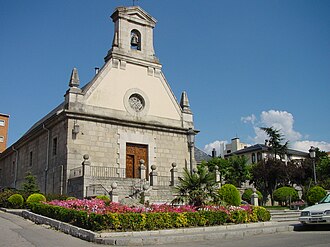
- The Iglesia de San Miguel Arcángel dates from the 18th century. The rather unadorned structure built over a demolished storage or tithe barn (posito) in the city of Madrid has a simple bell gable (espadaña) .
- About 150 m away is the in 1785 under Charles III. built fountain Fuente Los Caños .
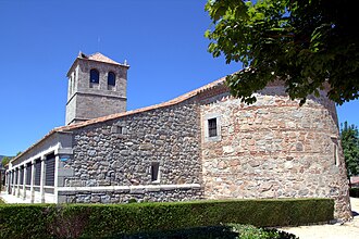
- The Centro Cultural La Torre consists of the rest of a Romanesque church, which has been changed again and again and has served as a cultural center since the 1970s.
- One in the 18th century under Charles III. The built bridge (Puente de Rosario) made it possible to cross the river safely.
Web links
- Guadarrama, sights - photos + information (Spanish)
- Guadarrama, sights - photos + information (Spanish)
Individual evidence
- ↑ Cifras oficiales de población resultantes de la revisión del Padrón municipal a 1 de enero . Population statistics from the Instituto Nacional de Estadística (population update).
- ↑ Guadarrama - Climate tables
- ^ Guadarrama - population development
- ↑ Guadarrama Church


