Hoyo de Manzanares
| Municipality of Hoyo de Manzanares | ||
|---|---|---|
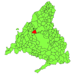
| coat of arms | Map of Spain | |

|
|
|
| Basic data | ||
| Autonomous Community : | Madrid | |
| Comarca : | Cuenca Alta del Manzanares | |
| Coordinates | 40 ° 37 ′ N , 3 ° 55 ′ W | |
| Height : | 1001 msnm | |
| Area : | 45.18 km² | |
| Residents : | 8,434 (Jan 1, 2019) | |
| Population density : | 186.68 inhabitants / km² | |
| Postal code : | E-28240 | |
| Municipality number ( INE ): | 28072 | |
| administration | ||
| Mayor : | José Antonio Antolínez Sousa ( PP ) | |
| Address of the municipal administration: | Ayuntamiento Plaza Mayor, s / n 28240 Hoyo de Manzanares |
|
| Website : | www.hoyomanzanares.com | |
| Location of the municipality | ||

|
||
Hoyo de Manzanares is a municipality in the comarca of Cuenca Alta del Manzanares in the Community of Madrid in Spain . The municipality borders the city of Madrid to the south . In the northeast of the municipality is the Sierra del Hoyo , a mountain range that geologically belongs to the Sierra de Guadarrama .
geography
Geographical location
Hoyo lies entirely in the Cuenca Alta del Manzanares Biosphere Reserve . The Arroyo de Trofa stream flows to the south. In the north the municipality is bounded by the Sierra del Hoyo. The highest point is the Estepar at 1403 m .
Neighboring communities
- Northwest: Moralzarzal
- North:?
- East: Colmenar Viejo
- South: Madrid and Torrelodones
climate
The climate of Hoyo is oceanic-continental .
- See also: Climate Spain
population
In 2006, 84.61% of the population had Spanish citizenship. 6.83% came from South and Central America, 4.37% from Europe (2.68% EU, 1.69% non-EU) and 3.76% from Africa. The rest are spread across the rest of the world.
| development | 1985 | 1990 | 1995 | 2000 | 2005 | 2006 | 2007 |
|---|---|---|---|---|---|---|---|
| Residents | 1,711 | 2,035 | 2,941 | 3,842 | 6.140 | 6.376 | |
| Proportion of foreigners | 9.58% | 14.19% | 15.39% |
development

politics
After the local elections on May 27, 2007, José Antonio Antolinez de Sousa of the People's Party replaced Fernando Esteban from the Social Democrats as mayor.
Municipal council
| Municipal elections | 1987 | 1991 | 1995 | 1999 | 2001 | 2007 |
|---|---|---|---|---|---|---|
| Izquierda Unida | 0 | 0 | 1 | 1 | 1 | 2 |
| Partido Popular | 8th | 4th | 8th | 5 | 6th | 4th |
| PSOE | 3 | 2 | 2 | 2 | 2 | 2 |
| other | 0 | 5 | 0 | 5 | 4th | 5 |
| total | 11 | 11 | 11 | 13 | 13 | 13 |
Economy and Infrastructure
traffic
About 5 km to the southwest is the A6 motorway (Madrid - A Coruña ), from where it is 30 km to Madrid. You can reach Madrid Moncloa by bus lines 611 and 611A.
Individual evidence
- ↑ Cifras oficiales de población resultantes de la revisión del Padrón municipal a 1 de enero . Population statistics from the Instituto Nacional de Estadística (population update).
- ↑ Instituto Estatística: Municipio o Zona: Manzanares El Real ( Memento of the original of September 30, 2007 in the Internet Archive ) Info: The archive link was inserted automatically and has not yet been checked. Please check the original and archive link according to the instructions and then remove this notice.
- ^ Instituto Estatística de Madrid: Elecciones en la Comunidad de Madrid. Elecciones Locales Results of the local elections 1987-2007 (Spanish)
Web links
- www.sierraguadarramamanzanares.org Tourism portal of the Asociación de Desarrollo Sierra de Guadarrama -Alto Manzanares
- partido popular Hoyo de Manzanares People's Party (local party)
- PSOE / PSM Hoyo Social Democrats (local party)
- Partido Independiente Popular de Hoyo Independent People's Party of Hoyo
- Agrupacíon Independiente de Hoyo Independent


