San Lorenzo de El Escorial
| San Lorenzo de El Escorial municipality | ||
|---|---|---|

|
||
| coat of arms | Map of Spain | |

|
|
|
| Basic data | ||
| Autonomous Community : | Madrid | |
| Province : | Madrid | |
| Comarca : | Cuenca del Guadarrama | |
| Coordinates | 40 ° 36 ′ N , 4 ° 8 ′ W | |
| Height : | 1032 msnm | |
| Area : | 56.4 km² | |
| Residents : | 18,369 (Jan 1, 2019) | |
| Population density : | 325.69 inhabitants / km² | |
| Postal code : | E-28200 | |
| Municipality number ( INE ): | 28131 | |
| administration | ||
| Official language : | Castilian | |
| Mayor : | José Luis Fernández-Quejo del Pozo ( PP ) | |
| Website : | www.sanlorenzodeelescorial.org | |
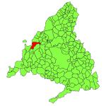
| Location of the municipality | ||

|
||
San Lorenzo de El Escorial is a municipality in the northwest of the Spanish region of Comunidad de Madrid .
geography
The municipality is located in the Sierra de Guadarrama at an average altitude of 1035 meters and is 47 km from Madrid. It has 18,369 inhabitants (as of January 1, 2019).
Attractions
In San Lorenzo there are two monuments closely linked to Spanish history:
- The monastery and palace complex Real Sitio de San Lorenzo de El Escorial , built between 1563 and 1584 on the initiative of King Philip II of Spain according to plans by Juan Bautista de Toledo , is considered the largest Renaissance building in the world.
- The Abadía de la Santa Cruz del Valle de los Caídos can be seen as the most important architectural symbol of the Franco dictatorship .
Town twinning
The municipality maintains partnerships with Saint-Quentin in France and San Lorenzo in Paraguay.
Individual evidence
- ↑ Cifras oficiales de población resultantes de la revisión del Padrón municipal a 1 de enero . Population statistics from the Instituto Nacional de Estadística (population update).
Web links
Commons : San Lorenzo de El Escorial - collection of images, videos and audio files

