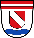
Aholfing
| coat of arms | Germany map | |
|---|---|---|

|
Coordinates: 48 ° 57 ' N , 12 ° 28' E |
|
| Basic data | ||
| State : | Bavaria | |
| Administrative region : | Lower Bavaria | |
| County : | Straubing arch | |
| Management Community : | Rain (Lower Bavaria) | |
| Height : | 324 m above sea level NHN | |
| Area : | 21.4 km 2 | |
| Residents: | 1864 (Dec. 31, 2019) | |
| Population density : | 87 inhabitants per km 2 | |
| Postal code : | 94345 | |
| Area code : | 09429 | |
| License plate : | SR , BOG, MAL | |
| Community key : | 09 2 78 112 | |
| LOCODE : | DE AHQ | |
| Community structure: | 5 districts | |
| Association administration address: | Schloßplatz 2 94369 Rain |
|
| Website : | ||
| Mayor : | currently no 1st BGM, new election on September 13, 2020 | |
| Location of the municipality of Aholfing in the Straubing-Bogen district | ||
Aholfing is a municipality in the Lower Bavarian district of Straubing-Bogen and a member of the Rain administrative community . Aholfing is located in the Danube Forest region .
Community structure
The community has five officially named districts, the parish village of Aholfing as the core town, the parish village of Niedermotzing , the parish village of Obermotzing , the village of Puchhof and the wasteland of Landstorf .
There are three districts: Aholfing, Niedermotzing and Obermotzing.
history
Until the church is planted
The place name Aholvingin (also Aholuingin ), first mentioned around 1132, is derived from the personal name Aholf and the property suffix -ing . The spelling Aholfing has been known since around 1298. Aholfing belonged to the Straubing Rent Office and Straubing Court of the Electorate of Bavaria . In the course of the administrative reforms in Bavaria , today's municipality was created with the municipal edict of 1818 .
Incorporations
On January 1, 1975, the previously independent communities of Niedermotzing and Obermotzing were incorporated.
Population development
In the period from 1988 to 2019, the municipality grew from 1,078 to 1,864 by 786 inhabitants or 72.91% - the highest percentage increase in the district in the period mentioned.
| year | 1840 | 1871 | 1900 | 1925 | 1939 | 1950 | 1961 | 1970 | 1987 | 1991 | 1995 | 2000 | 2005 | 2007 | 2008 | 2009 | 2010 | 2011 | 2012 | 2013 | 2014 | 2015 | 2018 | 2019 |
|---|---|---|---|---|---|---|---|---|---|---|---|---|---|---|---|---|---|---|---|---|---|---|---|---|
| Residents | 896 | 1008 | 1140 | 1135 | 1078 | 1409 | 1088 | 1136 | 1076 | 1210 | 1410 | 1562 | 1696 | 1755 | 1762 | 1757 | 1757 | 1730 | 1762 | 1784 | 1828 | 1813 | 1828 | 1864 |
politics
In 2013, the municipality had tax income of € 1,222,000, of which the trade tax income (net) was € 344,000.
mayor
Mayor until April 2020 was Georg Wagner (CSU / UW / ÜWG). Michael Scheitinger (ÜWG), who was elected in the runoff election in the 2020 mayor election, did not take office. Until the new election in autumn 2020, the official business will be carried out by the second mayor.
Municipal council
The municipal council election on March 15, 2020 led to the following result for the composition:
- CSU: 5 seats
- ÜWG: 7 seats
The municipal council consists of the first mayor and twelve members.
Architectural monuments
economy
In 2013, 100 people were employed at the Aholfing site subject to social security contributions. There were a total of 703 employees at the place of residence. In 2010 there were 28 agricultural holdings; 1831 hectares were used for agriculture, 1651 hectares of which were arable land.
education
There are the following institutions (as of 2018):
- 1 day care center with 67 places and 65 visitors (14 of them under three years of age)
literature
- Josef Buchner, Gustl Buchner: Aholfing - history of a Danube community, Volume I: Aholfing and Puchhof . Ed .: Aholfing municipality. Aholfing 2005.
Web links
- Homepage
- Aholfing: Official statistics of the LfStat
- Entry on Aholfing's coat of arms in the database of the House of Bavarian History
Individual evidence
- ↑ "Data 2" sheet, Statistical Report A1200C 202041 Population of the municipalities, districts and administrative districts 1st quarter 2020 (population based on the 2011 census) ( help ).
- ^ Community Aholfing in the local database of the Bavarian State Library Online . Bayerische Staatsbibliothek, accessed on July 3, 2017.
- ↑ District. Municipalities and districts. Bavarian Surveying Administration, archived from the original on April 11, 2013 ; accessed on March 31, 2015 .
- ↑ District in PDF. (PDF; 1.9 MB) Bavarian Surveying Administration, archived from the original on April 2, 2015 ; accessed on March 31, 2015 .
- ^ Federal Statistical Office (ed.): Historical municipality directory for the Federal Republic of Germany. Name, border and key number changes in municipalities, counties and administrative districts from May 27, 1970 to December 31, 1982 . W. Kohlhammer GmbH, Stuttgart / Mainz 1983, ISBN 3-17-003263-1 , p. 631 .
- ↑ Local elections in the district of Straubing-Bogen. District Sraubing-Bogen, accessed on May 30, 2020 .
- ↑ Announcement of the final election results of the election of the municipal council on March 15, 2020


