Barbaste
| Barbaste | ||
|---|---|---|

|
|
|
| region | Nouvelle-Aquitaine | |
| Department | Lot-et-Garonne | |
| Arrondissement | Nérac | |
| Canton | Lavardac | |
| Community association | Albret Community | |
| Coordinates | 44 ° 10 ′ N , 0 ° 17 ′ E | |
| height | 38-146 m | |
| surface | 38.70 km 2 | |
| Residents | 1,522 (January 1, 2017) | |
| Population density | 39 inhabitants / km 2 | |
| Post Code | 47230 | |
| INSEE code | 47021 | |
 Barbaste Mill |
||
Barbaste is a municipality with 1522 inhabitants (at January 1, 2017) in France in the department of Lot-et-Garonne in the region Nouvelle-Aquitaine .
geography
The city lies on the banks of the Gélise River , which flows into the Baïse in Lavardac . Barbaste is located in the Buzet wine region .
history
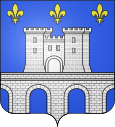
- On the Ténarèze , a Gallo-Roman road between the Pyrenees and the Garonne , a Romanesque bridge with ten arches was built over the Gélise in the 12th century .
- A century later, a towered watermill was built by the local lords before it was bought by the d'Albret family in 1308. It has a square floor plan with a side length of 15 m and is flanked by four crenellated square towers about 29 m high. Since it is close to the bridge, it was also used as a fortress for collecting tolls . In the 16th and 17th centuries it was more of a castle than a mill and was often visited by the French King Henri IV , who came from the d'Albret family and became the owner of the mill, while passing through and hunting. It was sold at the beginning of the 19th century and in 1821 the new owners added the Maison Aunac , a splendid residence.
Attractions
- Romanesque bridge over the Gélise
- Fortified mill at Barbaste
