Xaintrailles
| Xaintrailles | ||
|---|---|---|
|
|
||
| region | Nouvelle-Aquitaine | |
| Department | Lot-et-Garonne | |
| Arrondissement | Nérac | |
| Canton | Lavardac | |
| Community association | Albret Community | |
| Coordinates | 44 ° 12 ′ N , 0 ° 16 ′ E | |
| height | 80-196 m | |
| surface | 10.26 km 2 | |
| Residents | 418 (January 1, 2017) | |
| Population density | 41 inhabitants / km 2 | |
| Post Code | 47230 | |
| INSEE code | 47327 | |
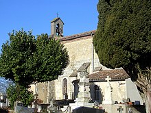
 View over the village to the Château Xaintrailles |
||
Xaintrailles is a French municipality with 418 inhabitants (at January 1, 2017) in the department of Lot-et-Garonne in the region Nouvelle-Aquitaine . It belongs to the Arrondissement of Nérac and the Albret Communauté , a local authority association founded in 2016 .
geography
The municipality of Xaintrailles is located 30 kilometers west of the city of Agen and about 80 kilometers southeast of Bordeaux in the Buzet wine-growing region .
Several streams ( Ruisseau Coutan, Ruisseau de Romanin ) have their source in the municipal area of 10.26 km² , all of which drain towards the east to the Garonne tributary, the Baïse . In the north-west of the municipality the hilly landscape reaches its highest point at 196 m (church and cemetery of the core town). Outside the settlements, the soil is used intensively for agriculture. The landscape is characterized by a mix of fields, pastures, bushland and vines, while forests predominate in the north ( Richet le Gavachon, Le Tuco de Petit ).
The districts of Cantinolle, Lasmazères, Doumerc, Coulin and Jean de Goux belong to Xaintrailles .
Neighboring communities of Xaintrailles are Ambrus in the north, Buzet-sur-Baïse in the northeast, Mongaillard in the east, Lavardac in the southeast, Barbaste in the south and Pompiey in the west.
history
The place has been documented since the early Middle Ages, when Xaintrailles and the surrounding area were part of an area conquered by the English King Edward II . The place became known nationwide through Jean Poton de Xaintrailles , a minor nobleman and one of the captains of Jeanne d'Arc in the Hundred Years War . He became Marshal of France and Military Governor of Aquitaine in 1453 and expanded the striking castle at the western end of the town ( Château de Xaintrailles ), whose existence has been documented since 1259. After the death of Jean Poton de Xaintrailles in 1461, the subsequent lords of the castle (Bernard Lamothe, the governors of Casteljaloux , Blaise de Montesquiou from 1570 and Armand François Maximilien de Lau de Lusignan from 1724) continued to expand the château. The name Xaintrailles is a typical example of phonetic changes due to different acoustic perceptions over the centuries. The originally Gallo-Roman name - Sainte-Eulalie (after Saint Eulalia as patron saint) - finally changed from 1793 to today's Xaintrailles via Sainteulaille, Sintalaille, Sentaraille and Saintraille .
Population development
| year | 1962 | 1968 | 1975 | 1982 | 1990 | 1999 | 2006 | 2017 | |
| Residents | 379 | 408 | 342 | 349 | 410 | 396 | 380 | 418 | |
| Sources: Cassini and INSEE | |||||||||
Attractions
- Xaintrailles Castle ( Château de Xaintrailles ), Monument historique
- Church of St. John the Baptist ( Église Saint-Jean-Baptiste )
Economy and Infrastructure
There are ten farms in the community (growing grain, breeding poultry, sheep and goats) and 13 winegrowers.
The D 141 road from Houeillès to Vianne runs through Xaintrailles . In Damazan , 13 kilometers north of Xaintrailles, there is a connection to the A 62 autoroute . The train station in Port-Sainte-Marie, 16 kilometers away, is on the Bordeaux – Sète railway line .
supporting documents
- ↑ Origine du nom and Un peu d'histoire on www.xaintrailles.fr (French)
- ↑ Xaintrailles on cassini.ehess.fr
- ↑ Xaintrailles on insee.fr
- ^ Entry in the Base Mérimée of the Ministry of Culture. Retrieved April 6, 2014 (French).
- ↑ Farms including winemakers on annuaire-mairie.fr (French)

