Bern-Burgfeld
|
Burgfeld Common quarter in Bern |
|
|---|---|
| Coordinates | 602 983 / 200703 |
| height | 553- 563 m |
| surface | 0.09391 km² |
| Residents | 743 (2019) |
| Population density | 7912 inhabitants / km² |
| Proportion of foreigners | 10.5% (2019) |
| Quarter number | 408 |
| Post Code | 3006 |
| Statistical district | Beundenfeld |
| district | Kirchenfeld-Schosshalde |
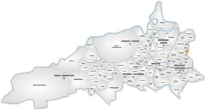
Burgfeld is a common quarter in District IV ( Kirchenfeld-Schosshalde ) and the statistical district of Beundenfeld . In the east it forms the city limit to Ostermundigen and borders the Kleine Allmend and the Galgenfeld industrial zone .
In 2019 there were 743 residents in the quarter, 665 of them Swiss and 78 foreigners.
Burgfeld and Galgenfeld are also viewed as a common quarter and are then the largest in terms of area in District V. The Burgfeld quarter is also known as the "Fliegerquartier". In memory of the first military airfield on the Kleine Allmend, the residential streets are named after aviation pioneers. The residential development consists of single and multi-family houses.
The Burgfeld parish hall was converted into a school building and the Burgfeld district school was created.
Individual evidence
- ↑ Interactive city map of the city of Bern (selection under "Topics")
- ↑ Resident population 2019 (PDF, 4.3 MB) City of Bern, March 2020, pp. 5 and 14 , accessed on March 29, 2020 .
- ↑ Burgfeld / Galgenfeld on the website of the district representation district 4 (QUAV4)
- ^ Burgfeld district + school = Burgfeld district school on bern.ch
Web links
- Burgfeld District Association

