Bern-Schosshalde / Obstberg
|
Schosshalde / Obstberg Common district in Bern |
|
|---|---|
| Coordinates | 601 835 / 199499 |
| height | 521– 572 m |
| surface | 0.2385 km² |
| Residents | 1970 (2019) |
| Population density | 8260 inhabitants / km² |
| Proportion of foreigners | 14% (2019) |
| Quarter number | 417 |
| Post Code | 3006 |
| Statistical district | Schosshalde |
| district | Kirchenfeld-Schosshalde |
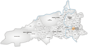
Schosshalde / Obstberg is a smaller common quarter in the statistical district 22 Schosshalde of the district IV Kirchenfeld-Schosshalde . It borders on Rosengarten , Schönberg / Bitzius , Wyssloch , Egelmoos , Gryphenhübeli / Thunplatz , the Bear Park and Altenberg .
In 2019, 1970 people lived in the usual quarter, 1695 of them Swiss and 275 foreigners.
The name Schosshalde is the Moränentereasse returned between Schosshaldenstrasse, Schosshalde Forest, 0berer Zollgasse, Buchserstrasse and Egelgasse. Obstberg was the name of a country house on Aargauerstalden.
Before 1880, only two simple houses were built on the Obstberg. Between 1890 and 1914, the quarter between Kleinem Muristalden, Laubeggstrasse and Schosshaldenstrasse was almost completely built over and was given today's appearance - mostly terraced apartment buildings for the upper middle class. The most imposing development is the 'brick settlement' built by Jakob Glur on Obstbergweg from 1893 to 1902.
Web links
Individual evidence
- ↑ Interactive city map of the city of Bern (selection under "Topics")
- ↑ Resident population 2019 (PDF, 4.3 MB) City of Bern, March 2020, pp. 5 and 14 , accessed on March 29, 2020 .
- ↑ Historical-Topographical Lexicon of the City of Bern 2019, p. 219
- ↑ Construction inventory of the City of Bern 2018 on bern.ch p. 7 ff.

