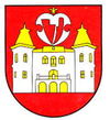
Betliar
| Betliar | ||
|---|---|---|
| coat of arms | map | |

|
|
|
| Basic data | ||
| State : | Slovakia | |
| Kraj : | Košický kraj | |
| Okres : | Rožňava | |
| Region : | Gemer | |
| Area : | 24.669 km² | |
| Residents : | 942 (Dec. 31, 2019) | |
| Population density : | 38 inhabitants per km² | |
| Height : | 341 m nm | |
| Postal code : | 049 21 | |
| Telephone code : | 0 58 | |
| Geographic location : | 48 ° 42 ′ N , 20 ° 31 ′ E | |
| License plate : | RV | |
| Kód obce : | 525545 | |
| structure | ||
| Community type : | local community | |
| Administration (as of November 2018) | ||
| Mayor : | Ľubomír Zatroch | |
| Address: | Obecný úrad Betliar Šafárikova 67 04921 Betliar |
|
| Website: | www.betliar.ocu.sk | |
| Statistics information on statistics.sk | ||
Betliar ( German Betler , Hungarian Betlér ) is a municipality in eastern Slovakia . It is located in the southeastern part of the Slovak Ore Mountains in the Slaná Valley, about 6 km from Rožňava .
The place was first mentioned in writing in 1330 as a Bethler . Today the place is known for the Betliar Castle . It was built on the foundations of an older Renaissance castle at the beginning of the 18th century.
Web links
Commons : Betliar - collection of images, videos and audio files

