Slavec
| Slavec Szalóc |
||
|---|---|---|
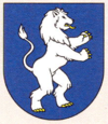
| coat of arms | map | |

|
|
|
| Basic data | ||
| State : | Slovakia | |
| Kraj : | Košický kraj | |
| Okres : | Rožňava | |
| Region : | Gemer | |
| Area : | 17.522 km² | |
| Residents : | 479 (Dec 31, 2019) | |
| Population density : | 27 inhabitants per km² | |
| Height : | 230 m nm | |
| Postal code : | 049 11 ( Plešivec post office ) | |
| Telephone code : | 0 58 | |
| Geographic location : | 48 ° 35 ' N , 20 ° 28' E | |
| License plate : | RV | |
| Kód obce : | 526266 | |
| structure | ||
| Community type : | local community | |
| Structure of the municipality: | 2 parts of the community | |
| Administration (as of November 2018) | ||
| Mayor : | Gejza Ambrúš | |
| Address: | Obecný úrad Slavec č. 109 049 11 Slavec |
|
| Website: | www.slavec.sk | |
| Statistics information on statistics.sk | ||
Slavec , Hungarian Szalóc (until 1948 Slovak "Salovec" - until 1927 "Solovec") is a municipality in the east of Slovakia with 479 inhabitants (December 31, 2019), which for Okres Rožňava , a circle of kraj Košický heard and is counted to the traditional landscape of Gemer .
geography
The municipality is located in the middle of the Slovak Karst in a canyon-like valley of the Slaná river . The municipality extends both in the valley and on the two plateaus on both sides of the valley; these are the Plešivská planina west and Silická planina east of the place. In the latter plateau there are several caves, ravines and springs, for example Gombasecká jaskyňa . The center of the village lies at an altitude of 230 m nm and is ten kilometers from Rožňava .
In addition to the main town Slavec, the district Vidová (Hungarian Vígtelke ) has belonged to the municipality since 1961 , as well as the hamlets Gombasek and Hámor.
Neighboring municipalities are Brzotín in the north, Silica in the east, very briefly Silická Brezová in the southeast and Plešivec in the south and west.
history
Slavec was first mentioned in writing in 1320 as Zalouchhaza , in the 14th century the village was the subject of a dispute between the Bebek and Mariássy families . In 1371 a Pauline monastery was built in Gombasek, to which part of the village belonged until 1556. Other lords were Hámossy , Esterházy , Ragály and most recently Andrássy . In 1828 there were 62 houses and 439 inhabitants who were employed in the lime kiln, agriculture, as shepherds and ironworkers.
Until 1918/1919, the place in Gemer and Kleinhont counties belonged to the Kingdom of Hungary and then came to Czechoslovakia or now Slovakia. From 1938 to 1945 he was once again part of Hungary due to the First Vienna Arbitration .
population
According to the 2011 census, Slavec had 458 inhabitants, including 235 Magyars, 157 Slovaks, 17 Roma, seven Czechs and one Ukrainian. 41 residents gave no answer. 170 residents supported the Reformed Church, 87 residents the Roman Catholic Church, 13 residents the Evangelical Methodist Church, nine residents the Jehovah's Witnesses, six residents the Greek Catholic Church, five residents the Evangelical Church AB, two residents the Evangelist Church Church and one resident to the Apostolic Church. 106 inhabitants were without a denomination and the denomination of 59 inhabitants was not determined.
Attractions
- Gombasecká jaskyňa cave , discovered in 1951 and developed for tourism since 1955
- Reformed church in Slavec, originally built in the Gothic style, significantly rebuilt in 1801
- Ruins of the Pauliner monastery from 1371, destroyed in 1556
Individual evidence
- ↑ 2011 census by ethnicity (Slovak) ( Memento from October 6, 2014 in the Internet Archive )
- ↑ 2011 census by denomination (Slovak) ( Memento from September 7, 2012 in the Internet Archive )
Web links
- Entry on e-obce.sk (Slovak)

