
Woltmershausen
| District of Bremen Woltmershausen |
||
|---|---|---|
  |
||
| Basic data | rank | |
| Surface: | 5.386 km² | 19/23 |
| Residents : | 14,417 | 17/23 |
| Population density : | 2,677 inhabitants per km² | 10/23 |
| Proportion of foreigners: | 18.1% | 11/23 |
| Unemployment rate: | 13.6% | 7/23 |
| Coordinates : | 53 ° 5 ' N , 8 ° 46' E | |
| Districts: |
Woltmershausen Rablinghausen |
|
| Postal code : | 28197 | |
| District : | south | |
| Local office : | Neustadt / Woltmershausen | |
| Website: | Woltmershausen | |
| All area information as of December 31, 2014. All demographic information as of December 31, 2016. |
||
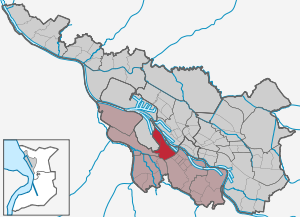
Woltmershausen ( Low German Woltmershusen ) is a district of Bremen and belongs to the southern district of Bremen .
Geography and districts
Woltmershausen is located on the left side of the Weser in the southwest of the city. The district is adjacent to the districts of Neustadt in the east and Seehausen and Strom in the west and south.
Woltmershausen

Area: 3.25 km², 10,796 inhabitants
Woltmershausen's origins go back to prehistoric times. The name refers to the settlement of a landlord named Woltmer (Woldemar). In the 18th century there were six full courtyards, three Kötner and a few Brinkitzer and house residents . The population was about 300.
Woltmershausen belonged to the Niedervieland and was located behind the Weser dike. In 1666 the people of Bremen burned the village down when the city was besieged by the Swedes because it was in the fortress area; During the reconstruction, some parts of the house were raised to protect against flooding, others were not allowed to be built again. Only the more distant Kamphof has been preserved, of which an old row of linden trees in the Woltmershauser Friedhof and the street name Kamphofer Damm still testify.
The structure changed in the 19th century. Shipbuilding was initially carried out on the banks of the Weser , but other industries were only reluctantly found. The number of inhabitants increased steadily , shops, restaurants and businesses developed on Woltmershauser Straße .
Due to the proximity of the port, sawmills and planing mills were built by the timber dealers. Larger industrial plants also settled in Woltmershausen, such as the Woltmershausen gas works and the Martin Brinkmann tobacco factory. South on the street Auf dem Bohnenkamp developed an extensive parcel area. In 1902 Woltmershausen became its own parish (part of Rablinghausen); at the same time the previous village was included as a district in Bremen .
Woltmershausen today has around 11,000 inhabitants with a fairly constant population. Most of the working population are artisans, manual workers and white-collar workers. More than 4,000 people are employed in seven industrial companies.
The entrance to Woltmershausen was marked for decades by a large gasometer at the Neustädter freight yard. It was built in 1954, was the second tallest building after the cathedral and could store more than 100,000 cubic meters of town gas . The tower was green, but the upper part was painted with red and white rectangles based on the Bremen bacon flag . Thirty years later it was torn down again.
Rablinghausen
Area: 1.77 km², 3089 inhabitants
The Rablinghausen village church , which was built as a baroque hall building until 1750 and was rebuilt after being destroyed in the Second World War, is worth seeing . The old farmhouse Westerdeich is remarkable .
Politics, administration
Advisory Board
The Woltmershausen Advisory Board is also responsible for the districts of Hohentorshafen and Neustädter Hafen in the Häfen district. It usually meets publicly on the first Monday of each month in the Kulturhaus Pusdorf, Woltmershauser Straße 444. The advisory board is made up of the representatives of the political parties elected at the district level or individual candidates. The advisory board elections take place every four years, at the same time as the elections for the Bremen citizenship . The advisory board discusses all issues of the district that are of public interest and makes decisions on this, which are passed on to the administration, the state government and the townspeople. He forms specialist committees for his work. The advisory board has its own budget for district-related measures.
The spokesperson for the advisory board is Edith Wangenheim (SPD). Your deputy is Ole Lindemann (CDU).
Local office
A joint for the districts of Neustadt and Woltmershausen and districts Hohentorshafen and Neustadt port local exchange set up as a local administrative authority. The local office manager is Annemarie Czichon.
history
Surname
The Vieland was mentioned around 1280 as in the vi lande , around 1297 as Vilant and around 1364 as Vylant .
Woltmershausen probably comes from the Saxon settler Woltimar von Liestmunde , who, according to a document from 1083, settled on the Werder to the left of the Weser. The vernacular also says Pusdorf zu Woltmershausen, as the wind probably "blows" a lot here.
Rablinghausen was in 1250 Rat Ring Husen and from 1295 Ratbringhusen . Something similar could probably have been called a family settling there.
1200 to 1900
In 1244 Woltmershausen and 1250 Rablinghausen were first mentioned in a document. The places belonged to the Goh Vieland , which from 1598 was called Niedervieland .
The customs house was built on Warturmer Heerstraße in 1577 , where the toll for the dam over the Ochtum lowlands , which had to be maintained , was raised. It was and is also known as the Storchennest Gasthaus .
Woltmershausen and Rablinghausen were burned down by order of the Bremen council in 1666 in order to get a clear field of fire against the advancing Swedes. Only two courtyards in Rablinghausen remain.
Woltmershausen and Rablinghausen originally belonged to the parish of St. Martini in Bremen . In 1746, Niedervieland established its own parish with the villages of Rablinghausen, Woltmershausen, Lankenau, Strom and Neuenland. In 1750 the new building of a baroque hall church - the Rablinghauser church - was completed. In 1772 Strom and Neuenland left the parish again.
School: The St. Martini congregation was also responsible for the school location, and since 1690 it had maintained a secondary school at the church in Rablinghausen. In 1848 there were three classes with 216 students. Due to the population increase, the school was constantly expanded and in 1891 it had 8 classes.
From 1871 there was also a constantly growing secondary school in the parish on Woltmershauser Straße with 20 classes in 1902. In 1903 a new building was built on Woltmershauser Allee which was destroyed in 1944.
Woltmershausen, Rablinghausen and Lankenau had a total of 660 inhabitants in 1812.
The Neustadtgraben was deepened in 1840. It served to relieve the battles and as a winter harbor.
The Bremen – Oldenburg railway line - now the border line for Woltmershausen - with the Neustädter Bahnhof was built in 1867. The security harbor got a siding. The structure changed, shipbuilding was carried out on the banks of the Weser, other industries followed.
The new Woltmershauser Canal established a new connection to the Weser from 1873 with the security harbor (from 1900 Hohentorshafen ). Businesses settled here, especially timber companies. The Bremer Lagerhaus Gesellschaft (BLG) was founded here in 1877. The industrial area now expanded to include the Woltmershauser Vordeichsland. The Woltmershauser sandy beach was later removed in favor of the Neustädter Hafen .
The tobacco factory Martin Brinkmann started production in Woltmershausen in 1911 and was the largest employer in the district until it was relocated to Berlin in 1984.
From 1900
At the turn of the century in 1900, Woltmershausen became a place of residence for mainly port and shipyard workers. In Rablinghausen, the village character is retained for longer. The left bank of the Weser with the sandy beach was a popular leisure area for many Bremen residents.
In 1902 Woltmershausen was incorporated into the city of Bremen and in 1921 Rablinghausen was incorporated. In 1905 Woltmershausen, Rablinghausen and Lankenau had 7,473 inhabitants.
In 1905, the new school on Rechtenflether Straße (today elementary school) in Woltmershausen opened with 12 classes. It should be expanded to up to 18 classes and received an extension in 1957.
The neo-Gothic Christ Church on Woltmershauser Strasse was inaugurated in 1906.
Tram line 7 was extended to Rablinghausen-Bakeweg in 1933. The housing welfare institution of the Nazis at Warturmer Platz was established in 1936. The settlement was intended for community strangers with many children who were forcibly committed.
After the Second World War , Woltmershausen had 18,544 inhabitants in 1960. At that time from 1960 to 1962 the Neustädter Hafen was built and a Hanse cog from the 14th century was recovered during dredging work in the Weser .
In 1960 the first construction phase of the school on Butjadinger Strasse in Woltmershausen was completed.
The gas plant was shut down in 1964. The gasometer remained in place until 1984.
In 1965 tram line 7 was shut down and buses took over local public transport.
The Weser-Uferpark from Lankenauer Höft to Rablinghausen was completed in 1972.
In 1981 the ferry connection between Woltmershausen and Gröpelingen / Walle was closed .
With the opening of the Kulturladen Pusdorf in 1982, social and cultural work in the district received new impulses.
The construction of the freight traffic center (GVZ) in 1983 and the expansion of the industrial area strengthened Woltmershausen's business location considerably. By 2008, over 130 companies with over 5,500 employees had settled in the 500 hectare area. The GVZ Entwicklungsgesellschaft founded for this purpose and the Bremer Investitionsgesellschaft (BIG) business development agency represent the interests of area development.
In spring 2013 the ferry connection to the right bank of the Weser was reactivated. In seasonal weekend traffic, the Weser ferry now connects Lakenauer Höft with the Waterfront shopping center in Gröpelingen and Überseestadt .
Population development
| Town / district | 1812 | 1855 | 1905 | 1955 | 1975 | 1995 | 2007 |
|---|---|---|---|---|---|---|---|
| Woltmershausen | 311 | 956 | 6,629 | 9,863 | 10,852 | 10,697 | |
| Rablinghausen | 128 | 183 | 844 | 3,889 | 3.226 | 3,103 | |
| district | 439 | 1,148 | 7,473 | 17,680 | 13,752 | 14,078 | 13,800 |
The village of Lankenau had around 220 inhabitants in 1812 and around 270 in 1855, which are included in the totals and in the number of inhabitants of Rablinghausen for 1905.
Average annual population from 1975 as data from the Bremen State Statistical Office.
Culture and sights
Buildings


- The Protestant church Rablinghausen on Rablinghauser Deich is a baroque building by Grütter from 1748/50. It was rebuilt in 1964/65 (coordinates: 53 ° 5 ′ 31.4 ″ N , 8 ° 45 ′ 17.8 ″ E ).
- The historicizing , Protestant Christ Church in Woltmershausen on Woltmershauser Strasse planned by Otto Blendermann and built from 1904 to 1906 (coordinates: 53 ° 5 ′ 0 ″ N , 8 ° 46 ′ 3.4 ″ E ).
- The stork's nest on Warturmer Heerstraße was once the customs house between Bremen and the county of Oldenburg . The Renaissance building from 1577 now houses an inn. The Warturm was destroyed in 1813 and removed in 1820.
- The two-storey, listed police station Woltmershauser Straße 71 was planned by Hans Ohnesorge in 1909/1910 . The building in the form of a north German residential house in the 18th and 19th centuries has a half- hip roof .
- The former cemetery administrator's house from 1948 (Woltmershauser Str. 494, cemetery side entrance) is the first building certificate of the American bungalow style in Bremen . It is an angular bungalow with a hipped roof .
- The Catholic St. Benedict Church (Auf dem Bohnenkamp) from 1966 was designed by Karl-Heinz Bruns.
Monuments, art
- On the Bohnenkamp: district in the clutches of industry and traffic by Jürgen Schmiedekampf
- Rechtenflether Straße 24: Dancing on the head by Gunther Gerlach
- Weserufer: Paths to the Weser by Kai Thies
- Weseruferpark Rablinghausen : The Lankenau Monument by Hans-Jürgen Breuste stood from 1975 to 2006.
- Woltmershausen: Atleth III by Hans-Jürgen Breuste
- Woltmershausen: Recklin with his poodles by Peter KF Krüger
- Woltmershausen: Ways to the Weser by Ralph Kull
- Woltmershauser Straße: Color coding system by Peter Vogel
- Woltmershauser Straße: Paths to the Weser from Herwig Gillerke
- Woltmershauser Straße: Leaf catcher by Andreas Wegner
- Woltmershauser Strasse 152: The all-busting run of money by Jimmi D. Paesler
- Woltmershauser Straße 174: Nostalgia by Jub Mönster
- Woltmershauser Straße 241: mural by Birgit Hansen and Gerhard Schlueter
- Woltmershauser Tunnel: wall painting by Jub Mönster
Parks, green spaces
- The approximately 22 hectare Weseruferpark Rablinghausen with the paths on the dike from Lankenauer Höft to Woltmershausen was created from 1970 to 1974 on rinsing fields from the port to the left of the Weser. In 2006 a play and water garden was created . The 300 meter long bathing beach on the Weser has been usable since 2009. A small iron cog by Hans-Dieter Tietjen reminds of the place where the Bremen cog from 1380 was found, which can be seen in the German Maritime Museum in Bremerhaven.
- The allotment garden areas Wardamm- Woltmershausen, Am Reedeich and on the Neuenlander Wasserlöse / Grolländer Ochtum / Alten Ochtum comprise around 2000 allotment gardens, which are looked after by nine associations.
- The 5 hectare Woltmershauser Friedhof with a neo-Gothic chapel and the oldest stock of oaks on the left side of the Weser.
Public facilities
General
- The Neustadt / Woltmershausen local office is in Neustadt, Neustadtscontrescarpe 44
- The Woltmershausen Police Station , Woltmershauser Strasse 71
- The Kulturhaus Pusdorf from 1982 at Woltmershauser Strasse 444
schools
- The Rablinghausen school , Dorfkampsweg 50, is a primary school.
- The school at Rechtenflether Straße 24 in Woltmershausen is a primary school
- The Roter Sand Oberschule at Butjadinger Straße 21 in Woltmershausen is an all-day school and a school center in secondary level I.
Social
- The kindergartens Kita Roter Sand , Christ Church Woltmershausen , Charlotte Niehaus , the AWO in Blexer Straße and the children's and youth center on Warturmer Platz
- The JUSA Bremen Forum for Youth and Social Work , Auf dem Grünen 13
- Foundation village Rablinghausen of the Bremer Heimstiftung , Rablinghauser Landstr. 51 a-e
- Krohne Senior Care , Woltmershauser Strasse 266
- Old people's meeting place, Woltmershauser Str. 310
- Facility for the disabled in the Bremen workshop - Westerdeich facility
- Jugi Roter Sand, youth center of the DRK
- Institutions for unemployment counseling, addiction support and self-help groups, discussion groups, etc.
- Playhouse Treff Kamphofer Damm, day care center Bremen
Churches
- Protestant parish Christ Church Woltmershausen , Woltmershauser Str. 376, with a neo-Gothic church of 1906 by Otto Blendermann designed
- Protestant parish Rablinghausen , Rablinghauser Deich 3, with the baroque church Rablinghausen from 1748/50
- Protestant Free Church Woltmershausen , Woltmershauser Strasse 298
- Catholic Sankt Benedikt parish , Butjadinger Str. 70, with the church from 1966 designed by Karl-Heinz Bruns
Sports
- Hanseaten-Kampfbahn, Hansaweg 15
- The gymnastics and sports club Woltmershausen from 1890 , Hansaweg 15
- The water sports club Warturm Warturmer Heerstraße 151
- The water sports club Fink , Warturmer Heerstraße 140
- The 18 lane disc golf course at the Weseruferpark
Economy and Transport
economy
Woltmershausen is characterized by a large area of the commercial economy, which is connected to the ports (Neustadthafen, Hohentorshafen) on the left bank of the Weser.
In the commercial area on the gasworks which was since 1910 Martin Brinkmann AG settled. Brinkmann employed around 6,000 people in the tobacco industry here in the 1930s and left Bremen in 1984.
The Stadtwerke Bremen operated here from 1901 to 1964, a gas station with its striking Gasometer , which was reduced by the 1984th Today there is a control center on the site, the administration for the networks, training centers and warehouse of swb AG .
Today there are still many small and medium-sized companies in this area.
There are various car dealerships in the Warturmer Heerstraße / Senator-Apelt-Straße area.
To the west of Woltmershausen in Niedervieland, in the Seehausen district, there is the Bremen freight center (GVZ) and the post freight center.
traffic
Transportation
The most important connection for Woltmershausen is bus line 24 (Rablinghausen - Domsheide - Hauptbahnhof - Neue Vahr-Nord ). It replaces line 7 of the Bremen tram , which was discontinued in 1965 and which ran on the same route.
The bus routes 61 (Sandhausen - Strom - Rablinghausen) and 62 (Hasenbüren - Neustädter Hafen - Rablinghausen) only run every hour and are replaced by the ring routes 65 and 66 in the evenings and on weekends. The bus route 63 (GVZ-Hauptbahnhof) runs outside the residential areas and is therefore of little importance for the district.
Streets
The A 281 motorway has been running along the edge of the district since 2008 and connects the freight center with the A1 motorway . The district can be reached via Stromer Straße via two connection points. An extension of the motorway under the Weser to Oslebshausen to the A 27 motorway is planned.
In the district are Woltmershauser road and Rablinghauser highway , the main access roads.
Biking and hiking trails
There are cycle paths past Rablinghausen u. a. on the dike of the Weser to the Weseruferpark Rablinghausen and the Lankenauer Höft . The Ochtum lowlands can be reached via the roadstead and Langer Damm . The Alter Schutzdeich cycle path leads via Wardamm to Huchting. In the middle of the district there is a connection on Butjadinger Straße , Mittelkamp and Simon-Bolivar-Straße .
Personalities
In alphabetic order
- Johann Hermann Duntze (1790–1874), pastor in Rablinghausen (1819–1869), author of the four-volume history of the free city of Bremen (1845–1851)
- Joachim "Bommel" Fischer (* 1960), action artist and author
- Johann Jakob Hoops (1840–1916), senior teacher in Rablinghausen (1864–1902)
- Hinrich Hormann (1863–1920), educator , member of the Bremen citizenship and the German Reichstag ( progressive people's party ), founder of the Woltmershausen citizens' association (regional association)
- Heinrich Hüneke, until 1921 the last mayor of Rablinghausen / Lankenau, Hünekestrasse in Rablinghausen
- Friedrich Wilhelm Pokhans, known as a popular country hunter in the 1920s
- Hermann Ritter (1878–1949), senator and entrepreneur, since 1900 owner of the Martin Brinkmann company , which has been based in Woltmershausen since 1910
- Horst Stäcker (1931–2015), 1963 to 1986 member of the Bremen Citizenship (SPD)
- Edith Wangenheim (* 1947), member of the advisory board (1988–91) and 1994 to 2007 of the Bremen Citizenship (SPD)
literature
- Herbert Black Forest : The Great Bremen Lexicon . 2nd, updated, revised and expanded edition. Edition Temmen, Bremen 2003, ISBN 3-86108-693-X .
- Monika Porsch: Bremer Straßenlexikon, Volume 6 Woltmershausen, Huchting , Carl Schünemann Verlag, Bremen, 1997, new ISBN 3-7961-1840-2
- Kulturladen Pusdorf (Ed.): Story (s) behind the tunnel. A historical reader. 750 years of Woltmershausen . Bremen 1994.
Web links
- Woltmershausen on www.bremen.de
- www.woltmershausen.de , district portal for the Bremen districts of Woltmershausen and Rablinghausen
Individual evidence
- ↑ Bremen small-scale information system at www.statistik-bremen.de - Table 449-01: Floor area according to type of actual use
- ↑ Bremen small-scale information system at www.statistik-bremen.de - Table 173-01: Population by gender
- ↑ Bremen small-scale information system at www.statistik-bremen.de - Table 173-61: Foreign population by nationality group and gender
- ↑ Bremen small-scale information system at www.statistik-bremen.de - Table 255-60: Unemployed according to selected groups of people and unemployment rate
- ↑ a b Statistisches Jahrbuch 2009 (PDF; 4.0 MB) Statistisches Landesamt Bremen, pp. 9–11 , accessed on June 15, 2010 .
- ↑ corporate history of the Weser network Bremen GmbH
- ↑ § 1 Local Law on Advisory Boards and Local Offices. transparenz.bremen.de, accessed on April 14, 2016 .
- ↑ Architecture Guide Bremen: b.zb: 416
- ^ Art in public space in Bremen
- ^ Website of the Kulturhaus Pusdorf
- ↑ Named after Charlotte Niehaus (1882–1975) politician ( SPD ), member of the Bremen citizenship and the workers' welfare organization
- ^ Report in the Weser-Kurier on June 14, 2019
- ↑ With the tram line 7 to Woltmershausen ( Memento from February 15, 2014 in the Internet Archive ) (former BSAG website)
Districts: Mitte (Bremen) | Ports (Bremen) | Neustadt (Bremen) | Obervieland | Huchting (Bremen) | Woltmershausen | Eastern suburbs | Schwachhausen | Vahr | Horn Lehe | Oberneuland | Osterholz (Bremen) | Findorff (Bremen) | Walle (Bremen) | Groepelingen | Burglesum | Vegesack | Blumenthal (Bremen) . Districts: Seehausen (Bremen) | Strom (Bremen) | Borgfeld | Hemelingen | Blockland .