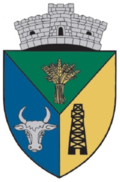
Buza (Cluj)
|
Buza Buzaten Buza |
||||
|
||||
| Basic data | ||||
|---|---|---|---|---|
| State : |
|
|||
| Historical region : | Transylvania | |||
| Circle : | Cluj | |||
| Coordinates : | 46 ° 55 ' N , 24 ° 9' E | |||
| Time zone : | EET ( UTC +2) | |||
| Height : | 383 m | |||
| Area : | 29.47 km² | |||
| Residents : | 1,264 (October 20, 2011) | |||
| Population density : | 43 inhabitants per km² | |||
| Postal code : | 407115 | |||
| Telephone code : | (+40) 02 64 | |||
| License plate : | CJ | |||
| Structure and administration (as of 2016) | ||||
| Community type : | local community | |||
| Structure : | Buza, Rotunda | |||
| Mayor : | Ștefan Czegher ( UDMR ) | |||
| Postal address : | Str. Principală, no. 63 loc. Buza, jud. Cluj, RO-4071105 |
|||
| Website : | ||||
Buza ( German Buzaten , Hungarian Búza ( Buza to German Lippe )) is a municipality in the Cluj district in the Transylvania region in Romania .
Geographical location
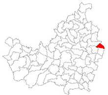
The municipality of Buza is located in the west of the Transylvanian Basin in the east of the Cluj district. The place Buza is located on the county road (drum județean) DJ 161E about 30 kilometers southeast of Gherla (Neuschloss) and about 70 kilometers northeast of the district capital Cluj-Napoca (Klausenburg) . The incorporated village of Rotunda (ung. Keresztesvölgy ) is ten kilometers east of the community center.
history
The place Buza was first mentioned in a document in 1220. Archaeological finds on the area - called Vrabia , Izvoare , Beg , Ursoaica by the locals - of the place Buza, could be dated back to prehistory , according to E. Orosz and M. Roska . An earth castle is located, according to EA Bielz at Dealul Cetăţii (ung. Várhegy ), this was not yet assigned period of history.
In the list of historical monuments of the Romanian Ministry of Culture on the area of the place Buza (near După Lab and Dosul Tăpăieșului ), settlements that point to the Bronze Age are noted.
In the Kingdom of Hungary , today's municipality belonged to the Kékes chair district in Szolnok-Doboka County , then to the historical Someș district and, from 1950, to today's Cluj district.
population
The population of the municipality developed as follows:
| census | Ethnic composition | ||||
|---|---|---|---|---|---|
| year | population | Romanians | Hungary | German | other |
| 1850 | 1,364 | 832 | 469 | - | 63 |
| 1941 | 2,382 | 1,272 | 1.109 | - | 1 |
| 1992 | 1,506 | 796 | 693 | - | 17th |
| 2002 | 1,389 | 716 | 663 | - | 10 |
| 2011 | 1,264 | 604 | 583 | - | 77 (50 Roma) |
Since 1850, the highest number of inhabitants in the area of today's municipality was determined in 1941. The highest population was Romanians (1327) in 1956, Magyars in 1941 and Roma (61) in 1850. In 1890 25 people identified themselves as Romanian Germans.
Attractions
- The manor house of the Hungarian aristocratic Bornemisza family , today's village shop, built in the 19th century, is a listed building.
Web links
Individual evidence
- ↑ 2011 census in Romania ( MS Excel ; 1.3 MB)
- ↑ a b Heinz Heltmann, Gustav Servatius (Ed.): Travel Guide Siebenbürgen. Kraft, Würzburg 1993, ISBN 3-8083-2019-2 .
- ^ Institute Of Archeology - Buza , accessed July 21, 2017 (Romanian).
- ↑ a b List of historical monuments of the Romanian Ministry of Culture, updated 2015 (Romanian; PDF; 12.7 MB)
- ↑ Census, last updated November 2, 2008 (Hungarian; PDF; 525 kB)
- ↑ Bornemisza mansion in Buza at turismcatina.ro accessed on July 21, 2017 (multilingual)


