Cadenet
| Cadenet | ||
|---|---|---|

|
|
|
| region | Provence-Alpes-Cote d'Azur | |
| Department | Vaucluse | |
| Arrondissement | Apt | |
| Canton | Cheval-Blanc | |
| Community association | Territorial South Luberon | |
| Coordinates | 43 ° 45 ' N , 5 ° 23' E | |
| height | 147-376 m | |
| surface | 25.08 km 2 | |
| Residents | 4,190 (January 1, 2017) | |
| Population density | 167 inhabitants / km 2 | |
| Post Code | 84160 | |
| INSEE code | 84026 | |
| Website | http://www.mairie-cadenet.fr | |
 Cadenet from the east |
||
Cadenet is a French municipality with 4190 inhabitants (at January 1, 2017) in the Vaucluse department in the region of Provence-Alpes-Cote d'Azur . The municipality is part of the Luberon Regional Nature Park .
Population development
| year | 1962 | 1968 | 1975 | 1982 | 1990 | 1999 | 2008 |
| Residents | 2,409 | 2,401 | 2,483 | 2,640 | 3,232 | 3,883 | 4.014 |
Attractions
- Castle ruins
- Saint-Étienne church (12th and 16th centuries)
- Cave dwellings above the village, which were inhabited until 1960
- Notre-Dame des Anges chapel
- Several fountains from the 16th to 19th centuries century
- Basket maker museum
Personalities
- Troubadour Cadenet (* 1160), born in Cadenet
- Elzéar of Sabran (1285–1323), lord of Cadenet, saint
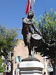
- André Estienne (1777-1837), drummer in French. Army, also known as d'Tambour Arcola known
- Félicien-César David (1810–1876), composer, born in Cadenet
Town twinning
- Arcole (Italy)
- Varvari-Myrtia (Greece)
Web links
Commons : Cadenet - collection of images, videos and audio files

