
Gargas (Vaucluse)
| Gargas | ||
|---|---|---|
.svg)
|
|
|
| region | Provence-Alpes-Cote d'Azur | |
| Department | Vaucluse | |
| Arrondissement | Apt | |
| Canton | Apt | |
| Community association | Pays d'Apt-Luberon | |
| Coordinates | 43 ° 54 ' N , 5 ° 22' E | |
| height | 201-461 m | |
| surface | 14.9 km 2 | |
| Residents | 3,039 (January 1, 2017) | |
| Population density | 204 inhabitants / km 2 | |
| Post Code | 84400 | |
| INSEE code | 84047 | |
 Gargas |
||

Gargas is a French commune in the Vaucluse department in the region of Provence-Alpes-Cote d'Azur . It belongs to the Arrondissement of Apt and the Canton of Apt . The inhabitants call themselves Gargassiens or Gargassiennes.
geography
Gargas is made up of a main settlement and the hamlets of Le Château, La Coquillade, La Grand Fontaine, Le Jas, Les Lombards, Perrotet, Saint-Jean, Les Tamisiers, Les Sauvans, Les Vieux Sauvans and Les Margouillons. The municipality district is bordered to the north by Saint-Saturnin-lès-Apt , in the east and the southeast by Apt , in the southwest of Bonnieux and on the west by Roussillon .
Population development
| 1962 | 1968 | 1975 | 1982 | 1990 | 1999 | 2006 | 2011 |
|---|---|---|---|---|---|---|---|
| 614 | 690 | 1,065 | 1,870 | 2,875 | 2,928 | 2,980 | 2,900 |
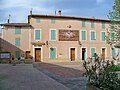
Municipal Office (Mairie)

Saint-Denis church

"Mines de Bruoux" mine

Gargas on an old postcard


Web links
Commons : Gargas - collection of images, videos and audio files