Auribeau
| Auribeau | ||
|---|---|---|

|
|
|
| region | Provence-Alpes-Cote d'Azur | |
| Department | Vaucluse | |
| Arrondissement | Apt | |
| Canton | Apt | |
| Community association | Pays d'Apt-Luberon | |
| Coordinates | 43 ° 50 ′ N , 5 ° 28 ′ E | |
| height | 513-1,122 m | |
| surface | 7.5 km 2 | |
| Residents | 71 (January 1, 2017) | |
| Population density | 9 inhabitants / km 2 | |
| Post Code | 84400 | |
| INSEE code | 84006 | |
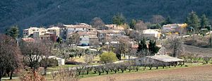
 Auribeau village |
||
Auribeau is a French municipality with 71 inhabitants (at January 1, 2017) in the department of Vaucluse in the region Provence-Alpes-Cote d'Azur . It belongs to the canton of Apt in the arrondissement of the same name .
geography
Auribeau is located around seven kilometers southeast of the city of Apt . Neighboring municipalities are Sivergues , Cucuron , Cabrières-d'Aigues , Castellet-en-Luberon and Saignon .
In the southeast of the municipality rises the Mourre Nègre , which at 1,125 meters is the highest peak in the Luberon Mountains. The river Aigue Brun rises in the municipality and flows into the Durance after 23 kilometers .
traffic
The départementale D48 route runs through the village of Auribeau .
history
Auribel was first mentioned in 1158 and originally developed around a small fortification and a Romanesque chapel. In the 14th century the community was abandoned and 200 years later repopulated on the site of the present village.
Population development
| year | 1962 | 1968 | 1975 | 1982 | 1990 | 1999 | 2008 | 2016 |
|---|---|---|---|---|---|---|---|---|
| Residents | 16 | 22nd | 30th | 38 | 46 | 59 | 73 | 72 |
politics
In the French presidential elections in 2002 , the left-wing radical politician Olivier Besancenot ( LCR ) achieved by far the best result in the first ballot with 38% of the vote. In 2007 he lost a few votes, but ended up with Nicolas Sarkozy ( 25.42% ) just behind the socialist presidential candidate Ségolène Royal ( 27.12% ).
Attractions
The small parish church of St-Pierre-et-St-Paul was built in the early 18th century. Before that, the residents attended masses in Castellet, Saignon or in the former chapel. The church has a beautiful nativity scene with nativity scenes from the 18th and 19th centuries. Its bell tower , with two arched openings above the west facade, bears a bell from 1732, donated by a galley captain.
From the medieval village, parts of the donjon , remains of the wall, some medieval houses and the St-Pierre chapel have been preserved. The buildings were restored in the 1990s .
literature
- Michel Albarède u. a .: Vaucluse (= Encyclopédies du Voyage ). Gallimard Loisirs, Paris 2007, ISBN 2-7424-1900-4 , p. 272 .
Web links
Individual evidence
- ↑ The community on annuaire-mairie.fr
- ↑ auribeau.com: History of the place. (No longer available online.) Archived from the original on March 4, 2016 ; Retrieved September 22, 2012 .
- ^ French Ministry of the Interior : Results of the 2002 presidential election. Retrieved September 22, 2012 .
- ^ French Ministry of the Interior : Results of the 2007 presidential elections. Retrieved September 22, 2012 .
- ↑ a b Michel Albarède et al .: Vaucluse. 2007, p. 272.


