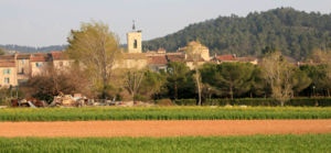
La Bastide-des-Jourdans
| La Bastide-des-Jourdans | ||
|---|---|---|

|
|
|
| region | Provence-Alpes-Cote d'Azur | |
| Department | Vaucluse | |
| Arrondissement | Apt | |
| Canton | Pertuis | |
| Community association | Territorial South Luberon | |
| Coordinates | 43 ° 47 ' N , 5 ° 38' E | |
| height | 348-725 m | |
| surface | 27.74 km 2 | |
| Residents | 1,566 (January 1, 2017) | |
| Population density | 56 inhabitants / km 2 | |
| Post Code | 84240 | |
| INSEE code | 84009 | |
 La Bastide-des-Jourdans |
||
La Bastide-des-Jourdans is a French commune with 1,566 inhabitants (at January 1, 2017) in the Vaucluse department in the region of Provence-Alpes-Cote d'Azur . It belongs to the canton of Pertuis in the Apt arrondissement .
geography
La Bastide-des-Jourdans is located in the southeast of the Vaucluse department , halfway between the towns of Manosque ( 13 km ) and Pertuis ( 15 km ). Neighboring communities in Vaucluse are Vitrolles-en-Lubéron in the west, Grambois in the south and Beaumont-de-Pertuis in the southeast. The north-eastern border is formed by the communes of Pierrevert , Montfuron and Montjustin in the Alpes-de-Haute-Provence department .
In the northwest of the municipality rise the foothills of the Grand Luberon with the Luberon Regional Park , to which the municipality belongs. At the lieu-dit Pié de Gache, the river Èze , which forms part of the southern border with Grambois and flows into the Durance after 24.3 kilometers, rises at 530 meters above sea level .
traffic
Several départementales routes intersect in the center of the village . The D956 leads to Pertuis in the southwest and to the Alpes-de-Haute-Provence department in the north. The city of Manosque can be reached via the D27 in an easterly direction. The smaller roads D42 and D216 provide access to the neighboring communities of Vitrolles-en-Luberon, Grambois and Beaumont-de-Pertuis.
history
The village was founded in the 13th century at the confluence of the Ravin du Bois and the Eze rivers. The name goes back to two Ritter brothers who owned a castle known as Bastida . Due to its favorable location on the road between Aix-en-Provence and Forcalquier , the town soon began to flourish and had up to 1000 inhabitants during its economic heyday in the 16th century. During this time, a new city wall was built, which also enclosed areas beyond the Ravin du Bois . In the 18th century the village experienced a renewed boom due to the silkworm breeding . In addition to wine and olive cultivation , some textile craft could establish itself. In the 19th century, increasing rural exodus and industrialization resulted in the depopulation of the area.
Population development
| year | 1962 | 1968 | 1975 | 1982 | 1990 | 1999 | 2006 | 2017 |
|---|---|---|---|---|---|---|---|---|
| Residents | 471 | 522 | 540 | 597 | 814 | 964 | 1211 | 1566 |
Attractions
The main street of the village is the 19th century Cours . It leads along the old city wall and past the unfinished Notre-Dame-des-Amandiers church , of which only a few remains have been preserved. It was to be built on a plot of land acquired in 1868 and to replace the parish church. However, the work was stopped prematurely due to excessive construction costs. The Porte du Fiol city gate is one of the remarkable remains of the second walling built in the early 16th century . Above the archway there are traces of a double gate lock and a weir gate that was once supported by four corbels . The bell tower dates from the same era and has three bells, the oldest of which dates from 1613. The small 16th-century chapel Notre-Dame-de-Consolation is at the crossroads of three streets east of the wall. In front of it is a four-step staircase and a cross .
From the first castle , built by the Jourdan brothers, only the curtains in the lower part of the west and north walls and the small square tower in the northeast corner have been preserved. The following feudal lords carried out some important extensions in the 16th century, such as the redesign of the square tower and the construction of a four-storey round tower in the northwest corner on the site of an older tower. At the end of the 19th century the ruined castle was bought by a painter. He gave her a restoration and had a house built on the old walls.
The Notre-Dame parish church , built in the south of the village, dates from the 13th century and has been rebuilt several times. As a result of the increasing population, different chapels and a north and south aisle were gradually added. The altarpiece of the high altar is one of its main attractions. It dates from around 1660 and shows a portrait of Mary together with Saints Peter and Saint Paul , Saint Mark and a " martyr - Pope ". Above it are shown in a smaller painting Francis of Assisi , a bishop and Saint Bernard.
literature
- Michel Albarède u. a .: Vaucluse (= Encyclopédies du Voyage ). Gallimard Loisirs, Paris 2007, ISBN 2-7424-1900-4 , p. 294-295 .
- Marie-Christine Mansuy u. a .: Parc Naturel Régional du Luberon (= Encyclopédies du Voyage ). Gallimard Loisirs, Paris 2010, ISBN 978-2-7424-2737-6 , pp. 147 .


