
Altmelon
|
market community Altmelon
|
||
|---|---|---|
| coat of arms | Austria map | |
 |
|
|
| Basic data | ||
| Country: | Austria | |
| State : | Lower Austria | |
| Political District : | Zwettl | |
| License plate : | ZT | |
| Surface: | 38.31 km² | |
| Coordinates : | 48 ° 27 ' N , 14 ° 58' E | |
| Height : | 880 m above sea level A. | |
| Residents : | 847 (January 1, 2020) | |
| Population density : | 22 inhabitants per km² | |
| Postcodes : | 3633, 3925, 4372 | |
| Area code : | 0 28 13 | |
| Community code : | 3 25 19 | |
| NUTS region | AT124 | |
| Address of the municipal administration: |
Altmelon 60 3925 Altmelon |
|
| Website: | ||
| politics | ||
| Mayor : | Manfred Stauderer ( ÖVP ) | |
|
Municipal Council : ( 2020 ) (15 members) |
||
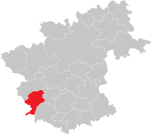
| Location of Altmelon in the Zwettl district | ||
  |
||
 Klaus pond |
||
| Source: Municipal data from Statistics Austria | ||

Altmelon is a market town with 847 inhabitants (as of January 1, 2020) in the Zwettl district in the Waldviertel in northwest Lower Austria .
geography

The market town of Altmelon, together with the communities of Arbesbach , Groß Gerungs , Langschlag and Rappottenstein, form the so-called Waldviertel highlands, which encompass the westernmost part of the Zwettl district. Altmelon is located on a hilly high plateau at 900 m above sea level and is characterized by forest and moor landscapes , by small-scale agriculture and not to be forgotten - the local residents call themselves "rocky" - by numerous granite formations , which give this landscape its rustic character. The Kleine Kamp rises in the municipality, in the Weinsberger Forest near Kleinpertenschlag, and a smaller part of the municipality drains towards Naarn . The Klausteich, a former alluvial pond, is used today as a fishing and bathing pond. It is on the border with Upper Austria and can be reached via a short footpath.
Community structure
The municipality includes the following 11 localities (population in brackets as of January 1, 2020):
- Altmelon (297)
- Dietrichsbach (75)
- Dürnberg (0)
- Fichtenbach (48)
- Großpertenschlag (105)
- Kleinpertenschlag (131)
- Kronberg (45)
- Kronegg (63)
- Marchstein (18)
- Perwolfs (34)
- Schwarzau (31)
The community consists of the cadastral communities Altmelon, Dietrichsbach, Fichtenbach, Großpertenschlag, Kleinpertenschlag and Perwolfs.
Neighboring communities
| Arbesbach | ||
| Königswiesen (Upper Austria) |
.svg)
|
Schönbach |
| St. Georgen am Walde (Upper Austria) | Bear head |
Climate and vegetation
The climate is rough and inhospitable due to the unprotected altitude, cold and snow reliable in winter and pleasant in summer. Spruce mixed forest predominates as forest cover , pine in the moor areas . The predominant form of cultivation is grassland , along with crops such as potatoes , barley and rye . Fruit growing is particularly limited, with only a few apple , creeper and cherry trees .
history
Altmelon was created as a late medieval clearing at the beginning of the 13th century and was first mentioned in 1259 as "Mailan". In 1263 Heinrich IV. Von Kuenring , at that time the master of Rappottenstein Castle , founded a Cistercian convent , which was soon abandoned. The surrounding rural settlements Perwolfs and Perthenschlag (today Großpertenschlag) were first mentioned in documents in 1371. Dietrichsbach was founded around 1700 by Ferdinand Freiherr von Dietrichstein , owner of the Arbesbach estate, and had a glassworks and a brewery. Even later, in the 18th century, Kleinpertenschlag, Fichtenbach and Kronegg (formerly Cronets) emerged as logging settlements. In 1854 the municipality of Altmelon was constituted with the cadastral communities Altmelon, Dietrichsbach and Perwolfs and the municipality of Großpertenschlag consisting of the cadastral communities Großpertenschlag, Kleinpertenschlag and Fichtenbach. In 1970 both parishes merged under the name Pertenschlag-Melon and on the occasion of the market survey in 1985 the name was changed to Altmelon according to the name of the parish.
Population development
| census | Residents |
|---|---|
| 2011 | 864 |
| 2001 | 922 |
| 1991 | 924 |
| 1981 | 1007 |
| 1971 | 1053 |
Source: Altmelon population development. (PDF) Statistics Austria
The population development, which has been negative for a long time due to the peripheral economic situation, has stabilized over the past decade.
politics
The municipal council has 15 members.
- With the municipal council elections in Lower Austria in 1990, the municipal council had the following distribution: 13 ÖVP and 2 SPÖ.
- With the local council elections in Lower Austria in 1995, the local council had the following distribution: 10 ÖVP, 4 FPÖ and 1 SPÖ.
- With the municipal council elections in Lower Austria in 2000, the municipal council had the following distribution: 10 ÖVP, 4 FPÖ and 1 SPÖ.
- With the municipal council elections in Lower Austria in 2005 , the municipal council had the following distribution: 11 ÖVP, 2 FPÖ and 2 SPÖ.
- With the municipal elections in Lower Austria in 2010 , the municipal council had the following distribution: 12 ÖVP, 2 FPÖ and 1 SPÖ.
- With the municipal council elections in Lower Austria in 2015 , the municipal council had the following distribution: 13 ÖVP and 2 SPÖ.
- With the municipal council elections in Lower Austria 2020 , the municipal council has the following distribution: 15 ÖVP.
- mayor
- until 2009 Josef Auer (ÖVP)
- since 2010 Manfred Stauderer (ÖVP)
Culture and sights

- Catholic parish church Altmelon ( patronage : St. James the Elder ): The parish church shows a mixture of different styles. According to the first mention in 1259, the oldest parts, the presbytery and the bell tower attached to the side, are of Gothic origin. After the Arbesbach parish gained independence at the end of the 18th century , the nave was increased.
- Altmelon Farmer's Museum: The museum shows everyday objects from bygone times. Both work equipment and clothing give an impression of the arduous everyday life in the area. The collection of farm machinery, especially old combustion engines, is particularly worth seeing.
- Arbesbach Blacksmith Museum
- Events
- Kirtag at the Iron Image, always on Trinity Sunday, the Sunday after Pentecost
- Jakobikirtag, always on the Sunday of or after the day of the church patron James the Elder
economy
Most of the residents of Altmelon municipality have to commute . In turn, the majority of those employed in their home municipality work in the agriculture and forestry sector. Tourism is becoming more and more important, mainly in summer. The north-south long-distance hiking trail and the Eisenwurzenweg also lead through Altmelon .
traffic
Altmelon is on Greiner Straße (B119), as are the towns of Fichtenbach, Kronegg, Kleinpertenschlag and Marchstein.
Sports
- numerous hiking , mountain bike and riding trails
- tennis
- Cross-country skiing
- Ice stock sport
Personalities
- People related to the community
- Christine Nöstlinger , writer
Web links
- 32519 - Altmelon. Community data, Statistics Austria .
- Official website of the municipality
Individual evidence
- ↑ Statistics Austria: Population on January 1st, 2020 by locality (area status on January 1st, 2020) , ( CSV )
- ^ Result of the local council election 1995 in Altmelon. Office of the Lower Austrian State Government, March 30, 2000, accessed on January 11, 2020 .
- ^ Election result of the municipal council election 2000 in Altmelon. Office of the Lower Austrian State Government, February 4, 2005, accessed on January 11, 2020 .
- ^ Election result of the local council election 2005 in Altmelon. Office of the Lower Austrian State Government, March 4, 2005, accessed on January 11, 2020 .
- ^ Election result of the local council election 2010 in Altmelon. Office of the Lower Austrian State Government, October 8, 2010, accessed on January 11, 2020 .
- ^ Election results for the 2015 municipal council elections in Altmelon. Office of the Lower Austrian State Government, December 1, 2015, accessed on January 11, 2020 .
- ↑ Results of the local council election 2020 in Altmelon. Office of the Lower Austrian State Government, January 26, 2020, accessed on January 29, 2020 .
Cadastral communities: Altmelon | Dietrichsbach | Fichtenbach | Großpertenschlag | Kleinpertenschlag | Perwolfs
Localities: Altmelon | Dietrichsbach | Dürnberg | Fichtenbach | Großpertenschlag | Kleinpertenschlag | Kronberg | Kronegg | Marchstein | Perwolfs | Schwarzau
Market place: Altmelon Villages: Großpertenschlag | Kleinpertenschlag Rotten: Dietrichsbach | Fichtenbach | Kronberg | Kronegg | Marchstein | Swiss houses Scattered houses: Perwolfs | Schwarzau
Counting section: Großpertenschlag | Altmelon

Allentsteig | Altmelon | Arbesbach | Bad Traunstein | Bear head | Echsenbach | Göpfritz an der Wild | Grafenschlag | Big Gerungs | Großgöttfritz | Gutenbrunn | Kirchschlag | Kottes-Purk | Long strike | Martinsberg | Ottenschlag | Pölla | Rappottenstein | Sallingberg | Schönbach | Schwarzenau | Schweiggers | Waldhausen | Zwettl-Lower Austria