
Gontenschwil
| Gontenschwil | |
|---|---|
 |
|
| State : |
|
| Canton : |
|
| District : | Kulm |
| BFS no. : | 4135 |
| Postal code : | 5728 |
| Coordinates : | 653 464 / 235854 |
| Height : | 533 m above sea level M. |
| Height range : | 486–755 m above sea level M. |
| Area : | 9.74 km² |
| Residents: | 2150 (December 31, 2019) |
| Population density : | 221 inhabitants per km² |
|
Proportion of foreigners : (residents without citizenship ) |
17.8% (December 31, 2019) |
| Website: | www.gontenschwil.ch |
 Gontenschwil |
|
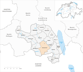
| Location of the municipality | |
  |
|
Gontenschwil ( Swiss German : older ˌɡʊndiʃˈʋiːu , younger ˌɡɔndiʃˈʋiːu ) is a municipality in the Swiss canton of Aargau . It belongs to the Kulm district , is located in the upper Wynental and borders the canton of Lucerne .
geography
The village is located in a side valley of the Wyna , which is separated to the east from the main valley by a distinctive side moraine , on average thirty meters high . It is continued in the terminal moraine of Zetzwil , which stretches like a bar across the entire Wynental. The moraines were formed during the Würme Ice Age when the Reuss Glacier retreated . After the end of the Ice Age, they dammed a shallow lake. This silted up when the Wyna broke through the obstacle. For thousands of years there was an extensive swamp area , the Gontenschwiler Moos, which was only drained during the First World War. Below the breakthrough is the extensive matten field.
The settlement area, which is over two kilometers long, is located immediately west of the lateral moraine in the Sagenbachtal and consists of the districts of Unterdorf, Kirchdorf and Oberdorf. At the upper village the moraine merges into the southern foothills of the 872 meter high Stierenberg , there is the hamlet of Geisshof ( 637 m above sea level ). On the west side of the Sagenbach valley, the terrain initially rises steeply and then merges into an elongated plateau on average 700 meters high. The hamlet of Hasel ( 675 m above sea level ) lies on this . There are individual farms scattered across the entire municipality.
The area of the municipality is 974 hectares , of which 259 hectares are forested and 139 hectares are built over. The highest point is at 750 m above sea level. M. on the mountain forest hill (a foothill of the Stierenberg), the deepest point at 496 m above sea level. M. at the Wyna. Neighboring communities are Schmiedrued in the west, Oberkulm in the northwest, Zetzwil in the northeast, Leimbach and Reinach in the east and the Lucerne community of Rickenbach in the south.
history
The area around Gontenschwil was already settled during the Neolithic Age when people settled on the shores of what was then the lake. Several finds of objects suggest the existence of an estate during Roman times . The settlement founded by the Alamanni was first mentioned in 1173 as Gundoltswilre in a letter of protection issued by Emperor Friedrich I "Barbarossa" to Beromünster Abbey . The place name goes back to the Old High German Gundolteswilari , which means "Hofsiedlung des Gundolt".

In the Middle Ages the village was under the rule of the Counts of Lenzburg , from 1173 on that of the Counts of Kyburg . After these died out, the Habsburgs took over sovereignty and blood jurisdiction in 1273 . The lower jurisdiction was in the hands of wealthy villagers. In 1415 the confederates conquered Aargau. Gontenschwil now belonged to the subject area of the city of Bern , the so-called Berner Aargau , and formed its own judicial district in the Lenzburg office . In 1528 the Bernese introduced the Reformation . In 1640 a mineral and healing spring was discovered; As a result, many patients in Bad Schwarzenberg sought relief from their suffering. The heyday of the baths was from the 19th century to the First World War, until 1990 mineral water was bottled.
In March 1798 the French took Switzerland, ousted the «Gracious Lords» of Bern and proclaimed the Helvetic Republic . Gontenschwil has been part of the canton of Aargau since then. In the 18th and 19th centuries, cotton processing dominated economic activity. In 1850 the community had more inhabitants than today. But due to the collapse of the textile industry , almost thirty percent of all residents moved away by 1900, not a few of them emigrating overseas. In 1901 the hamlet of Geisshof, a former Steckhof , was separated from Reinach and assigned to Gontenschwil.
Only the opening of the Wynentalbahn on March 5, 1904 could stop the decline. One year later, an aluminum foundry was established , which later became the Alu Menziken Group . The tobacco industry also gained a foothold. The population began to increase slightly again, but has stagnated since 1950. An industrial zone was established near the train station in the 1960s.
Attractions


The Gontenschwiler Church was first mentioned in 1295. After the village became an independent parish in 1498, a church tower was built on the north side . Due to ongoing decay, the old church, with the exception of the tower, had to be demolished in 1622 and replaced by a new building in the same place.
coat of arms
The blazon of the municipal coat of arms reads: "In white on green ground a green fir tree, in the head of the shield accompanied by two red hearts." A community seal with a fir tree already existed in 1777 . The two hearts were added in 1941 to avoid confusion with similar coats of arms.
population
The population developed as follows:
| year | 1653 | 1764 | 1803 | 1850 | 1900 | 1930 | 1950 | 1960 | 1970 | 1980 | 1990 | 2000 | 2010 |
| Residents | 545 | 1039 | 1541 | 2297 | 1646 | 1832 | 2102 | 2161 | 2139 | 2050 | 2104 | 2055 | 2090 |
On December 31, 2019, 2,150 people lived in Gontenschwil, the proportion of foreigners was 17.8%. In the 2015 census, 48.7% described themselves as Reformed and 16.5% as Roman Catholic ; 34.8% were non-denominational or of other faiths. In the 2000 census, 92.7% stated German as their main language, 1.8% Serbo-Croatian , 1.7% Albanian and 1.0% each Italian and Turkish .
Politics and law
The assembly of those entitled to vote, the municipal assembly , exercises legislative power. The executing authority is the five-member municipal council . He is elected by the people in the majority procedure, his term of office is four years. The parish council leads and represents the parish. To this end, it implements the resolutions of the municipal assembly and the tasks assigned to it by the canton. The Kulm District Court is the first instance responsible for legal disputes . Gontenschwil belongs to the Friedensrichterkreis IX (Unterkulm).
economy
According to the corporate structure statistics (STATENT) collected in 2015, there are around 1,000 jobs in Gontenschwil, 9% of them in agriculture, 38% in industry and 53% in the service sector. The manufacture of washing machines and foam , the trade in gardening tools and the graphics industry are of importance. One of the oldest aluminum foundries in the world has been located on the site of a disused mill since 1903 , and is also the main factory of the Alu Menziken Group . The company last trading under the name AMG - Alu Metall Guss AG , however, stopped production in October 2016. A clinic for addicts has existed in the hamlet of Hasel since 1973. Most of the employed are commuters and work in the larger neighboring villages such as Reinach or in the Aarau region .
traffic

The village is not directly on the main road 23 through the Wynental , but on a side road (K332) that leads from Zetzwil towards Sursee . The connection to the public transport network is through a station of the Wynentalbahn . However, this only opens up the lower village in the far north, there is no bus connection to the other parts of the village. On weekends, a night bus runs from Aarau train station through the Wynental to Menziken .
education
The community has two kindergartens and three school houses in which the primary school , the junior high school and the secondary school are taught. The district school can be attended in Reinach or Unterkulm . The nearest schools are the old district school and the new district school (both in Aarau ) and the district school Beromünster in Lucerne Beromünster .
Personalities
- Friedrich Erismann (1842–1915), ophthalmologist and hygienist
- Jakob Frey (1824–1875), writer
- Samuel Frey (1820–1905), politician and judge
- Heiner Gautschy (1917–2009), radio and television journalist
- Michelle Hunziker (* 1977), television presenter
- Andreas Müller (* 1934), former National Councilor (LdU)
- Erwin Zschokke (1855–1929), veterinarian
- Richard Zschokke (1865–1946), civil engineer and politician
literature
- Hans Walti: Gontenschwil. In: Historical Lexicon of Switzerland .
- Michael Stettler : The art monuments of the canton of Aargau . Ed .: Society for Swiss Art History . Volume I: The districts of Aarau, Kulm, Zofingen. Wiese Verlag, Basel 1948, DNB 366495623 .
Web links
Individual evidence
- ↑ Cantonal population statistics 2019. Department of Finance and Resources, Statistics Aargau, March 30, 2020, accessed on April 2, 2019 .
- ↑ Cantonal population statistics 2019. Department of Finance and Resources, Statistics Aargau, March 30, 2020, accessed on April 2, 2019 .
- ↑ a b Beat Zehnder: The community names of the canton of Aargau . In: Historical Society of the Canton of Aargau (Ed.): Argovia . tape 100 . Verlag Sauerländer, Aarau 1991, ISBN 3-7941-3122-3 , p. 176-178 .
- ↑ a b National map of Switzerland, sheet 1109, Swisstopo.
- ↑ Standard area statistics - municipalities according to 4 main areas. Federal Statistical Office , November 26, 2018, accessed on May 26, 2019 .
- ^ Martin Hartmann, Hans Weber: The Romans in Aargau . Verlag Sauerländer, Aarau 1985, ISBN 3-7941-2539-8 , p. 171 .
- ^ Stettler: The art monuments of the canton of Aargau. Volume I: The districts of Aarau, Kulm, Zofingen. Pp. 194-198.
- ^ Joseph Galliker, Marcel Giger: Municipal coat of arms of the Canton of Aargau . Lehrmittelverlag des Kantons Aargau, book 2004, ISBN 3-906738-07-8 , p. 166 .
- ↑ Population development in the municipalities of the Canton of Aargau since 1850. (Excel) In: Eidg. Volkszählung 2000. Statistics Aargau, 2001, archived from the original on October 8, 2018 ; accessed on May 25, 2019 .
- ↑ Resident population by religious affiliation, 2015. (Excel) In: Population and Households, Community Tables 2015. Statistics Aargau, accessed on May 26, 2019 .
- ↑ Swiss Federal Census 2000: Economic resident population by main language as well as by districts and municipalities. (Excel) Statistics Aargau, archived from the original on August 10, 2018 ; accessed on May 26, 2019 .
- ↑ circles of justice of the peace. Canton of Aargau, accessed on June 21, 2019 .
- ↑ Statistics of the corporate structure (STATENT). (Excel, 157 kB) Statistics Aargau, 2016, accessed on May 25, 2019 .
- ^ Clinic in Hasel