
Großgeschaidt
|
Großgeschaidt
Heroldsberg market
Coordinates: 49 ° 33 ′ 45 ″ N , 11 ° 10 ′ 31 ″ E
|
|
|---|---|
| Height : | 413 m above sea level NHN |
| Area : | 2.33 km² |
| Residents : | 521 (2011) |
| Population density : | 224 inhabitants / km² |
| Incorporation : | May 1, 1978 |
| Postal code : | 90562 |
| Area code : | 09126 |
.jpg) Aerial view from the south (2020)
|
|
Großgeschaidt ( East Franconian Gschā or Grousgschā ) is a district of the Heroldsberg market in the Central Franconian district of Erlangen-Höchstadt .
geography
Geographical location
The village is located about ten kilometers northeast of Nuremberg and 13 km southeast of Erlangen on a ridge of the Sebalder Reichswald . Großgeschaidt lies on and on the northern slope of an elongated ridge of the Black Jura (Lias), which forms part of the Franconian layered plain. The location on the ridge with various viewpoints in the direction of Franconian Switzerland and the Schwabach Valley is popular with hikers. On the northern slope of Großgeschaidt, next to the "Gänsbrunnen" spring, some smaller rivulets to the Altbach, which joins the Kübelsbach coming from Röckenhof to the Geroldsbach and after about 3.5 kilometers between Kleinsendelbach and Steinbach, flows into the Schwabach .
Contrary to popular belief, Bundesstraße 2 does not form the border between Groß- and Kleingeschaidt. Some buildings east of Bundesstraße 2 still belong to Großgeschaidt, including the BRK rescue station and Flad & Flad Communications GmbH.
Neighboring places
Neighboring towns and areas are (starting in the north and clockwise):
Eckental (OT-Oberschöllenbach), OT- Kleingeschaidt , non-parish area Geschaidt , Kalchreuth
history
The history of Großgeschaidt probably goes back to the middle of the 11th century. At that time, the German Emperor Heinrich III took over . , Duke of Bavaria and Swabia, from Bamberg Bishop Hartwig a piece of forest that was later to be called "Sebalder Wald" after the Nuremberg main church Sankt Sebald . In the following years (1050–1100) clearing was carried out in the primeval forest, which was largely inaccessible at that time, in order to make the land usable. In the course of this reclamation, in addition to Großgeschaidt, the settlements of Behringersdorf , Bruck , Kalchreuth , Eckenhaid , Beerbach and Neunhof are being built in the area. Großgeschaidt was " Reichsgut " and belonged together with the other newly created settlements and hamlets to what was then Reichsamt Heroldsberg. This is evidenced by the so-called Nuremberg “Reichsalbüchlein” for the time around 1300.
In 1302 the place was first mentioned in a document as "Gescheyth". The defining word of the place name is gescheide ( mhd. Border). So the place was on a natural or political border. The Fraisch border between the offices of Heroldsberg and Eschenau could be used as a political border . Somewhat absurd but possible is the derivation of Geschaide, which in beekeepers' terminology describes an empty bee container. Accordingly, beekeeping would be assumed there. The interpretation can be based on the Zeidler freedom letter of 1350 from Emperor Charles IV , by which forest bee care in the Sebald Forest is documented.
From 1295 to 1299 Großgeschaidt was pledged to the Nuremberg citizen Johann Fürer via its mother settlement Heroldsberg, and from 1299 to 1348 to the Counts of Nassau , who also had properties in Nuremberg. In 1361 Count Johann von Nassau sold the entire Hofmark, as the former Heroldsberger Reichsamt was now called, to the Burgrave of Nuremberg, Albrecht the Fair.
In the second half of the 14th century, Großgeschaidt belonged to the estates that the Burgrave Albrecht bought his daughter Anna and her husband Duke Swantibor III. bequeathed by Pomerania-Stettin. They sold the entire Hofmark Heroldsberg in 1391 to Konrad and Heinrich Geuder , and thus one of the oldest patrician families from Nuremberg. The Geuder expanded Heroldsberg to their ancestral home and called themselves Geuder von Heroldsberg .
Like the surrounding communities, Großgeschaidt suffered from the Margrave Wars. During the First Margrave War , Heroldsberg and Eschenau were burned down in 1449 by the troops of Margrave Albrecht Achilles of Ansbach-Bayreuth, and since they had to go through Großgeschaidt, it can be assumed that this “Nuremberg village” was also damaged. In the Second Margrave War, around a hundred years later, the place also hit: between 1551 and 53, Großgeschaidt was completely burned down by the troops of Margrave Albrecht Alcibiades as the “Nuremberg Village”.
At the time of the Thirty Years' War "the Tilly soldiers lived badly in the village". In 1625 and 1627 the neighboring community of Eschenau was hit twice by imperial equestrian associations, who looted and requisitioned whatever was available. The whole area was badly affected by the chaos of war. In Kalchreuth 70% of the population died, in Eschenau half of the inhabitants died.
Großgeschaidt remained part of the Gudersian possessions for around 270 years, only to pass to the Welser patrician family in 1661 . Around 135 years later, Prussian troops occupied the place, Großgeschaidt and the surrounding places became "Prussian possession" in 1796. During the Napoleonic Wars, the place was occupied by the French and finally in 1810 it was incorporated into the Kingdom of Bavaria , newly created under Napoleon .
As part of the community edict (early 19th century), Großgeschaidt was assigned to the Kalchreuth tax district . In 1818 the rural community Großgeschaidt was formed. In administration and jurisdiction, it was subordinate to the Erlangen Regional Court and in the financial administration to the Erlangen Rent Office (from 1920 Erlangen Tax Office ). In 1862 the solitude of Johannisthal was founded in the municipality . From 1862 Großgeschaidt was administered by the Erlangen District Office (renamed the Erlangen District in 1938 ). The jurisdiction remained until 1879 the District Court Erlangen, from 1880 at the district court Erlangen . The municipality had an area of 2.332 km².
During the Second World War , Großgeschaidt was part of an air defense position for Nuremberg, which was commanded from Kalchreuth. American troops reached the place between April 16 and 17, 1945 and the fighting of World War II came to an end for the area.
On May 1, 1978, Großgeschaidt was incorporated into Heroldsberg as part of the regional reform .
Population development
Großgeschaidt community
| year | 1818 | 1840 | 1852 | 1855 | 1861 | 1867 | 1871 | 1875 | 1880 | 1885 | 1890 | 1895 | 1900 | 1905 | 1910 | 1919 | 1925 | 1933 | 1939 | 1946 | 1950 | 1952 | 1961 | 1970 |
|---|---|---|---|---|---|---|---|---|---|---|---|---|---|---|---|---|---|---|---|---|---|---|---|---|
| Residents | 128 | 220 | 226 | 222 | 256 | 262 | 264 | 255 | 248 | 272 | 257 | 249 | 248 | 254 | 256 | 258 | 247 | 260 | 269 | 425 | 422 | 403 | 336 | 370 |
| Houses | 29 | 32 | 46 | 46 | 49 | 54 | 59 | 68 | ||||||||||||||||
| source |
Location Großgeschaidt
| year | 1818 | 1840 | 1861 | 1871 | 1885 | 1900 | 1925 | 1950 | 1961 | 1970 | 1987 | 2011 |
|---|---|---|---|---|---|---|---|---|---|---|---|---|
| Residents | 128 | 220 | 256 | 264 | 259 | 241 | 244 | 402 | 319 | 354 | 568 | 521 |
| Houses | 29 | 32 | 45 | 48 | 53 | 58 | 64 | 59 | ||||
| source |
religion
The place has been predominantly Protestant since the Reformation and parish to St. Egidien (Beerbach) . The inhabitants of the Roman Catholic denomination are parish to St. Walburga (Kirchröttenbach) .
Public facilities
Großgeschaidt has its own train station and thus a connection to the R21 Nuremberg-Nordost - Graefenberg (Graefenbergbahn) line. The Heroldsberg community operates a kindergarten in the district. On the upper floor there is an event room that is used in a variety of ways by local and foreign associations and private individuals. The volunteer fire brigade also operates a fire station with emergency vehicles. and the Bavarian Red Cross the "Erlanger Oberland" ambulance. Since September 2013 the association "Gschaader Dorftreff eV" has been running a village meeting place in a converted room in the fire station, which is intended as a meeting place for the local residents to compensate for the loss of the last inn.
Culture and sights
societies
Großgeschaidt has a large variety of clubs relative to the number of inhabitants. In addition to the men's choir 1870 Groß- and Kleingeschaidt, "Die Gemütlichkeit", which organizes the solstice celebrations in June and the carnival ball, the "egg women" who take care of the Easter fountain or the jewelry of it, the "Kirwaboum G'Gscha", which organize the parish fair on the last weekend in June, to name the Association of Reservists of the German Federal Armed Forces RK Großgeschaidt and the local volunteer fire department. Since 2013 the association "Gschaader Dorftreff eV" has been organizing a meeting point in the village, which is intended to compensate for the elimination of the local inns as a meeting point for the villagers.
Architectural monuments
Großgeschaidt has a number of listed properties. An illustrated list of these buildings can be found in the list of architectural monuments in Heroldsberg .
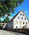
Sandstone block construction, mid-19th century

Sandstone block construction, mid-19th century


Regular events

At Easter time, the fountain in front of the fire station is decorated by local associations and attracts many visitors as a stop on an ' Easter fountain tour' through Franconian Switzerland. The Easter Fountain Festival takes place on Good Friday.
The Kirwa always takes place on the weekend with the first Sunday in July.
At the summer solstice the traditional solstice fire takes place, which is organized by the local association "Gemütlichkeit".
A carnival ball traditionally takes place at carnival time, as well as a separate children's carnival on Shrove Tuesday.
Economy and Infrastructure
Business
Over a dozen commercial operations (craft, trade, industry and services) are active in Großgeschaidt. Most of the companies are small businesses. The largest employer is the company FLAD & FLAD Communication GmbH on the eastern edge of the village.
traffic
Großgeschaidt has a stop on the single-track Graefenbergbahn (R21).
The federal highway 2 cuts the district on the eastern edge. Thanks to this location, the A3 motorway and Nuremberg Airport can be reached in a short time. The district road ERH 10 crosses the B 2 into the neighboring Kleingeschaidt (0.5 km southeast) or to Käswasser (1.75 km west). The district road ERH 8 leads to Oberschöllenbach (1 km northwest).
literature
- Johann Kaspar Bundschuh : Großgschaid, Klein-Gscheid . In: Geographical Statistical-Topographical Lexicon of Franconia . tape 2 : El-H . Verlag der Stettinische Buchhandlung, Ulm 1800, DNB 790364298 , OCLC 833753081 , Sp. 406 ( digitized version ).
- Johann Kaspar Bundschuh : Small and large business . In: Geographical Statistical-Topographical Lexicon of Franconia . tape 3 : I-Ne . Verlag der Stettinische Buchhandlung, Ulm 1801, DNB 790364301 , OCLC 833753092 , Sp. 155 ( digitized version ).
- Dorothea Fastnacht: Erlangen: former city and district (= historical book of place names of Bavaria, Middle Franconia . Volume 7 ). Commission for Bavarian State History, Munich 2015, ISBN 978-3-7696-6869-8 , p. 122-129 .
- August Gebeßler : City and district of Erlangen (= Bavarian art monuments . Volume 14 ). Deutscher Kunstverlag, Munich 1962, DNB 451450949 , p. 119 .
- Franz Krug (ed.): The district of Erlangen-Höchstadt . Publishing house for authorities a. Wirtschaft, Hof (Saale) 1979, ISBN 3-921603-00-5 , p. 113-114 .
Web links
- Großgeschaidt website
- Großgeschaidt in the location database of the Bayerische Landesbibliothek Online . Bayerische Staatsbibliothek, accessed on November 1, 2019.
- Großgeschaidt in the Topographia Franconiae of the University of Würzburg , accessed on November 1, 2019.
- Großgeschaidt in the historical gazette of the Verein für Computergenealogie , accessed on November 1, 2019
Individual evidence
- ↑ D. Fastnacht, p. 126.
- ↑ a b Großgeschaidt in the BayernAtlas
- ↑ a b Online chronicle of the Heroldsberg community , on the community website
- ↑ Johannes Bischoff: The importance of the Zeidelschützen or the Nuremberg Zeidelmännchen , as well as Erlanger building blocks for Franconia. Local history . 7 born in 1960.
- ↑ D. Fastnacht, p. 126.
- ↑ a b Description of the history of the village of Großgeschaidt by Wilhelm Held, Brand, published in 1965 by Ewald Glückert and Ernst Schön
- ^ Heroldsberg / Wilhelm Malter. - “Nürnberg”, 1973, p. 23
- ↑ Chronicle of Major Gräf “Grimmiger Krieg” , by Fritz Fink.
- ^ Ewald Glückert: The Neunhofer Land in seven centuries In: Neunhofer Land , 5, 1979. - P. 68-69.
- ↑ a b c Alphabetical index of all the localities contained in the Rezatkreise according to its constitution by the newest organization: with indication of a. the tax districts, b. Judicial Districts, c. Rent offices in which they are located, then several other statistical notes . Ansbach 1818, p. 32 ( digitized version ).
- ^ Address and statistical manual for the Rezatkreis in the Kingdom of Baiern . Buchdruckerei Chancellery, Ansbach 1820, p. 31 ( digitized version ).
- ↑ a b c d Bavarian State Statistical Office (Hrsg.): Official local directory for Bavaria, territorial status on October 1, 1964 with statistical information from the 1961 census . Issue 260 of the articles on Bavaria's statistics. Munich 1964, DNB 453660959 , Section II, Sp. 771 ( digitized version ).
- ↑ Experiences at the end of the war 65 years ago , Ernst Bayerlein.
- ^ Federal Statistical Office (ed.): Historical municipality directory for the Federal Republic of Germany. Name, border and key number changes in municipalities, counties and administrative districts from May 27, 1970 to December 31, 1982 . W. Kohlhammer, Stuttgart / Mainz 1983, ISBN 3-17-003263-1 , p. 711 .
- ↑ a b Only inhabited houses are given. In 1818 these were designated as fireplaces , in 1840 as houses , and from 1871 to 1987 as residential buildings.
- ^ A b Eduard Vetter (Ed.): Statistical handbook and address book of Middle Franconia in the Kingdom of Bavaria . Self-published, Ansbach 1846, p. 89 ( digitized version ).
- ↑ a b c d e f g h i j k l m n Bavarian State Statistical Office (Hrsg.): Historical municipality register: The population of the municipalities of Bavaria from 1840 to 1952 (= contributions to Statistics Bavaria . Issue 192). Munich 1954, DNB 451478568 , p. 170 , urn : nbn: de: bvb: 12-bsb00066439-3 ( digitized version ).
- ↑ a b Joseph Heyberger, Chr. Schmitt, v. Wachter: Topographical-statistical manual of the Kingdom of Bavaria with an alphabetical local dictionary . In: K. Bayer. Statistical Bureau (Ed.): Bavaria. Regional and folklore of the Kingdom of Bavaria . tape 5 . Literary and artistic establishment of the JG Cotta'schen Buchhandlung, Munich 1867, Sp. 1016 , urn : nbn: de: bvb: 12-bsb10374496-4 ( digitized version ).
- ↑ a b Kgl. Statistical Bureau (ed.): Complete list of localities of the Kingdom of Bavaria. According to districts, administrative districts, court districts and municipalities, including parish, school and post office affiliation ... with an alphabetical general register containing the population according to the results of the census of December 1, 1875 . Adolf Ackermann, Munich 1877, 2nd section (population figures from 1871, cattle figures from 1873), Sp. 1181 , urn : nbn: de: bvb: 12-bsb00052489-4 ( digital copy ).
- ↑ a b K. Bayer. Statistical Bureau (Ed.): Localities directory of the Kingdom of Bavaria. According to government districts, administrative districts, ... then with an alphabetical register of locations, including the property and the responsible administrative district for each location. LIV. Issue of the contributions to the statistics of the Kingdom of Bavaria. Munich 1888, Section III, Sp. 1112 ( digitized version ).
- ↑ a b K. Bayer. Statistical Bureau (Ed.): Directory of localities of the Kingdom of Bavaria, with alphabetical register of places . LXV. Issue of the contributions to the statistics of the Kingdom of Bavaria. Munich 1904, Section II, Sp. 1179 ( digitized version ).
- ↑ a b Bavarian State Statistical Office (ed.): Localities directory for the Free State of Bavaria according to the census of June 16, 1925 and the territorial status of January 1, 1928 . Issue 109 of the articles on Bavaria's statistics. Munich 1928, Section II, Sp. 1217 ( digitized version ).
- ↑ a b Bavarian State Statistical Office (ed.): Official place directory for Bavaria - edited on the basis of the census of September 13, 1950 . Issue 169 of the articles on Bavaria's statistics. Munich 1952, DNB 453660975 , Section II, Sp. 1050 ( digitized version ).
- ↑ a b Bavarian State Statistical Office (Hrsg.): Official local directory for Bavaria . Issue 335 of the articles on Bavaria's statistics. Munich 1973, DNB 740801384 , p. 173 ( digitized version ).
- ↑ Bavarian State Office for Statistics and Data Processing (Ed.): Official local directory for Bavaria, territorial status: May 25, 1987 . Issue 450 of the articles on Bavaria's statistics. Munich November 1991, DNB 94240937X , p. 334 ( digitized version ).
- ↑ a b Website of the district , with detailed information.
- ↑ Website of the local BRK association , with detailed information.
- ↑ Website of the "Kirwaboum G'Gscha"
- ^ Website , the reservists' association of the Bundeswehr RK Großgeschaidt.