Grotenrath
|
Grotenrath
City of Geilenkirchen
Coordinates: 50 ° 56 ′ 24 ″ N , 6 ° 3 ′ 30 ″ E
|
|
|---|---|
| Height : | 100 (94-106) m |
| Residents : | 822 (Nov. 30, 2012) |
| Postal code : | 52511 |
| Area code : | 02451 |
|
Location of Grotenrath in Geilenkirchen
|
|
|
Catholic parish church Grotenrath
|
|

Grotenrath is a district of the middle town of Geilenkirchen in the district of Heinsberg in North Rhine-Westphalia .
geography
location
Grotenrath is located southwest of Geilenkirchen near the state road 42 , which connects Geilenkirchen with Heerlen (Netherlands). To the west of Grotenrath lies the nature reserve of the Teverener Heide . The state border with the Netherlands is about two kilometers away.
Waters
Grotenrath is located on the Rodebach (GEWKZ 221822), which absorbs rainwater and forwards it towards the Maas . The stream with a total length of 28.9 km begins in Siepenbusch in the city of Übach-Palenberg and continues on its way via Grotenrath, Teveren , Gillrath , Stahe , Gangelt towards the Netherlands.
Neighboring places
| Geilenkirchen Air Base | Nierstrass | Teveren |

|
Siepenbusch | |
| Abdessenbosch NL | Scherpenseel | Übach-Palenberg |
Type of settlement
The place Grotenrath is a loosely built row village with a rural environment.
history
Place name
- 14th century Grotenrode
- 1483 Grotenraede
- 1506 Groetenraede
- 1666 Grotenradt
Local history
At the beginning of the settlement of Grotenrath there was probably the great clearing . This is how the name Grotenrath could be interpreted. The place used to belong to the Jülich office of Geilenkirchen . The tithe under Grotenrath was in the 14th century next to 70 acre land ter Heyden a Heinsberger feud that later the man chamber was under Geilenkirchen. The place originally belonged to the Teveren court . In 1828 Grotenrath had 619 inhabitants, in 1852 there were 594 inhabitants and belonged to the mayor's office of Teveren. In the course of the regional reform on January 1, 1972, the mayor's office of Teveren was dissolved. The legal successor is the city of Geilenkirchen (§ 29 Aachen Law ).
Church history
The affiliation of the people to their church was originally divided in Grotenrath. The southern part of the village belonged to the parish Marienberg , the northern part to the parish Teveren. To a certain independence to get as a parish, began in 1841 with collections to build its own house of worship . The foundation stone was laid on October 17, 1844 . In 1848 Grotenrath received its own vicar . On August 26, 1863 Grotenrath was raised to parish. The church was solemnly consecrated on October 4, 1867. In 1911, the four-storey west tower with two-storey extensions on the sides was placed in front of the church.
The majority of the population consists of Catholics . In the course of the parish reforms in the Diocese of Aachen , the formerly independent Catholic parish of St. Kornelius Grotenrath was incorporated into the Community of Parishes (GdG) St. Bonifatius Geilenkirchen .
Attractions
- Catholic parish church Grotenrath, Corneliusstraße, as monument no.32
- Stained glass in the parish church of St. Cornelius
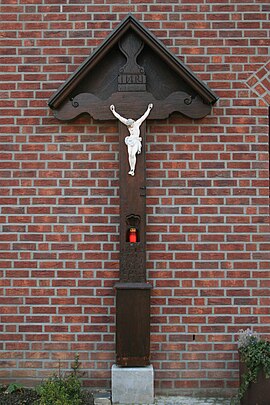
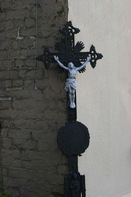
- Hauskreuz, at Waldstrasse 1, as memorial no.22
- Road cross, on Grenzweg as monument no.23
Infrastructure
- In December 2012, 822 people lived in Grotenrath.
- There are several farms , some with animal husbandry , a building contractor , a roofer , a travel agency , a restaurant , a property management , a painting , a tile shop, a shop for textiles and clothing , a center for martial arts , a beautician , a picture agency , a fishing tackle shop, a naturopath and a midwife, as well as some small businesses.
- Three bus stops, Eigelshoven, Am Feldkreuz and at the post office on Line 491 in the AVV Geilenkirchen- Übach and back.
- Two playgrounds, Am Bach and Hinter den Höfe
- The cemetery on Ulweg
School system
- Grotenrath primary school 1925 2 classes, 2 levels, 1 teacher, 1 teacher 94 children
- Grotenrath elementary school 1965 3 classes, 3 teaching positions 90 children
societies
- St. Cornelius Schützenbruderschaft Grotenrath eV 1904
- Drummers and Pfeifercorps Grotenrath eV.
- SV Scherpenseel-Grotenrath 1909
- Church choir St. Cäcilia Grotenrath
- Sports club Gut Blatt
- Carrier pigeon club slogan Heimat Grotenrath
Regular events
- May fair
- Patronage party with bird shot
- St. Martin parade in Grotenrath
Street names
Am Feldkreuz, Corneliusstraße, Emesfeld, Grenzweg, Hinter den Höfe, Im Kämpchen, Küfenweg, Laubenweg, Scherpenseeler Straße, Ulweg, Waldstraße, Zum Buschfeld, Zum Hochmoor
literature
- The art monuments of the districts of Erkelenz and Geilenkirchen, 1904, page 401
- Handbook of the Diocese of Aachen, page 706–707
- Leo Gillessen: The localities of the district of Heinsberg , page 120
- Leo Gillessen: About place names and settlement studies of the southern Selfkantkreis , In: Heimatkalender des Selfkantkreis Geilenkirchen-Heinsberg, 1970, pages 38-49 and 1971, pages 41-49
- Hermann Josef de Giorgi: From the school history of the Heinsberg district , museum publication 14
Web links
- Website of the city of Geilenkirchen
- Monuments in the city of Geilenkirchen
- Churches and chapels in the city of Geilenkirchen
Individual evidence
- ^ German basic map 1: 5000
- ↑ http://www.lanuv.nrw.de/fileadmin/lanuv/wasser/pdf/Gewaesserverzeichnis%20GSK3C.xls
- ^ Federal Statistical Office (ed.): Historical municipality directory for the Federal Republic of Germany. Name, border and key number changes in municipalities, counties and administrative districts from May 27, 1970 to December 31, 1982 . W. Kohlhammer, Stuttgart / Mainz 1983, ISBN 3-17-003263-1 , p. 310 .
- ↑ http://www.glasmalerei-ev.net/pages/b3416/b3416.shtml


