
Bahrenborstel
| coat of arms | Germany map | |
|---|---|---|

|
Coordinates: 52 ° 34 ' N , 8 ° 49' E |
|
| Basic data | ||
| State : | Lower Saxony | |
| County : | Diepholz | |
| Joint municipality : | Church Village | |
| Height : | 44 m above sea level NHN | |
| Area : | 31.27 km 2 | |
| Residents: | 1105 (Dec. 31, 2019) | |
| Population density : | 35 inhabitants per km 2 | |
| Postal code : | 27245 | |
| Area code : | 04273 | |
| License plate : | DH, SY | |
| Community key : | 03 2 51 003 | |
| LOCODE : | DE BL3 | |
| Community structure: | 2 districts | |
| Association administration address: | Rathausstrasse 12 27245 Kirchdorf |
|
| Website : | ||
| Mayor : | Matthias Stelloh | |
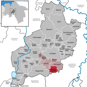
| Location of the community of Bahrenborstel in the district of Diepholz | ||
  |
||

Bahrenborstel ( Boornbössel in Low German ) is a municipality in the Diepholz district in Lower Saxony . It belongs to the municipality of Kirchdorf , which has its administrative seat in the village of Kirchdorf .
geography
Geographical location
Bahrenborstel lies between the Dümmer Nature Park and the Steinhuder Meer Nature Park, roughly halfway between Bremen and Minden . About seven kilometers south of the municipality is the Great Moor , to which the Darlatenmoor connects to the north. A section of the Große Aue runs a few kilometers to the northwest .
Community structure
The five districts of the municipality are:
- Bahrenborstel
- Goethen
- Hook moor
- Hespeloh
- Holzhausen
history
Bahrenborstel first appeared in a document in 1310 as "up dem Borne". In earlier times the place belonged to the Uchte office , with this it fell to Hesse in 1582, until it returned to Hanover in 1816 .
Incorporations
On March 1, 1974, the community of Holzhausen was incorporated.
Place name
Earlier place names of Bahrenborstel were Bermeburstolte and Beringburstole up dem Borne around 1380 and Bargenborstel in 1520, Bergenborstel in 1528 and Baryenborstel in 1530. Bahrenborstel is a compound place name. A basic form of Beringeborstel or Berningeborstel can be assumed. It contains the word -borstel, which often becomes -bostel and means "settlement point". The element -ing is associated with a first name such as Ber- or Bern-. The entire name could mean a settlement of the people or clan of Ber or Bern - the bear is in the first name.
politics
Municipal council
The local council from Bahrenborstel consists of eleven non-attached councilors. (Status: local election on September 11, 2016)
mayor
Matthias Stelloh has been honorary mayor of the municipality of Bahrenborstel since 2016. Armin Tiemann was the municipal director from 1974 to 2004.
Previous incumbents:
- 1974–1981: Wilhelm Tönsing
- 1981–1986: Günter Stumpe
- 1986–2016: Heinz Albers (CDU)
coat of arms
Blazon : The coat of arms of the municipality shows in gold a black upright bear striding to the right between two black trees, underneath a black ploughshare.
traffic
The community is in the immediate vicinity of the federal highway 61 which leads from Minden to Sulingen .
Individual evidence
- ↑ State Office for Statistics Lower Saxony, LSN-Online regional database, Table 12411: Update of the population, as of December 31, 2019 ( help ).
- ^ Federal Statistical Office (ed.): Historical municipality directory for the Federal Republic of Germany. Name, border and key number changes in municipalities, counties and administrative districts from May 27, 1970 to December 31, 1982 . W. Kohlhammer, Stuttgart / Mainz 1983, ISBN 3-17-003263-1 , p. 189 .
- ^ Jürgen Udolph (research): The "place name researcher". In: website NDR 1 Lower Saxony . Archived from the original on December 28, 2014 ; accessed on August 2, 2019 .
Web links
Affinghausen | Asendorf | Bahrenborstel | Barenburg | Barnstorf | Barver | Bassum | Borstel | Brockum | Bruchhausen-Vilsen | Dickel | Diepholz | Drebber | Drentwede | Ehrenburg | Eydelstedt | Sanctuary | Hemsloh | Hude | Kirchdorf | Lembruch | Lemförde | Maasen | Marl | Martfeld | Mellinghausen | Neuenkirchen | Quernheim | Rehden | Scholen | Schwaförden | Swarms | Siedenburg | Staffhorst | Stem horn | Stuhr | Sudwalde | Sulingen | Syke | Twistringen | Varrel | Wagenfeld | Wehrbleck | Wetschen | Weyhe