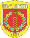
Ivankiv
| Ivankiv | ||
| Іванків | ||

|
|
|
| Basic data | ||
|---|---|---|
| Oblast : | Kiev Oblast | |
| Rajon : | Ivankiv Raion | |
| Height : | no information | |
| Area : | 8 km² | |
| Residents : | 10,526 (2018) | |
| Population density : | 1,316 inhabitants per km² | |
| Postcodes : | 07200 | |
| Area code : | +380 4591 | |
| Geographic location : | 50 ° 56 ' N , 29 ° 54' E | |
| KOATUU : | 3222055100 | |
| Administrative structure : | 1 urban-type settlement , 3 villages | |
| Address: | вул. І. Проскури 47 07200 смт. Іванків |
|
| Website : | http://ivankiv-sr.gov.ua/ | |
| Statistical information | ||
|
|
||
Iwankiw ( Ukrainian Іванків ; Russian Иванков Iwankow , Polish Iwanków ) is an urban-type settlement in the north of the Ukrainian Kiev Oblast with 10,500 inhabitants (2018) and the administrative seat of the raion of the same name .
The village, founded in 1589, has had the status of an urban-type settlement since 1940. Ivankiv lies on the left bank of the Teteriv ( Тетерів ), a 365 km long right tributary of the Dnieper . The capital Kiev is about 80 km southeast of the village and the Chernobyl exclusion zone is 25 km away. The settlement council Municipality of Ivankiv are still villages Bolotnja , Saprudka ( Запрудка ) and Fedoriwka ( Федорівка ).
Web links
Commons : Ivankiw - collection of pictures, videos and audio files
- Entry on the place in the Encyclopedia of Modern Ukraine (Ukrainian)
- Location information (Ukrainian)
- Entry on the place in the geographical directory of the Kingdom of Poland and other Slavic countries
Individual evidence
- ↑ Cities in Ukraine at pop-stat.mashke.org, accessed July 2, 2019


