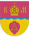
Makariw
| Makariw | ||
| Макарів | ||

|
|
|
| Basic data | ||
|---|---|---|
| Oblast : | Kiev Oblast | |
| Rajon : | Makariv district | |
| Height : | no information | |
| Area : | 62.76 km² | |
| Residents : | 10,362 (2012) | |
| Population density : | 165 inhabitants per km² | |
| Postcodes : | 08000 | |
| Area code : | +380 4578 | |
| Geographic location : | 50 ° 28 ' N , 29 ° 49' E | |
| KOATUU : | 3221655100 | |
| Administrative structure : | 1 urban-type settlement , 3 villages | |
| Address: | вул. Фрунзе 30 08000 смт. Макарів |
|
| Website : | http://makariv.com.ua/ | |
| Statistical information | ||
|
|
||
Makariw ( Ukrainian Макарів ; Russian Макаров Makarow , Polish Makarów ) is an urban-type settlement in the Ukrainian Kiev Oblast with 10,300 inhabitants (2012) and the administrative seat of the Rajon of the same name .

history
The settlement, founded in 1506, has had the status of an urban-type settlement since 1956. During the Second World War , the settlement was occupied by Wehrmacht troops from July 10, 1941 to November 8, 1943 .
geography
Makariw lies on the bank of the Sdwysh ( Здвиж ), a 145 km long right tributary of the Teteriv . The capital Kiev is 59 km east of the city. In addition to Makariw, the settlement council also includes the villages Kalyniwka ( Калинівка ), Fasiwotschka ( Фасівочка ) and Suriwka ( Зурівка ). The M 06 trunk road , which connects Kiev with Zhytomyr , runs south of the village .
Rajon
Makariw Rajon, the administrative center of which is the town, has an area of 1,364 km² and a population of about 37,500. The population density is 28 inhabitants per km².
Web links
- Entry on the place in the geographical directory of the Kingdom of Poland and other Slavic countries
- Makarów, miasteczko śród polesia kijowskiego . In: Filip Sulimierski, Władysław Walewski (eds.): Słownik geograficzny Królestwa Polskiego i innych krajów słowiańskich . tape 5 : Kutowa Wola – Malczyce . Walewskiego, Warsaw 1884, p. 922 (Polish, edu.pl ).
- Makarów, miasteczko, powiat kijowski . In: Filip Sulimierski, Władysław Walewski (eds.): Słownik geograficzny Królestwa Polskiego i innych krajów słowiańskich . tape 15 , part 2: Januszpol – Wola Justowska . Walewskiego, Warsaw 1902, p. 292 (Polish, edu.pl ).
Individual evidence
- ↑ Cities in Ukraine at pop-stat.mashke.org, last accessed on February 5, 2014


