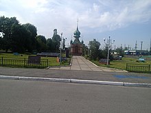
Krasyatychi
| Krasyatychi | ||
| Красятичі | ||

|
|
|
| Basic data | ||
|---|---|---|
| Oblast : | Kiev Oblast | |
| Rajon : | Poliske district | |
| Height : | no information | |
| Area : | 7 km² | |
| Residents : | 629 (2019) | |
| Population density : | 90 inhabitants per km² | |
| Postcodes : | 07053 | |
| Area code : | +380 4592 | |
| Geographic location : | 51 ° 5 ' N , 29 ° 38' E | |
| KOATUU : | 3223556100 | |
| Administrative structure : | 1 urban-type settlement , 3 villages | |
| Address: | вул. Жовтнева буд. 84 07 053 смт. Красятичі |
|
| Website : | City council website | |
| Statistical information | ||
|
|
||
Krasjatytschi ( Ukrainian Красятичі ; Russian Красятичи Krasjatitschi , Polish Kresiatycze ) is an urban-type settlement in the Ukrainian Oblast of Kiev with about 630 inhabitants (2019) and since July 10, 1996 the administrative seat of the Poliske district .
The settlement founded in 1560 was called Tscherwone misto ( Червоне місто ) or Russian ( Красне місто Krasne misto ) until 1900 . Krasjatichi is located 105 km northeast of Kiev and has had the status of an urban-type settlement since April 10, 2006.
In addition to the main town, the villages of Dubowa (Дубова), Michliwschtschyna (Міхлівщина) and Lissowe (Лісове) belong to the settlement council of the same name . The regional road P-02 runs through the settlement .
Web links
Commons : Krasjatytschi - collection of pictures, videos and audio files
- Entry on the location in the Encyclopedia of Modern Ukraine (Ukrainian)
- Local history of Krasyatychi in the history of cities and villages of the Ukrainian SSR (Ukrainian)
- Kresiatycze . In: Filip Sulimierski, Władysław Walewski (eds.): Słownik geograficzny Królestwa Polskiego i innych krajów słowiańskich . tape 4 : Kęs – Kutno . Walewskiego, Warsaw 1883, p. 663 (Polish, edu.pl ).
Individual evidence
- ↑ Cities in Ukraine at pop-stat.mashke.org, accessed December 5, 2019
- ↑ Local website on the official website of the Verkhovna Rada ; accessed on April 19, 2020 (Ukrainian)


