
Jubiläumsweg Bodenseekreis
| Jubiläumsweg Bodenseekreis | |
|---|---|

|
|
| Data | |
| length | 111 kilometers |
| location | Bodenseekreis , Baden-Wuerttemberg , Germany |
| Markers | Logo of the Lake Constance district |
| Starting point |
Kressbronn am Bodensee , train station 47 ° 35 ′ 39.8 ″ N , 9 ° 35 ′ 56.6 ″ E |
| Target point |
Lingen -Therme 47 ° 46 '8.8 " N , 9 ° 8' 54.1" O |
| Type | trail |
| Height difference | a total of ± 2,200 m |
| The highest point |
810 m above sea level NHN in front of Betenbrunn |
| Lowest point |
403 m above sea level NHN train station Überlingen-Therme |
| Level of difficulty | easy / medium |
| season | Spring autumn |
| Months | April, May, October |
| Viewpoints | Schleinsee , Gehrenberg Tower , Heiligenberg , Haldenhof near Sipplingen |
| particularities | many landscape and nature reserves |
The Jubiläumsweg Bodenseekreis is a 111-kilometer hiking trail that was set up in 1998 for the 25th anniversary of the Bodenseekreis .
General
The path leads through the hinterland of Lake Constance . The choice of the route through thirteen towns and municipalities in the Lake Constance district was deliberately “away from Lake Constance” and the main stream of tourists into the attractive hinterland: Here too, many natural and cultural beauties, some of which are still unknown, can be discovered.
Waymarks
The Jubiläumsweg is signposted along its entire length. After almost uniform signage for the entire Lake Constance region in recent years, the Jubiläumsweg can now also be hiked against the main direction described below.
At the start of each stage, the hiker will find a large board with information on the route, the stage length and the average walking time. Both the new and various old signposts can be found along the way.
Information board
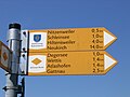
Big signpost

Small waymark

Waymarks (old)

Waymarks (older)

Waymark lookout point


A group of around ten volunteer road attendants , under the direction of the District Office and in conjunction with the responsible municipalities, is responsible for the signposting and maintenance of the Jubilee Trail.
Stages
The hiking trail is divided into a total of six stages, each of which hikers need around four to six hours to walk. The kilometers indicated in brackets refer to the starting point of the described stage.
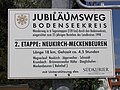
First stage: Kressbronn train station - Neukirch, around 18 km

From Lake Constance through the hilly landscape of the Allgäu region.
The first stage leads from the Kressbronn train station to the eastern edge of the Lake Constance district. Past Nunzenberg (1.5 km), Gattnau and Arensweiler , through the Poppis district ( ), under the federal road 31 , immediately up to the left, you reach Riedensweiler ( ). The nature reserve Chess Ried right are leaving and Nitzenweiler ( ) it goes on to Kressbronner district Schleinsee (4,5 km). The baroque Assumption Chapel, built in 1737, can be visited here. The vantage point above Schleinsee ( ) is considered by many hikers and cyclists in spring to be the most beautiful point on the entire Jubilee Trail: the view over Schleinsee, countless flowering fruit trees and Lake Constance over to the 2,502 meter high Säntis in Appenzellerland . Over many roots, through Busenhaus ( ) am Degersee , Oberwolfertsweiler and Hiltensweiler - here the church of the Catholic parish of St. Dionysius - you get to the Langnauer Waldparkplatz ( ) - branch to the Langnauer Waldlehrpfad (additional hiking time about one hour) - into the valley of the Argen , After the Rhine and Bregenzer Ache, the third largest Lake Constance tributary (9 km). In Heggelbach , the hiker crosses the Argen on a hanging walkway ( ) in the direction of Steinenbach . After a steep ascent towards Wittenberg , through the Kreuzweiher-Langensee nature reserve (swimming on the opposite bank: beach with sunbathing area, free of charge) and Unterlangensee ( ), you reach the stage destination Neukirch . A prominent point at the first stage destination in the center of the village ( ) is the church “St. Maria Rosary Queen ".
![]()
![]()
![]()
![]()
![]()
![]()
![]()
![]()
![]()
Second stage: Neukirch - Meckenbeuren station, around 17 km

Westward through the hills into the Schussen basin
For the second stage, you leave Neukirch through a wooded hilly landscape towards Oberrussenried. Past the wooden pond ( / 1.5 km) and the Jägerweiher nature reserve with bathing zone ( / 2.5 km) the Jubiläumsweg leads to Krumbach ( / 5.5 km). Here you should take the time to visit the baroque parish church “St. Georg ”: Pastor Josef Bosch commissioned Andreas Brugger's workshop in 1771 to design the pictures of the Fourteen Holy Helpers and the Way of the Cross . Via Matzenhaus, Mehrenberg and Hergottsweiler ( ) the hiker arrives at the chapel "Maria Königin des Friedens", built in 1954, above Brünnensweiler ( / 12 km). On the outskirts of Tettnang with its many hop fields , the Jubiläumsweg, which runs parallel to the Tettnang Hop Trail, leads hikers past Siggenweiler - a detour to the Tettnang Hop Museum is possible - through Dieglishofen and Kaltenberg ( / 14.5 km) towards Meckenbeurener Bahnhof ( ) - known to many as one of the stops from the folk song " Auf de Schwäbsche Eisebahne " - in the valley of the Schussen .
![]()
![]()
![]()
![]()
![]()
![]()
![]()
The entire area in and around Tettnang is determined by the hop plants that grow up to eight meters high. In Tettnang, around 1,600 hectares of cultivation area, between 40,000 and 50,000 quintals of hops are harvested annually for the production of top beers all over the world. The landmark of the Tettnang hop cultivation, the hop castle of the Hofgut Kaltenberg, to the right of the Jubiläumsweg, on the threshold of the Schussental, served as a hop drying building for over a century until 1977.
Third stage: Meckenbeuren train station - Markdorf train station, around 20 km

Forest, old cultivated land, a quiet river valley and an old border
Coming from the train station in Meckenbeuren, the Schussen is crossed before Brochenzell. After the Weißenau Forest, the path runs through the patches of Wannenhäuser and Wirgetswiesen, mainly through orchards and meadows used for agriculture. Before reaching Ailingen , hikers should definitely make a short detour to the chapel on Haldenberg , which was rebuilt in 1919 : on nice days, you have a wonderful view of the landscape from Allgäu to Linzgau and Lake Constance! The path leads through Ailingen at the Reinachmühle in the Rotachtal and after Unterteuringen through the Raderach Drumlin landscape to the Hepbacher-Leimbacher Ried . There is a hut here with information boards for observing rare breeding birds , including white storks , and the resident Heck cattle . Past Leimbach and through Bergheim , the path runs through an industrial area to Markdorf train station ( ).
![]()
Fourth stage: Markdorf station - Heiligenberg, around 20 km

Great panoramas on the way to the Linzgauer Bergland
After the previous “flat stage”, the longest and most physically demanding stage follows: From the train station through the old town of Markdorf and the Obertor, the climb to 704 m above sea level. NHN high Gehrenberg (3 km). When the weather is clear, you have a magnificent view from the Gehrenberg tower over Lake Constance to the Alps , the Allgäu and the Upper Swabian hill country up to the highest . After the descent, the Jubiläumsweg leads hikers through the villages of Deggenhausertal- Wendlingen (5 km), Eggenweiler (6.7 km), Untersiggingen (9.5 km) and Lellwangen (14.2 km). Between the two last-named places, the Jubiläumsweg runs parallel to the Franziskusweg : Several boards with prices allow hikers to linger here again and again. After a steep ascent, past an alpaca farm , you reach the 810 m above sea level. NHN highest point of the entire route (15.5 km), a barbecue area invites you to rest. In Betenbrunn (16.8 km) it is worth visiting the pilgrimage church, which was first mentioned in 1275, and the associated Way of the Cross. The path leads over the Amalienhöhe (19.8 km) down to Heiligenberg . This stage ends at the Fürstenbrunnen in front of the castle ( ) of the Fürstenberg family, built in 1914 .
![]()
Fifth stage: Heiligenberg - Owingen, around 18 km

High paths over Linzgau, large expanses and narrow forest canyons
The path of the fifth stage runs from Postplatz in front of the castle up to the ridge of the Amalienhain, through the Friedwald and over to Belle-Vue-Platz . When the visibility is good, hikers can enjoy a breathtaking view of the entire chain from the Vorarlberg Alps in the east, over the Säntis to the Bernese Oberland with the Eiger , Mönch and Jungfrau in the west. The path continues to the Frickinger Ringburg, incorrectly called the Schwedenschanze in the vernacular , and down to the Frickinger district of Altheim . The path leads past the Elisabethenhof and over the stone courtyards to the pilgrimage site of Maria im Stein and through the Aachtobel , one of the oldest nature reserves in Germany and the “ wildest piece of nature in the Lake Constance region ”. After a long ascent, the hiker reaches Hohenbodman . In addition to a deep well (23 m) and the last hydraulic ram , there is one of the oldest linden trees in Germany. Through the Bodmerholz , the hiker arrives at the stage destination at the Owingen town hall ( ).
![]()
Sixth stage: Owingen - Überlingen, around 18 km

Over forest heights to the grand finale over the lake
The sixth and last stage leads through forests and open terrain past the Hochbühl, over the Stadtkopf and Pfaffenwaldweg down to Nesselwangen (5.6 km). Here is the church of St. Peter and Paul ; it was rebuilt after the Thirty Years War and enlarged in 1861. Via the new federal road 31 , you continue up to Sipplinger Berg (7.4 km). From here, the Lake Constance Water Supply Association supplies around four million citizens in 146 cities and municipalities and 34 water supply associations with drinking water. A few meters further on, the landscape offers a view of the Überlinger See and the Bodanrück on the opposite bank. After descending over the Haldenhof (9.1 km), first mentioned in 1441 , accompanied by fallen Nagelfluhbrocken , over the nuns level , through the Hödinger Tobel nature reserve to Hödingen (14 km), through Spetzgart (12.1 km) and the Spetzgarter Tobel to Goldbach (16.3 km) and past the Schächerkapelle in Maiengericht , Überlingen offers a wealth of contrasts to the kilometers covered: galleries, the Bodensee thermal baths, the city garden, the medieval city fortifications or the cathedral invite you to relax.
Others
There are several inns along the way for all stages. In the stage towns the (cyclist) hiker will find accommodation in a wide variety of price ranges. From Überlingen, all other stage locations and along the route there are regular train or bus connections via Friedrichshafen back to Kressbronn.
Jubilee path run
On October 19, 2008, on the occasion of the “35 Years of Lake Constance District” and “10 Years of Jubiläumsweg” anniversaries, the Jubiläumsweg Run took place under the patronage of District Administrator Lothar Wölfle . The starts took place in Überlingen and Kressbronn. The destination for the approximately 240 participants was in Markdorf.
From Überlingen it went against the direction described above on stages 6, 5 and 4 via Owingen and Heiligenberg (56 km), from Kressbronn on stages 1 to 3 via Neukirch and Meckenbeuren (55 km) to Markdorf.
literature
- Rainer Barth: Jubiläumsweg Bodenseekreis - From Kressbronn to Überlingen - The Bodenseekreis in 6 stages . Robert Gessler, Friedrichshafen 2016, ISBN 978-3-86136-191-6 .