
Königgrätzer Kreis
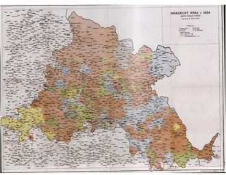

The Königgrätzer Kreis ( Hradecký kraj ) was an administrative district in the northeastern part of the Kingdom of Bohemia , named after the city of Königgrätz ( Czech : Hradec Králové ), whose head of the district had his seat in the district office building in this city.
It belonged to the old Bohemian circles and was reorganized in 1748 according to the administrative reforms of the time. With the administrative reforms after 1848, the districts functioned only as a supervisory authority and were replaced in 1867 by the more delicate system of political districts (see list of districts in Bohemia ).
Residents
The district included 54 dominions and 575 cadastral communities . Around 1845 there were 16 towns, 24 market towns and 628 villages and 927 single layers in the district .
The native population of the district is given on the basis of the 1843 census as 360,454 people. After the Bunzlau district , the Königgrätzer district was the region with the highest birth rates among the Bohemian districts in 1843 and 1844, but also in second place with the mortality rate .
In the district, there were 27 poor and beneficiary sick hospitals, two hospitals and 57 welfare institutions for the medical care of the poor population . The latter institutions were subordinate to ecclesiastical, military and lordly administrations.
Geographical description
Among the major towns in the district included Bohemian Skalitz , Borohrádek , Braunau , Častalowitz , Opočno , Dobruschka , Geyersberg , Hohenbruck , Jaroměř ( Jaromieř ), Hradec Kralove , Königinhof , Kosteletz , Kuks , Náchod , Neustadt whether the Mettau , Neuhradek , Politz , Reichenau , Rokitnitz , Senftenberg , Solnitz , Starkstadt , Tinischt and Trautenau .
The landscape in the district is partly mountainous, hilly and near the rivers Elbe and Adler flat. The most important mountain landscapes include the Eagle Mountains , the Politzer Bergland , the Halbstädter Bergland , the Schatzlarer Bergland and the south-eastern areas of the Giant Mountains . In the area of the Königgrätzer Kreis was also the Adršpach rock town (also called Steinwald by Watterich ).
Until 1477 Lewin and the surrounding area ( Lewiner Ländchen , Czech Levínsko ) and the area later called the Bohemian Angle belonged to the Königgrätzer Kreis. This year these areas were spun off from the Nachod rule and connected to the Hummel rule , which was incorporated into the Bohemian county of Glatz in the same year . This reduced the size of the Königgrätzer Kreis, whose eastern border was now only a few kilometers from Náchod .
The Elbe, the Adler, the Metuje ( Mettau ) and the Úpa ( Aupa ) are among the larger watercourses in the former district area . According to statistical compilations, around 1845 there were bodies of water or water-rich landscapes in the Königgrätzer Kreis, after ponds without cane growth (7.84 km 2 ), ponds and swamps with cane growth (0.35 km 2 ) and swamps without cane growth (1.18 km 2 ) were distinguished.
Agriculture and fishing
The fertile areas for farming are in the hilly and flat areas of the district. The cultivation of crops has been widespread in the vast plains for a long time. There is a total of 1483 km 2 of arable land, 195.8 km 2 of pastures and 880.4 km 2 of forest. The areas for meadows, gardens and vineyards made up a total of 331.4 km 2 .
Around 1845, wheat and barley were the most important types of grain in arable farming . The main areas of wheat cultivation were the regions around Smiřitz , Jaroměř, Großskalitz and Neustadt ob der Mettau . Within Bohemia, the Königgrätzer Kreis was the main focus on oat cultivation . Common crops here included potatoes , fodder herbs , legumes , flax and hemp . The focus of chicory cultivation was in the vicinity of the town of Königgrätz . There were grinding mills for agricultural raw products especially in the water-rich foothills, for example around Königinhof on the Elbe and at Kosteletz on the Adler.
In cattle farming around 1845 in the Königgrätzer Kreis, cattle farming was the top priority with 61,431 (1840: 71,520) cows and 4051 (1840: 4936) oxen . In second position with 45,428 (1840: 44,467) animals was shepherding .
8,000 pigs , 10,000 goats and 100,000 geese were also kept here . Around 1845 there were 14,224 (1840: 15,875) horses in the district . Of the wild animals , the pheasants and partridges and hares were the most common hunted animals around 1840 . Among the population of the mountain areas, the interest in their game use was aimed at wild boar and deer , some of which were kept in animal enclosures , as well as the capercaillie and hazel grouse .
In the Königgrätzer Kreis there were 7 industrial factories and 900 smaller businesses for processing sheep's wool and 261 smaller businesses that worked and processed animal hides and skins . Waste from livestock farming was processed by 177 companies. 51 businesses dealt with the processing of silk .
By using the natural fish population in the rivers began to eels carp , pike , barbel , Whites , tench , grayling , gobies and Haber fish in the mountain streams mainly trout . Animal trapping in the Elbe also yielded catfish , salmon and otters . The fish farming in ponds focused on the area of Častalowitz. The annual fish yield in the Königgrätzer Kreis around 1845 was 650 quintals.
Other commercial areas
In the Königgrätzer Kreis there were factories and smaller businesses that were active in the field of trimmings and plastering goods . In Königgrätz there were trading companies with a wide range of products. A pumping station supplied the old town, which is located on an elevation, with water from the Elbe. An important canvas manufacturer was located in Nachod . There was flax spinning and papermaking in the town of Trautenau, which also served as a storage area in the Giant Mountains. In Senftenberg one operated canvas weaving and the production of paper. There were companies in Reichenau for carded yarn spinning , cloth production , canvas bleaching and paper maché production . A large paper mill that could produce 2,400 reams a year was located in Hronow . In Braunau , cloth- making had existed for a long time, which primarily produced scarlet- colored goods and sold them to traders in Turkey on a large scale .
Mining industry and other mineral raw materials
Sandstone was extracted from quarries in several places for construction purposes . Gravel, sand and clay pits were operated.
Around 1845 there were two iron works , nine coal mines , an arsenic and a graphite works in the district . There were attempts to mine coal in several places: In the allodial rule Nachod near the villages of Schwadonitz , Straškowitz , Bohdashin , Wodolow , Hrtin, Zdarka , Sedlowitz, Oberkosteletz , Dřevíč , Zabokrk and Hronow. There was also coal mining near Schatzlar and in the Trautenau region the mines St. Franziska, Wilhelm, St. Johannis and Rafael.
traffic
The Schlesische Chaussee, which came from Prague, ran via Königgrätz, Jaroměř and Nachod across the border to Reinerz and Glatz . Around 1845, tolls were levied for national roads in the district, mostly in the suburbs, as well as bridge tariffs.
location
Adjacent counties and areas around 1845 were:
- in the north and east: the Prussian province of Silesia
- in the west: Bidschower Kreis
- in the south: Chrudimer Kreis
See also
literature
- Friedrich Carl von Watterich von Watterichsburg: Concise dictionary of regional studies of the Kingdom of Bohemia . 2nd edition, Prague (CW Medau and Comp.) 1845, p. 766 online
- Johann Gottfried Sommer : The Kingdom of Bohemia: statistically topographically represented. Fourth volume. Königgrätzer Kreis . JG Calve, Prague 1836 online
Individual evidence
- ^ A b Watterich, 1845, p. 724, overview sketch of the Kauřimer, Klattauer and Königgrätzer district
- ↑ Watterich, 1845, p. 276, table absolute population of the individual districts and the capital Prague
- ↑ Watterich, 1845, p. 275, population statistics
- ↑ Watterich, 1845, pp. 141–142, Königgrätzer Kreis, Armenversorgungsanstalten
- ↑ Watterich, 1845, pp. 142, 346, 703, 1144
- ↑ Watterich, 1845, pp. 15-16, entry Adersbacher Felsenstadt
- ^ František Musil: Východní Čechy v raném a vrcholném středověku . In: Ondřej Felcman et al: Ůzemí východních Čech od středověku po raný novověk . Hradec Králové 2011, ISBN 978-80-7422-106-4 , pp. 17–36, 89 and 158.
- ^ Watterich, 1845, pp. 6-7 Agriculture
- ^ Watterich, 1845, p. 766, 775 entries Königinhof, Kosteletz
- ↑ a b Watterich, 1845, pp. 71, 73, Animal raw product production
- ↑ Watterich, 1845, p. 76, Animal raw products refinement
- ↑ Watterich, 1845, p. 78, Animal raw products refinement
- ^ Watterich, 1845, p. 765, entry Königgrätz
- ^ Watterich, 1845, p. 904, entry Nachod
- ↑ Watterich, 1845, pp. 1147–1148, entry Trautenau
- ↑ Watterich, 1845, p. 1078, entry Senftenberg
- ^ Watterich, 1845, p. 1025, entry Reichenberg
- ↑ Watterich, 1845, p. 692, entry Hronow
- ↑ Watterich, 1845, p. 367, entry Braunau
- ^ Watterich, 1845, p. 725, overview sketch of the Kauřimer, Klattauer and Königgrätzer district
- ↑ Watterich, 1845, p. 252, entry mining
- ↑ Watterich, 1845, p. 1107, Steinkohlenprodukt ; 903-904, entry Nachod .
- ^ Watterich, 1845, pp. 703, 765, entries Jaroměř, Königgrätz