
Maximilianstrasse (Munich)
| Maximilianstrasse | |
|---|---|
|
|
|
 |
|
| Maximilian street from the Maximilianeum seen from | |
| Basic data | |
| State capital | Munich |
| Townships | Altstadt-Lehel , Au-Haidhausen |
| Created | from 1854 |
| Name received | 1856 |
| Connecting roads | Perusastrasse, Max-Planck-Strasse |
| Cross streets | Residenzstrasse , Hofgraben, Falkenturmstrasse, Alfons-Goppel-Strasse, Marstallstrasse, Am Kosttor, Falckenbergstrasse, Wurzerstrasse, Herzog-Rudolf-Strasse, Stollbergstrasse, Thomas-Wimmer-Ring, Karl-Scharnagl-Ring, St.-Anna-Strasse, Adelgundenstrasse, Thierschstrasse, Sternstrasse, Steinsdorfstrasse, Widenmayerstrasse , Praterinsel |
| Places | Max-Joseph-Platz |
| Numbering system | Orientation numbering |
| tram | Lines 19 and 21 |
| use | |
| User groups | Pedestrian traffic , bicycle traffic , individual traffic , public transport |
| Technical specifications | |
| Street length | 1.2 km |


The Maximilianstrasse is one of the four important urban boulevards Munich from the 19th century, next to the Briennerstraße , the Ludwig street and the Prince Regent Street .
The design of the street, the construction of which began in 1852, is the work of the architect Georg Friedrich Christian Bürklein , who made a name for himself with the construction of Munich Central Station . The road works were directed by the engineer Arnold von Zenetti , while Carl von Effner was responsible for the planting.
The architectural style , which combines elements of different stylistic epochs such as Neo-Gothic and Renaissance , met with a lot of criticism, but makes Maximilianstrasse unique for Munich in terms of urban planning. Since the 1970s, the area between the Altstadtring and the National Theater has acquired the reputation of a sophisticated and exclusive shopping mile.
Location and course

Maximilianstrasse begins at Max-Joseph-Platz ( Munich Residence ) and runs absolutely straight in a south-easterly direction towards the Isar . Shortly before the Altstadtring, it expands into a forum, crosses the Altstadtring (Thomas-Wimmer-Ring / Karl-Scharnagl-Ring) and leads in a new width to the Isar, to which, together with its green spaces with park-like plants, a flowing transition forms. Then Maximilianstrasse crosses the Isar and Praterinsel on the Maximiliansbrücke and ends in front of the Maximilianeum , which is also its visual end.
The eastern continuation of Maximilianstrasse, with the “circumference” of the Maximilianeum, is called Max-Planck-Strasse (formerly: Äußere Maximilianstrasse ), the short western extension over Max-Joseph-Platz is called Perusastrasse .
history
Royal time
As early as 1850, King Maximilian II began planning an architectural competition for the project of an Athenaeum in the area of today's Max-Weber-Platz, which was ultimately never realized . The son of King Ludwig I did not only want to emphasize his plans for urban expansion, some of which differed considerably from his father's ideas; Maximilian II wanted to demonstrate his consistent will to initiate a new architectural style, a mixture of different style epochs dominated by the English neo-Gothic and the skeleton construction idea of 19th century architecture. In his list of projects that were to be implemented after he took office, Crown Prince Maximilian had already listed a “connection between the city and the Isar from the Neue Residenz via the Lehel” in 1839.

A new development axis towards the east was deliberately chosen, which could not build on any predecessor and did not take into account the grown structures of the old town. In the gusset of what was then the Royal Mint , a building from the 16th century that is still completely based on the course of the second Munich city wall , the meeting of the two urban structures becomes particularly clear. Due to the tightness of the remaining space between the mint and the new buildings built between 1857 and 1863 at Maximilianstrasse 6–8, Bürklein executed a simulated balcony-like cornice with a glare facade between two corner wings. Behind this arcade front, crowned by figures, hid the Münzgarten from 1859, with a fountain in the middle. The former garden area has been used as a parking lot since the 20th century.
The end and culminating point of the street is the Maximilianeum, a community-based foundation that was supposed to help “talented Bavarian youths (of all levels)” to study. Fittingly, it was built not far from the hostel buildings of the old craftsmen's settlement Haidhausen (see Haidhausen , history ), some of which are still visible today , and today also houses the Bavarian parliament .

While the Max-Joseph-Platz in front of the Residenz is still very classicistic influenced by Ludwig I, the beginning of the Palais Toerring-Jettenbach (today completely gutted, mainly only the front to Max-Joseph-Platz has been preserved, the western front was in Including the modernization, it houses luxury offices and luxury condominiums, formerly Post Office Munich 1, also called Hauptpost or Residenzpost) the new buildings. In order to carry out the width of the street up to Max-Joseph-Platz, outbuildings of the National Theater were demolished in 1854. The first new building was the Hotel Vierjahreszeiten (1856–1858). Maximilian II did not experience the completion of Maximilianstrasse along its entire length. The last two building complexes shortly before the Maximiliansbrücke were built after his death: The building of the Wilhelmsgymnasium , the city's oldest grammar school and at that time the Wittelsbach's page education institute , was built under his son King Ludwig II in neo-Renaissance style (Carl Leimbach, 1875–1877); the neighboring property between Sternstrasse and Widenmayerstrasse and the property opposite to the south were only built on around 1890 under Prince Regent Luitpold .
After 1945
During the Second World War , the buildings on the street were badly damaged. During the reconstruction, the façades were primarily reconstructed. The property at the corner of Maximilianstrasse and Marstallplatz was still in ruins until 2002. At the end of the 1960s, the old town ring was broken through, which destroyed the character of the forum. This breakthrough was controversial in contrast to other measures of the “Urban Redevelopment” project : an underpass of Maximilianstrasse in a tunnel had about as many supporters as opponents.
At the end of the 1980s, the corner buildings on Thomas-Wimmer- and Karl-Scharnagl-Ring softened the Altstadtring breakthrough. In 2003, in the course of the redesign of Marstallplatz, the half-ruin of Maximilianstraße / corner of Marstallplatz was gutted and the facade was reconstructed.
shopping street
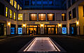
After the Second World War, the western part of the street developed into a fashionable boulevard, one of the most expensive addresses in the republic. Many international retail companies, especially from the fashion and jewelry industry, have branches on Maximilianstrasse, such as Chopard , Cartier , van Cleef & Arpels, Celine, Tom Ford, Giorgio Armani , Dolce & Gabbana , Etro , Blancpain, Fendi , Versace , Tod´ s , Loro Piana , Salvatore Ferragamo , Ermenegildo Zegna, Dior , Kiton, Valentino , Hublot, Bottega Veneta, Hermès, Officine Panerai, Chanel , Saint Laurent , Stone Island , Richard Mille , Ralph Lauren , Jil Sander , Escada , Bally, Omega, Brunello Cucinelli, Hugo Boss , Marni, Gucci , Montblanc , Jimmy Choo , Pomellato , Christian Louboutin, Brioni, Moncler and Bulgari . Traditional shops, restaurants and galleries were increasingly displaced.
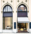
Bottega Veneta Boutique

Hugo Boss Store
Louis Vuitton business

Cartier Boutique


.jpg)

traffic
.jpg)
In the eastern part between Max-Joseph-Platz and Altstadtring, Maximilianstraße takes on the function of a collecting street for the surrounding areas and as a feeder to the underground car park of the National Theater. Traffic-calmed zones and one-way streets prevent through traffic to other parts of the city center. The eastern half of Maximilianstrasse is a heavily used connection between Altstadtring, Lehel, Haidhausen and the main streets along the Isar.
Public transport is mainly due to the tram - line 19 marked that passes through one of the main east-west lines of Munich Maximilianstrasse along the entire length. At the Maxmonument and the stop of the same name, it crosses line 16 . The underground with lines 4 and 5 runs roughly parallel to Maximilianstrasse; The nearest underground stations are Odeonsplatz (also U3 and U6 ) and Lehel .
Maximilianstrasse has an average of 2,660 passers-by per hour.
Attractions
- Hotel Vier Jahreszeiten (Maximilianstrasse 17) ( Rudolf Gottgetreu , 1856–1858)
- Schauspielhaus (Maximilianstrasse 26–28) ( Heilmann & Littmann , 1900/01)
- Government of Upper Bavaria (Maximilianstrasse 39) ( Friedrich Bürklein , 1856–1864)
- Five Continents Museum ; Maximilianstraße 42 ( Eduard Riedel , 1858–1865) (formerly the State Museum of Ethnology)
- Wilhelmsgymnasium ; Thierschstrasse 46, corner of Maximilianstrasse (Carl von Leimbach, 1875–1877)
- Maximilianeum (today, in addition to the Maximilianeum Foundation, also the seat of the Bavarian Parliament; Max-Planck-Str. 1) ( Friedrich Bürklein , 1857–1874)
Public facilities


State institutions
Museums
- Museum Five Continents Munich
- ZKMax , underground art space of the city of Munich
theatre
- Residenztheater
- National Theater
- Cuvilliés Theater
- Munich Kammerspiele
- GOP Varieté-Theater (formerly " Little Comedy at the Max II Monument ")
Schools and educational institutions
Monuments
- General Bernhard Erasmus Graf von Deroy ( Johann von Halbig , 1856)
- Sir Benjamin Thompson, Earl of Rumford ( Caspar von Zumbusch , 1866)
- Friedrich Wilhelm Joseph von Schelling ( Friedrich Brugger , 1861)
- Joseph von Fraunhofer (Johann von Halbig, 1868)
- King Maximilian II , called Maxmonument ( Caspar von Zumbusch , 1875)
- Colossal figure of Pallas Athene (north side of the Maximiliansbrücke) ( Franz Drexler , 1906)
- Niche fountain for Mayor Alois von Erhardt , (Maximiliansbrücke, on the island between the two parts of the bridge) ( Carl Hocheder , 1893)
Trivia

The Norwegian writer, Henrik Ibsen (1828–1906), lived at Maximilianstrasse 32 from 1885 to 1891; a plaque on the house reminds of this. His wife, Suzannah Daae Ibsen (1836–1914), lived in the apartment until 1895.
literature
- Klaus Gallas : Munich. From the Guelph foundation of Henry the Lion to the present: art, culture, history . DuMont, Cologne 1979, ISBN 3-7701-1094-3 (DuMont documents: DuMont art travel guide).
- Rudolf Gottgetreu: Façades for the new Maximilians-Strasse in Munich. In: Zeitschrift für Bauwesen , Volume 5, 1855, Column 353–362; with site plan and facade drafts, sheets 21, 22 and sheets 34-36 in the atlas .
Web links
Individual evidence
- ↑ Michael Petzet , Bavarian State Office for the Preservation of Monuments (ed.): Monuments in Bavaria. Volume 1, Part 1, City of Munich . Oldenbourg, Munich 1985, ISBN 3-486-52391-0 , p. 248.
- ↑ Katharina Blohm, Winfried Nerdinger (Ed.): Architecture Guide Munich . Reimer, Berlin 1994, ISBN 3-496-01120-3 , p. 6.
- ↑ http://www.shops-muenchen.de/strasse/muenchen/m/innenstadt/maximilianstr/einkaufen.html
- ↑ http://www.muenchen.de/aktuell/2017-07/das-sind-muenchens-beliebeneste-shopping-meilen.html
- ↑ Nora Große-Harmann: Without kitsch and plush. Süddeutsche.de, February 2008, accessed on December 26, 2012 .
Brienner Strasse with Wittelsbacherplatz , Karolinenplatz and Königsplatz | Ludwigstrasse with Odeonsplatz | Maximilianstrasse with Max-Joseph-Platz | Prinzregentenstrasse with Prinzregentenplatz
Coordinates: 48 ° 8 ′ 17 ″ N , 11 ° 35 ′ 9 ″ E