Monts (Indre-et-Loire)
| Monts | ||
|---|---|---|

|
|
|
| region | Center-Val de Loire | |
| Department | Indre-et-Loire | |
| Arrondissement | Tours | |
| Canton | Monts (main town) | |
| Community association | Touraine Vallée de l'Indre | |
| Coordinates | 47 ° 17 ' N , 0 ° 38' E | |
| height | 47-99 m | |
| surface | 27.28 km 2 | |
| Residents | 7,794 (January 1, 2017) | |
| Population density | 286 inhabitants / km 2 | |
| Post Code | 37260 | |
| INSEE code | 37159 | |
| Website | http://www.monts.org/ | |
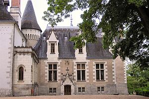
 Château de Candé |
||
Monts is a French commune with a population of 7,794 (as at 1st January 2017) in the department of Indre-et-Loire in the region of Center-Val de Loire ; it belongs to the Arrondissement Tours and is part of the canton of Monts . The inhabitants are called Montois .
geography
Monts lies on the Indre River , about fifteen kilometers south-southwest of Tours , and is surrounded by Joué-lès-Tours in the north, Montbazon in the northeast, Sorigny in the east and south, Thilouze in the southwest and Artannes-sur-Indre in the west.
history
The place is first mentioned as Mons Villa in 915.
Population development
- 1800: 1.125
- 1851: 1.205
- 1901: 1.430
- 1936: 1,649
- 1946: 1.784
- 1954: 2.129
- 1962: 2,053
- 1968: 3,506
- 1975: 4,480
- 1982: 5,421
- 1990: 6,221
- 1999: 6,514
- 2006: 7,013
- 2011: 6,995
Attractions
- Château de Candé , mansion, built at the beginning of the 16th century, Edward VIII. Wallis Simpson married here in 1937
- Château de La Roche
- Château Le Breuil
- Railway bridge over the Indre, built 1845–1848
- Mills on the Indre
Community partnerships
- Zeiskam , Rhineland-Palatinate, Germany, since 2008
Personalities
- George Messier (1896–1933), chemist and engineer, developed the shock absorbers
- Marie-Hélène Descamps (1938–2020), politician
literature
- Le Patrimoine des Communes d'Indre-et-Loire. Flohic Editions, Volume 2, Paris 2001, ISBN 2-84234-115-5 , pp. 913-923.
Web links
Commons : Monts - collection of images, videos and audio files
