National Highway 1D
| National Highway NH1D in India | |

|
|
| map | |
| Basic data | |
| Operator: | National Highways Authority of India |
| Overall length: | 422 km |
|
States : |
|
The National Highway 1D ( NH 1D ) also known as the Srinagar-Leh Highway , is a national highway that runs through the union territories of Jammu and Kashmir and Ladakh in northern India . The road connects Srinagar with Leh . It is one of only two roads that connect Ladakh to the rest of the world. The other road connection is the Leh-Manali Highway . The Srinagar-Leh Highway became a National Highway in 2006.
The ancient Central Asian trade route Srinagar-Leh- Yarkand was also known as the Treaty Road . It was named after a contract that was signed in 1870 between Maharaja Ranbir Singh and Thomas Douglas Forsyth .
Weather conditions
Snowfall blocks the highest passes for six months of the year. In spring, the Border Roads Organization (BRO) clears the snow and cleans up road damage caused by landslides . In 2008, about 18 m of snow fell on the Zoji La pass, which the road crosses.
geography
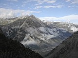
For most of the route, the NH 1D runs through very extreme relief and follows the historical trade route along the Indus , so that travelers can still see places of historical and cultural importance today. The road is usually open from early June to mid-November. The total distance is 422 km.
The highest points on the road are the Fotu La Pass at 4108 m, the Namika La Pass at 3700 m and the Zoji La at 3528 m.
There is a government checkpoint in Khalatse between Fotu La and Leh .
Dras about 170 km from Srinagar at an altitude of 3249 m is the first major place after Zoji La and before Namika La. The place is considered the coldest place in the world after Siberia , with temperatures down to −45 ° C.
history
In the 17th and 18th centuries the road was just one way that was impassable even for ponies . Goods, mainly pashmina wool , were brought to Kashmir by porters from Yarkand and Tibet for scarf production .
In the 19th century the connection was improved so that pony caravans could enter it. This expansion began after General Zorawar Singh conquered the Ladakh region from the Sikh Empire for Gulab Singh between 1836 and 1840 . The principality of Jammu and Kashmir was created in 1846 through the sale of Kashmir to Gulab Singh in the Treaty of Amritsar.
In April 1873 the Kashmiri government provided the annual sum of 2500 rupees for the maintenance of the road and its caravanserais .
In the 1950s, tensions around Ladakh increased. The People's Republic of China had built a 1200 km military road from Xinjiang to western Tibet. The road was discovered by India in 1957 and confirmed by Chinese maps in 1958 that mapped the road. Political tensions increased and led to the Indo-China border war of 1962.
The road on the Chinese side gave the Chinese army advantages for supplies and prompted the Indian army to build a road for the same purpose. Construction began in Srinagar in 1962 and reached Kargil after two years. This was the basis of the modern Srinagar-Leh Highway.
Restrictions on civil traffic were lifted in 1974.
The road was used as a deployment route by the Indian army in the 1999 Kargil War .
gallery
Web links
Individual evidence
- ^ Government of Jammu and Kashmir, Ladakh Autonomous Hill Development Council Kargil: Monthly News Letter . April 2006. Archived from the original on July 17, 2011. Retrieved June 30, 2009.
- ^ ExpressIndia.com: Srinagar-Leh road gets National Highway status . In: ExpressIndia.com . April 23, 2006.
- ↑ Jyoteeshwar Pathik: Glimpses Of History Of Jammu And Kashmir . Anmol Publications Pvt. Limited, New Delhi 1997, ISBN 81-7488-480-7 , pp. 117 ( books.google.com [accessed June 30, 2009]).
- ^ A b c d Henry Osmaston, Philip Denwood: Recent Research on Ladakh 4 & 5. Proceedings of the Fourth and Fifth International Colloquia on Ladakh . Motilal Banarsidass Publ., Delhi 1995, ISBN 978-81-208-1404-2 , pp. 236 ( books.google.com ).
- ↑ Thaindian.com: Srinagar-Leh highway to reopen after remaining closed for six months . March 20, 2009. Retrieved June 30, 2009.
- ↑ a b Thaindian.com: Srinagar-Leh highway to reopen after remaining closed for six months . February 28, 2008. Retrieved June 30, 2009.
- ↑ Ladakh, the Road journey on koausa.org
- ↑ NATIONAL HIGHWAYS AND THEIR LENGTHS ( Memento of the original from January 20, 2013 on WebCite ) Info: The archive link has been inserted automatically and has not yet been checked. Please check the original and archive link according to the instructions and then remove this notice. Details of National Highways in India-Source-Govt. of India
- ↑ a b c d e Hilary Keating: The Road to Leh Archived from the original on September 28, 2012. Info: The archive link was inserted automatically and has not yet been checked. Please check the original and archive link according to the instructions and then remove this notice. In: Aramco Services Company (ed.): Saudi Aramco World . 44, No. 4, Houston, Texas, July-August 1993, ISSN 1530-5821 , pp. 8-17. Retrieved June 29, 2009.


