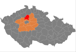
Okres Mělník
| Okres Mělník | |
|---|---|
| Kraj | Středočeský kraj |
| surface | 701.08 km² |
|
Inhabitants • Population density |
108,352 ( January 1, 2019 ) 137 inhabitants / km² |
|
Municipalities • of which cities • of which Městyse |
69 7 1 |
| LAU 1 | CZ0206 |
|
Vehicle registration number (issued until 2001) |
ME |

|
|
The Okres Mělník ( German district Melnik ) is a district in the Czech Republic .
The area of Okres Mělník is located in the north of the Středočeský kraj region and extends on both sides of the Elbe and Vltava rivers . It is a plain, the highest point of which is Vrátenská hora near Mšeno (508 meters nm). The lowest point of the circle is the surface of the Elbe near the village of Horní Počaply (153 meters).
Around 95,800 inhabitants live on 701 km² in 69 municipalities , and 62% of all inhabitants in the seven towns of Mělník , Kralupy nad Vltavou , Neratovice , Kostelec nad Labem , Mšeno , Liběchov and Veltrusy .
Until the middle of the last century agriculture was the main activity. After the Second World War , the construction of chemical plants, utilities and the food industry began, which strongly shaped the character of the landscape and became a major environmental burden. The largest plants are in Kralupy (Kaučuk and PROTOS) in Neratovice ( Spolana ), In Byšice (VITANA) and in Horní Počaply (power station). In agriculture, vegetables and fruits as well as wine are grown.
52.9% of the population are employed, 31% of them in the manufacturing sector. The gross wage is 16,937 crowns and is roughly the district average. Unemployment is 8.7%.
Attractions
In Mělník, in addition to some forests and nature parks, there are also a number of monuments:
- Kokořín Castle from the 14th century. It is one of the most visited castles in the country.
- Renaissance - Nelahozeves Castle
- Liblice Castle from 1699
- Liběchov Castle (with oriental collections),
- Mělník Castle
- Baroque - Veltrusy Castle .
- Vltava Canal
On January 1, 2007, the municipality Dolany from the Okres Praha-západ , Olovnice from the Okres Kladno and Čakovičky , Kojetice and Postřižín from the Okres Praha-východ were added. At the same time, the communities of Borek , Dřísy , Konětopy , Křenek , Lhota and Záryby moved to Okres Praha-východ.
cities and communes
Býkev - Byšice - Čakovičky - Cítov - Čečelice - Dobřeň - Dolany - Dolní Beřkovice - Dolní Zimor - Dřínov - Horní Počaply - Hořín - Hostín - Hostín u Vojkovi'c - Chlumín - Chorušice - Chvatěruby - Jeviněves - Kadlín - Kanina - Kly - Kojetice - Kokorin - Kostelec nad Labem - Kozomín - Kralupy nad Vltavou - Ledčice - Lhotka - Liběchov - Libiš - Liblice - Lobeč - Lužec nad Vltavou - Malý Újezd - Medonosy - Mělnické Vtelno - Mělník - Mšeno - Nebužely - Nedomice - Nelahozeves - Neratovice - Nosálov - Nová Ves - Obříství - Olovnice - Ovčáry - Postřižín - Řepín - Spomyšl - Stránka - Střemy - Tišice - Tuhaň - Tupadly - Újezdec - Úžice - Velký Borek - Veltrusy - Vidim - Vojkovice - Vraňany - Všestudy - Všetaty - Vysoká - Zálezlice - Zlončice - Zlosyň - Želízy
Web links
Coordinates: 50 ° 21 ' N , 14 ° 30' E
